Download
1 / 14
220 likes | 659 Views
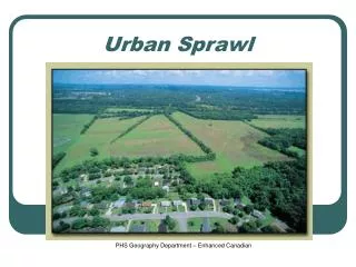
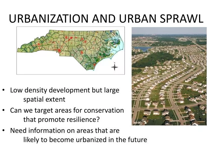
URBANIZATION AND URBAN SPRAWL. Low density development but large spatial extent Can we target areas for conservation that promote resilience? Need information on areas that are likely to become urbanized in the future. NY DEC. WHAT TYPE OF GROWTH ARE WE SIMULATING?. 1993.

E N D
URBANIZATION AND URBAN SPRAWL • Low density development but large spatial extent • Can we target areas for conservation that promote resilience? • Need information on areas that are likely to become urbanized in the future NY DEC
SLEUTH IS What Cellular Automaton Model Use historic rates of urbanization (from imagery) to calibrate model Simulate urban growth based on physical and social constraints and proximity to existing urban and transportation Monte Carlo-based simulation allows for probabilistic projections
Add about model Background, CA, spatial process , historic data, growth rules I:docs\ What About SLEUTH: USGS / UCSB Cellular Automaton Spatial Process Historic data Growth rules Spontaneous New Spreading Edge Growth Road-influenced Projections of future urbanization esri grid format 60m resolution urban, exurban value representing bins of probability Calibrated and predicted on modified USCB Combined Statistical Areas
HOW WE DEFINE URBAN AREAS Road Density as proxy for Suburban Growth
HOW WE DEFINE URBAN AREAS SLEUTH simulates spread of road density and therefore urbanization
HOW WE DEFINE URBAN AREAS UPPER BOUND ROAD DENSITY LOWER BOUND ROAD DENSITY NLCD URBAN CLASS
What SLEUTH Doesn’t Do Include detailed parcel level info Directly incorporate pop/demographic models to get at density/ housing demand Does allow for policy input through exclusion/resistance layers
When 2010 2020 2030 2040 2050 2060
Where Gulf Coastal Plain and Ozarks Appalachian Southeast Regional Assessment Project
Questions/Comments Questions or comments from presentation about the SLEUTH model or about our data products in general? Questions or comments in general about the SALCC, what we’re doing, where we’re going, etc.?
Contacts Ken McDermond – ken_mcdermond@fws.gov Rua Mordecai – rua@southatlanticlcc.org Janet Cakir – janet_cakir@nps.gov Amy Keister – amy_keister@fws.gov Laurie Rounds – laurie.rounds@noaa.gov Ginger Deason – ginger@southatlanticlcc.org

![Urban Sprawl [Date] Today I will: Know the causes, problems and solutions to Urban Sprawl.](https://cdn1.slideserve.com/1949902/slide1-dt.jpg)