Download
1 / 39
390 likes | 397 Views
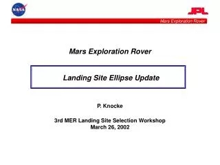
2003 MER Missions to Mars. Mars Rover Exploration at Gusev Crater and Back-Ups. Characterization and Science Potential of the Sites. 2nd 2003 Landing Site Workshop, Pasadena, Ca, Oct. 17-18, 2001. National Geographic. Gusev: Data Coverage Status in Landing Ellipse.

E N D
2003 MER Missions to Mars Mars Rover Exploration at Gusev Crater and Back-Ups Characterization and Science Potential of the Sites 2nd 2003 Landing Site Workshop, Pasadena, Ca, Oct. 17-18, 2001 National Geographic
Gusev: Data Coverage Status in Landing Ellipse Updated Ellipse (10/05/01): 96 x 19 km, Azimuth: 76 • 13 MOC images (7 during Extended Mission so far) • 5 MOLA Tracks • Area Covered: ~1,330 km2 • ~50% L. E. currently covered by 1.42 to 5.67 m/pxl res. MOC images
Hypotheses before MGS • 1. Ma’adim Vallis is a fluvial channel Possible alternate hypotheses: role of mass-wasting/fretted channel/glacial processes • 2. Ma’adim Vallis has been episodically active throughout Mars’ history- At least 3 main epochs • 3. Water from Ma’adim ponded in Gusev generating a series of lakes • 4. The mesas at the debouchment of Ma’adim are remnants of a delta • 5. The delta was formed under water and ice. At least, one lake was ice-covered --Antarctic analog • 6. Early lakes can have been heated by Gusev melt material, later by the formation of 20-km diam. Thyra crater • 7. Gusev provides a favorable environment for the preservation of pre-biotic and biotic record-- rapid burial, fine-grained sediments, hydrothermal activity
Hypotheses and New Data: MOLA and the Delta of Ma’adim 3 2 1 1 = ap 10942h 2 = ap 10856h 3 = ap 10440h
Gusev/Ma’adim Interaction and MOC Kuzmin et al., 2000. USGS Map I-2666
Fluvio-Lacustrine Activity: Epoch3 • Origin:Epoch 3 deposits from Ma’adim. Youngest deposits in the ellipse. • Hypothesis: Last active stage of Ma’adim. Deposits sub-lacustrine or sub-aerial (?) • Characteristics: Patches of bright, crusty-like material (Evaporite?). Localized veneers of dust. Flow lobes, few ridges, many outcrops. • Occurrence: ~20% of ellipse
E03-00012 500 M Res: 2.85m/pxl
E05-03287 500 M Res: 2.86m/pxl
E05-03287 500 M Res: 2.86m/pxl
Lake Sub-aerial deposit 2 m 0 Sub-lacustrine (laminations) Sub-aerial episode Sub-lacustrine (laminations)
Science at Ep-3 Deposits to MER Mission (Objectives and Payload) Traceability Matrix
Fluvio-Lacustrine Activity: Epoch2 • Origin:Largest deposit in the ellipse and in Gusev. Originated from Ma’adim. Flat and smooth. Pre-dated Epoch 3 deposits but post-dated delta. • Hypothesis:Ice-covered lake episode. • Characteristics:Flat and smooth. Degraded craters exposed, Thyra terraces, outcrops • Occurrence: 40% of ellipse
M03-02330 400 M Res: 2.84 m/pxl
M03-02330 400 M Res: 2.84 m/pxl
M07-00813 300 M Res: 4.26 m/pxl
Fluvio-Lacustrine Activity: Contact Epochs2-1 • Origin: Terrain with quasi conical 10-20-m high buttes associated with strongly eroded ~80-m high layered tabular hills. • Hypothesis: The morphology of the contact suggests an ice-covered lake • Characteristics: Locally rough. Many outcrops covering at least two fluvio-lacustrine epochs (and likely many episodes) • Occurrence: ~1% of ellipse
E05-00471 200 M Res: 2.96 m/pxl
E05-00471 AHbm1 250 – 280 m 20 – 25º 30 – 50 m • Marginal Stream Meltwater ICE AHbm1 AHgf1 Marginal Gully Outcrops AHgf1 300 M Gully Dimensions Res: 2.96 m/pxl
Science at Ep-2 Deposits to MER Mission (Objectives and Payload) Traceability Matrix
Fluvio-Lacustrine Activity: Epoch 1 • Origin: Material from Ma’adim. Elevation comparable to the delta of the channel. • Hypotheses: Remnants of early lacustrine episodes. Lakes possibly heated. Overtopping of Thyra in places? • Characteristics: Roughest area in ellipse. Many outcrops composed of small tabular and rounded buttes. • Occurrence: ~32% of ellipse
E05-01350 270 M Res: 3.36 m/pxl
E05-01350 270 M Res: 2.96 m/pxl
Science at Ep-1 Deposits to MER Mission (Objectives and Payload) Traceability Matrix
Precursor Epoch 1: Thyra • Origin: 20-km diameter impact crater • Hypothesis: Pre-date Epoch 1 deposit (outer east rims embedded). Basin filled with Epoch 2 lacustrine deposits. Inner walls may exposed early material and hydrothermally altered minerals • Characteristics: Exposed rim walls with some terracing. • Occurrence: ~7% of ellipse
M03-02330 Res: 2.84 m/pxl
Hydrothermal activity and lake deposits Gusev 158 km diam. melt - 10,000 km3 - location of samples in ellipse: • Gusev impact melt and hydrothermally altered material in the rim of Thyra in the center of the ellipse. • Gusev rim material ejected from three large craters (36, 31, 15, km diam.) within 2 crater diam. of the ellipse. Thyra 21 km diam., melt 140 km3 – location of samples: • Impact melt in the rim of Thyra in center of ellipse. 15 km diam. crater on east rim of Gusev, melt 4.7 km3 - location of samples in ellipse: • Impact melt in ejecta blanket and on the crater rim.
Craters contributing material to the ellipse within 2 crater diameters • Four craters have contributed ejecta material (impact melt and hydrothermal deposits) from the rim of Gusev to the landing site ellipse. • Two craters have primary ejecta and their own rim material exposed in or very close to the ellipse. • Within the ellipse, the 21 km diam. Thyra may have excavated lake deposits and impact melt from Gusev, and ejecta from the other craters.
Thermal effects of Gusev and craters contributing material to the ellipse within 2 crater diam.
Merits of Gusev (Summary) Science • 1. One of the few large basins that had a prolonged, episodic, hydrological history leaving unambiguous and accessible traces of several stages of lacustrine activity • 2. Existing fluvio-lacustrine models and interpretation of facies observed in MOC images frame hypotheses to be tested by the MER science team in a site that is perfectly suited for the MER payload. • 3. Fluvial and lacustrine activity cover most of Mars’ history. Witnessed climate changes • 4. Favorable environment for biological processes (water/energy) and their preservation (fine-grained sediments and chemical sedimentation) • Education and Public Outreach • 5. More than 1000 sites on the web about Gusev crater. The crater is being used throughout years by educators in high-schools, universities, and museums to explain students and general public the evolution of water on Mars, the search for life, and the future human colonization. It is familiar to the general public and popular. Varied landscapes: lakebed outcrops, Thyra rim material, mounds, contact between flows
Back-Up #1: Boeddicker • One 17 km diam. crater has contributed ejecta material (impact melt and hydrothermal deposits) from the rim to the landing site ellipse. • Two craters have contributed ejecta to the ellipse. • On the edge of the ellipse, the central uplift and crater rims may contain impact melt and hydrothermal deposits from Boeddicker.
M23-02043 Res: 5.72 m/pxl
M23-02043 300 M Res: 5.72 m/pxl
Testing hypotheses with the MER’s payload in EP69A • Promising Site • Potentially responding at least locally to the requirements of MER’s science objectives and payloads. However, • Currently not enough information to understand the nature of the fluvio-lacustrine record and reconstruct its history. Traces of channels and ridges seem to indicate that water could have occupied several regions of the crater. • Lack of information prevents the statement of realistic testable hypotheses • No obvious layering • Excellent prospect for landing and traverse safety if visible morphology is expandable to the rest of the ellipse. • Remains a viable back-up if more data can be provided and confirm the preliminary assessment
Summary 1 • Gusev provides: - An unambiguous record of aqueous activity throughout the landing ellipse - By its interaction with Ma’adim, the possibility to replace the explored materials into their hydro-geological context through time. Many deposits are related to terraces in Ma’adim. Traceable parent-rock regions in watershed. - Testable hypotheses about processes (fluvial, glacial, lacustrine) and resulting landforms and features. - The use of the full range of MER’s science payload to explore a site responding to all MER’s objectives
Summary 2 • EPA 69A is a potentially viable back-up but needs more coverage • Boeddicker has little coverage. The evidence for aqueous activity is indirect (regional lobate ejecta craters). Potential for hydrothermal activity. Should not be retained as a back-up at this stage.
Acknowledgments • People who contributed to this presentation are: • Nathalie Cabrol, NASA Ames Research Center • Edmond Grin, NASA Ames ResearchCenter • David Fike, NASA Ames Research Center • Horton Newsom, University of New Mexico • Ivan Thorsos, University of New Mexico • Rene De Hon, University of North Louisiana • Nadine Barlow, University of Florida • Special Thanks to: • The Center for Mars Exploration (CMEX, NASA Ames), Geoffrey Briggs and Virginia Gulick for their support which very much helped the preparation of the presented work.