Download
1 / 42
460 likes | 1.06k Views
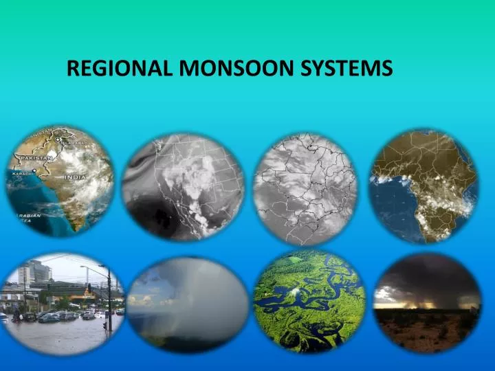
REGIONAL MONSOON SYSTEMS. Outline. Definition of Monsoon The Monsoon Makers Annual Monsoon Cycle Variability of the monsoons. Regional Monsoon Systems The Indian Monsoon The East Asia Monsoon The Australian Monsoon / East Asia Winter Monsoon The African Monsoon The American Monsoon s.

E N D
Outline • DefinitionofMonsoon • TheMonsoonMakers • AnnualMonsoonCycle • Variabilityofthemonsoons • Regional Monsoon Systems • TheIndianMonsoon • TheEastAsiaMonsoon • TheAustralianMonsoon/ EastAsiaWinterMonsoon • TheAfricanMonsoon • TheAmericanMonsoons
1) IndianMonsoon The Indian monsoon is made up of a number of components: The monsoon trough over northern India; The Mascarene anti-cyclonic system; The low level cross-equatorial jet; The Tibetan high pressure system; The tropical easterly jet; Monsoon cloudiness Rainfall
TheIndianMonsoon: surfacefeatures Monsoon trough: Formed over northern India; Northern Hemisphere Summer as part of the global ITCZ; Associated with surfacelow pressure; Mascarene high: Situated over the south-east Indian Ocean (30o S, 50o E); Generates a large outflow of air; The air moves north over the equator where it becomes a south-westerly flow known as the low level cross-equatorial jet;
TheIndianMonsoon Fig. 2 fromKrishnamurtiandBhalme (1976) MeanSeaLevelPressure for July
TheIndianMonsoonandsurfacecirculation Fig 5 fromKrishnamurtiandBhalme (1976) • Low level cross-equatorial jet: • Maximum intensity from June to August; • The jet splits in two branches at around 10o N, 60o E at this time; • Arrive over central west and southern coasts of India; • Important for rainfall amounts over western India. Monthlyprogressionofthelow-levelcross-equatorialjet
OtherimportantcharacteristicsoftheIndianMonsoon: • The Tibetan high: • Upper level anticyclone; • Located over northern India above the surface monsoon trough; (low level convergence matched by upper level divergence) • Well established during summer; • Moves in a south-southeast direction following the zone of maximum surface heating and low pressure; • The outflow of air from the southern flank of the Tibetan high gives rise to the Tropical easterly jet. • Tropical easterly jet lasts from June to September
Northern Hemisphere Upper level surface High pressure upper levels Low pressure upper levels Upward vertical movement transports air molecules to upper levels. More molecules imply in the increase of the weight of the column of the air above a given upper level surface Low pressure High pressure Low level Divergence Low level Convergence
Reasons for the easterly jet: During summer, the Tibetan Plateau, which is located in subtropical regions, intensify the ascent increasing air pressure in high levels Temperature Gradient High level High Pressure + - High level Easterly Jet High Pressure Ascending air Hot surface Low pressure system:
HighlevelwindsandtheIndianMonsoon Figs. 6 fromKrishnamurtiandBhalme (1976) Monthlymean200 hPawindfield Example of wind APRIL JAN (85 knots) 50 + 3x10 + 5 TibetanHigh Tropical Easterly JULY OCT
Convective processes andcloud in theIndianMonsoon • Cloud cover: • Important component; • Manifestation of moist convective processes; • Varies in both space and time. Fig. 1 fromKrishnamurtiandBhalme (1976)
TheSeasonalcycleofprecipitation, lowandhighlevelcirculation for theAsian-AustralianMonsoons • Arrows represent low-level winds (at 850mb) • Streamlines are tangent to the direction of the wind in 200mb (they indicate the formation and maintenance of the Tibetan High • Colors indicate OLR (remember low values of OLR are related to convective activity in tropical regions).
TheIndianMonsoonVariability Inter-annual variability (year to year) ENSO: The ENSO phenomenon is clearly associated with the Indian Monsoon El Niño Weaker Monsoon During the summer monsoon season: active and break phases Active phases of the Indian Monsoon: Trough intensifies Cloud development Mascarene high intensifies Tibetan high intensifies tropical easterly jet intensifies; Break phases of the Indian Monsoon: Opposite characteristics are observed
Regional Monsoon Systems • 1) TheIndianMonsoon • 2) The East Asia Monsoon • 3) The AustralianMonsoon/ EastAsiaWinterMonsoon • 4) The African Monsoon • 5) TheAmericanMonsoon
2) East Asia Monsoon • The East Asian can be divided into seven major components: • The Australian high; • The low-level cross equatorial jet at about 110o E • East Asia Summer Monsoon trough/ Zones of Convergence ; • Tropical Easterly Jet (Upper level return flow); • The Western Pacific High • The Mei-Yu Front Zone • Mid Latitude Disturbance
Regional Monsoon Systems 2) East Asia Monsoon • East Asian Monsoon also originates in air flows from: • The Indian Ocean (Indian monsoon airflow); • Western Pacific high (south-east flow from its western flank). • The low-level cross equatorial jet: • Carries with it large amounts of moisture (Inter-hemispheric mass exchange); • Stronger when the pressure difference between the Australian high and the East Asian trough is enhanced; • Over the Malaysian Peninsula the low-level jet meets the westerly Indian monsoonal flow and produces large amounts of rainfall. • Monsoon trough: • Stretches from western Pacific across Indo-China; • Associated with zones of convergence, cloudiness and rainfall.
2) East Asia Monsoon (1) The low-level cross equatorial jetatabout110o E; (2) Southwesterlies (3) East Asia Summer Monsoon trough/ Zones ofConvergence (4) The Western PacificHigh (5) The Mei-Yu Front Zone (6) Mid Latitude Disturbances (7) TibetanHigh (8) Tropical Easterly Jet (UpperlevelReturnFlow); 7 Fig 18b fromZhouandLau (1998) Shading topography. Dashed lines easterlies
2) ComponentsoftheEastAsiaMonsoon: Testyour memory! 1) East Asia Monsoon Trough or convergence zones High level High 2) Mei-Yu Front 3) Tibetan High 4) Western Pacific High: Low level 5) High level easterly jet 6) Low-level southerly 7) Low-level jet 8) Midlatitude disturbances
Regional Monsoon Systems 2) EastAsiaMonsoonVariability ENSO: ENSO onset in spring or summer: El Niño (La Niña) decreased (increased) rainfall over Indo-China, South China, Philippines region. El Niño rainfall below normal over eastern China.
Regional Monsoon Systems • 1) TheIndianMonsoon • 2) TheEastAsiaMonsoon • 3) The AustralianMonsoon/ EastAsiaWinterMonsoon • 4) The African Monsoon • 5) TheAmericanMonsoon
3) Australian Monsoon / East Asia Winter Monsoon Asian Summer monsoon Jun-Sep Asian Winter monsoon Dec-Mar • Winds (arrows) and convergence zones (dots). Prevailing winds at 700mb (3000m) and 500mb (5800m) levels • Note the changes in low and high level winds from summer to winter. • Note how the intertropical convergence zone moves to the Southern Hemisphere and affects North Australia – The Australian Monsoon.
3) Australian Monsoon / East Asia Winter Monsoon • South Hemisphere Extension of the Larger Asia Winter Monsoon System. Three major features of circulation: • Monsoon trough over South China Sea; • Surge of cold air within the northerly monsoon current from the northern Asia anticyclone system; • Reversal of upper level winds from easterly to westerly over southern China.
Regional Monsoon Systems 3) AustralianMonsoon / EastAsiaWinterMonsoon
3) Australian MonsoonVariability Interannual timescale: ENSO El Niño weaker Australian monsoon. Intraseasonal time-scales (active and break phases) (modulated by the Madden-Julian Oscillation.
Regional Monsoon Systems • 1) TheIndianMonsoon • 2) TheEastAsiaMonsoon • 3) TheAustralianMonsoon/ EastAsiaWinterMonsoon • 4) The African Monsoon • 5) The American Monsoon
Regional Monsoon Systems 4) African Monsoon • Differ from India and East Asia Systems in: • Magnitude; • Thickness of flow; • Geographical coverage; • High latitude air masses are not involved.
Regional Monsoon Systems 4) African Monsoon • West African Monsoon: • Surface pressure trough; • The Inter-Tropical Convergence Zone (ITCZ); • South Atlantic (St. Helena) and North African (Saharan) subtropical high pressure systems. • East African Monsoon: • The Inter-Tropical Convergence Zone (ITCZ); • Arabian and Mascarene high pressure systems; • East African low level jet; • West African mid-tropospheric jet stream; • Tropical easterly jet stream; • Subtropical jet streams.
Regional Monsoon Systems 4) AfricanMonsoonVariability ENSO: El Niño (La Niña) Subsidence (ascent) over west Africa and thus below (above) average convection.
Regional Monsoon Systems • 1) TheIndianMonsoon • 2) TheEastAsiaMonsoon • 3) TheAustralianMonsoon/ EastAsiaWinterMonsoon • 4) TheAfricanMonsoon • 5) The American Monsoon
5) American Monsoon: seasonal variation in convective activity (indicated by low values of OLR) and sea surface temperature (climatology) Sea surface temperature (oC, colors) and outgoing long wave radiation (Wm-2, contours) for December-February (left panel) and June-August (right panel). (Courtesy V. Kousky.) http://144.16.68.129/faculty/bng/IWM-III-BNG_overview.pdf
5) What are the main features of the American Monsoon that are similar to the Asian Monsoon? Schematic illustration of the North and South American monsoon systems (left and right panels, respectively). Shading indicates precipitation and dashed lines indicate convergence zones. Small arrows show low-level (900 hPa) winds, and thick arrows represent low-level jets. An "H" shows a subtropical surface high center, and an "A" indicates the monsoon high level anticyclone. (Adapted from V. Kousky.) http://144.16.68.129/faculty/bng/IWM-III-BNG_overview.pdf
Schematic vertical (longitude–pressure) crosssectionthrough the North America Monsoon System at 27.5°N. Schematic vertical cross section across South America displaying the major large-scale elements affecting the South America Monsoon System(from CLIVAR Web site online at http://www.clivar.org).
The recognition of the SA Monsoon is relatively recent. This is because winds do not change 120o from summer to winter. However, if we remove the annual mean, then the anomalies clearly change. Remember: Anomaly = Observed – Mean Westerly anomalies Easterly anomalies Zhou e Lau (1998)
The South America Monsoon System: wind anomaly and precipitation (Oct)
Although it is not observed a reversal of the low level wind between summer and winter over South America, there is a reversal in the wind anomalies in comparison with the annual average.
South America Monsoon System Shading topography. Dashed lines easterlies (1) The low-level cross equatorial jet (2) Northwesterlies (3) The Chaco Low(monsoon trough) (4) TheSouthAtlanticHigh (5) The SouthAtlanticCovergence Zone (SACZ) (6) Mid Latitude Disturbances (7) BolivianHigh (8) UpperlevelReturnFlow. Fig 18a fromZhouandLau (1998)
South America Summer Precipitation Low-Level Cross Equatorial Jet EnergyReleasedin theFormofLatentHeat BolivianHigh Tropical Easterly Jet UpperLevelJet Northwesterlies SACZ ChacoLow
Outline • DefinitionofMonsoon • TheMonsoonMakers • AnnualMonsoonCycle • Variabilityofthemonsoons • Regional Monsoon Systems • TheIndianMonsoon • TheEastAsiaMonsoon • TheAustralianMonsoon/ EastAsiaWinterMonsoon • TheAfricanMonsoon • Easter North PacificMonsoon/AmericanMonsoon? • Summary
SUMMARY • The Monsoon Makers: • Seasonal heating; • Moisture Processes; • The Earth’s Rotation. • Common features in monsoon systems: • Cloudiness and heavy rainfall [moisture processes]; • Cross-equator low level jet [seasonal heating + moisture processes]; • Low level circulation influenced by Subtropical anticyclones [moisture processes + Earth’s rotation]; • Monsoon trough (low level convergence) and associated convergence zones [moisture processes + Earth’s rotation]; • Upper level high pressure (upper level divergence) and associated upper level return flow [moisture processes + Earth’s rotation]; • Mid-latitude disturbances (NOT in African monsoon).
SUMMARY Although three main monsoon systems were traditionally recognized (African, Asian and Australian), recent studies have shown that a monsoon regime exists over tropical America. American
SUMMARY Internal dynamic and boundary forcing variations in the onset, duration, intensity, and cessation of the monsoons. ENSO: El Niño (La Niña) decreased (increased) rainfall over Indo-China, South China, Philippines region as well as west Africa region. El Niño rainfall below normal over Indian, eastern China and Australian monsoons.