Download
1 / 1
10 likes | 177 Views
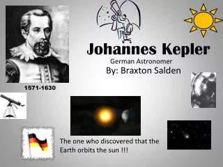
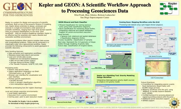
Kepler and GEON: A Scientific Workflow Approach to Processing Geosciences Data Efrat Frank, Ilkay Altintas, Bertram Ludaescher San Diego Supercomputer Center. GEON Mineral and Rock Classifier. Coming Soon: Mapping Workflow onto the Grid.

E N D
Kepler and GEON: A Scientific Workflow Approach to Processing Geosciences Data Efrat Frank, Ilkay Altintas, Bertram Ludaescher San Diego Supercomputer Center GEON Mineral and Rock Classifier Coming Soon: Mapping Workflow onto the Grid Processing Lidar dataset using a grid-mapper director (pegasus). • Mineral Classification for naming Igneous rocks using IUGS classification diagrams. • Rock Classification for extracting Atype bodies. Integrating relational and spatial databases. Support for portal environment execution. Input formats: • Igneous rock relational and spatial databases • Classification diagrams (SVGs) • Process reusability: Classification of samples • Next step: Represent the 3-D geometry of Atype bodies through modeling of gravity data. • Future step: Classification of orogenic basins. Classification algorithm sub-workflow Pluggable Web Services Mineral Classifier Searching for Lidar datasets and registering them Into a db2 spatial database. Browser display of results Local & remote JDBC access Composite actor Lidar datasets Processing PointInPolygon Rock Classifier Atype Output ArcIMS services Kepler as a Modeling Tool: Gravity Modeling Design Workflow Integrating heterogeneous gravity depth sources to create a 3-D gravity model. Lidar Processing Output SVG Diagram Implemented part inline documentation Grid interpolation actor Component (actor) libraries Observed Gravity Model Randy Keller, Ann Gates Kepler is a system for design and execution of scientific workflows. Built on top of the powerful Ptolemy II modeling tool, Kepler allows scientists to design, prototype and execute in a single environment a wide spectrum of scientific workflows, ranging from high-level domain-specific ones (e.g.mineral classification) to low-level “Grid workflows”. With an intuitive drag&drop interface, Kepler is an effective tool for scientists who need a flexible and extensible workflow environment. • Geosciences problems often require complex data access and computational analysis. These can be composed in a meaningful order into a geosciences workflow. Kepler provides the following components to assist geologists in scientific discovery:Data handling features: • Data extraction and registration workflows • Metadata based data search and access • Local and remote data access: • Relational and Geospatial databases • Web service data access (query) • Storage Resource Broker (SRB) • File Transfer Protocols: GridFTP, SCP, SRB • Processing tools: • Generic web service client • Legacy application integration via Shell- Command actor e.g. R, GMT • Browser user interface for visualization and user interface • Domain specific applications: • ArcIMS services • Point in polygon classification algorithm • Grid interpolation algorithms • Workflow prototyping tool (for napkin drawings) • Local and remote execution environments: • Local Kepler application • Execution from a portal environment • Coming soon: peer to peer execution model • Future Directions: • A workflow for integrating seismic events focal mechanisms (beach balls) with ArcIMS image services • Mapping workflows onto the grid, using Pegasus, to handle massive datasets (e.g., LIDAR) • A unified framework for accessing dataset and registering workflow products within the portal • Additional portal execution support • GRASS support The installer for Kepler 1.6a is available for download at http://kepler-project.org Kepler includes contributors from GEON, SEEK, SDM Center and Ptolemy II, supported by NSF ITRs 022567 (SEEK), EAR-0225673 (GEON), DOE DE-FC02-01ER25486 (SciDAC/SDM), and DARPA F33615-00-C-1703 (Ptolemy).