Download
1 / 49
490 likes | 508 Views
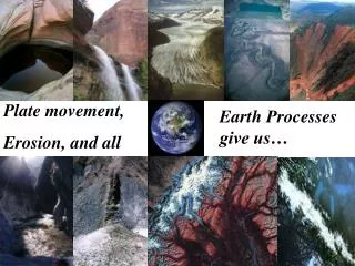
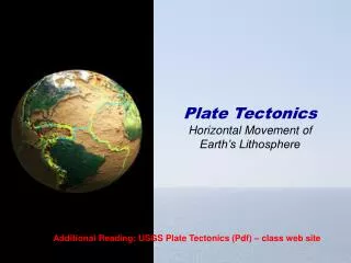
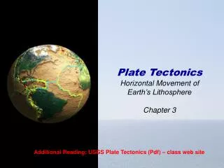
Plate Movement. Plate tectonics theory. Convection currents and sea floor spreading.

E N D
Plate tectonics theory Convection currents and sea floor spreading
In 1912 a German, Alfred Wegener, published his theory that a single continent existed about 300 million years ago. He named this super continent Pangaea and maintained that it had later split into the two continents of Laurasia in the north and Gondawanaland in the south. Today’s continents were formed from further splitting of these two masses.
Tectonic Plates Evidence of tectonic motion is based on similar fossils and rock types on opposing sides of the ocean
Palaeomagnetism Wegener’s theories were unable to explain how continental movement could have taken place. From the 1940s onwards evidence began to accumulate to show that Wegener could have been correct.
The mid-Atlantic ridge was discovered and studied. Examination of the ocean crust either side of the mid-Atlantic ridge suggested that sea-floor spreading was occurring.
The evidence for this is the alternating polarity of the rocks that form the ocean crust. Iron particles in lava erupted on the ocean floor are aligned with the Earth’s magnetic field. As the lavas solidify, these particles provide a permanent record of the Earth’s polarity at the time of the eruption - called paleomagnetism
Earth’s geomagnetic field is recorded as new crust cools. 3-3 New crust. Parallel bands of crust with the same magnetism form along the ridge. Driving Mechanisms for Plate Motions
Geomagnetic Polarity Reversals However, the Earth’s polarity reverses at regular intervals [approx every 400,000 years]. The result is a series of magnetic ‘stripes’ with rocks aligned alternately towards the north and south poles.
The striped pattern, which is mirrored exactly on either side of a mid-oceanic ridge, suggests that the ocean crust is slowly spreading away from this boundary. Moreover, the oceanic crust gets older with distance from the mid-Atlantic ridge.
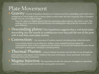
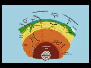
Movement of plates is caused by thermal convection of the “plastic” rocks of the asthenosphere which drag along the overlying lithospheric plates. 3-3 Driving Mechanisms for Plate Motions
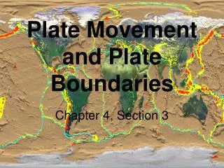
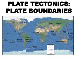
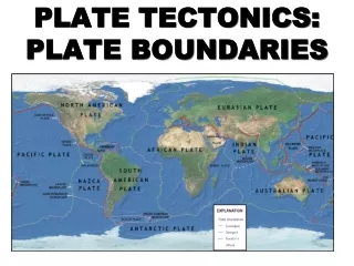
Earth’s surface is composed of a series of lithospheric plates. Plate edges extend through the lithosphere and are defined by seismicity. • Plate edges are trenches, oceanic ridges and transform faults. • Seismicity and volcanism are concentrated along plate boundaries.
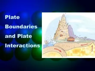
There are four types of plate boundaries • CONSTRUCTIVE /Divergent boundaries -- where new crust is generated as the plates pull away from each other. • DESTRUCTIVE /Convergent boundaries -- where crust is destroyed as one plate dives under another. • CONSERVATIVE /Transform boundaries -- where crust is neither produced nor destroyed as the plates slide horizontally past each other. • Plate boundary zones -- broad belts in which boundaries are not well defined and the effects of plate interaction are unclear.
Artist's cross section illustrating the main types of plate boundaries (see text); East African Rift Zone is a good example of a continental rift zone. (Cross section by José F. Vigil from This Dynamic Planet -- a wall map produced jointly by the U.S. Geological Survey, the Smithsonian Institution, and the U.S. Naval Research Laboratory.)
Convection Currents • Hot magma in the Earth moves toward the surface, cools, then sinks again. • Creates convectioncurrents beneath the plates that cause the plates to move.
CONSTRUCTIVE/Divergent Boundaries • Boundary between two plates that are moving apart or rifting • RIFTING causesSEAFLOOR SPREADING
Features of Constructive/Divergent Boundaries • Mid-ocean ridges • rift valleys • fissure volcanoes
Lava fountains (10 m high) spouting from eruptive fissures during the October 1980 eruption of Krafla Volcano. (Photograph by Gudmundur E. Sigvaldason, Nordic Volcanological Institute, Reykjavik, Iceland.)
Aerial view of the area around Thingvellir, Iceland, showing a fissure zone (in shadow) that is the on-land exposure of the Mid-Atlantic Ridge. Right of the fissure, the North American Plate is pulling westward away from the Eurasian Plate (left of the fissure). Large building (near top) marks the site of Lögberg, Iceland's first parliament, founded in the year A.D. 930. (Photograph by Oddur Sigurdsson, National Energy Authority, Iceland.)
In East Africa, spreading processes have already torn Saudi Arabia away from the rest of the African continent, forming the Red Sea. The actively splitting African Plate and the Arabian Plate meet in what geologists call a triple junction, where the Red Sea meets the Gulf of Aden. A new spreading center may be developing under Africa along the East African Rift Zone.
DESTRUCTIVE/Convergent Boundaries • Boundaries between two plates that are colliding • There are 3 types…
Type 1 • Ocean plate colliding with a less dense continental plate • Subduction Zone: where the less dense plate slides under the more dense plate • VOLCANOES occur at subduction zones
Ring of Fire Challenger Deep got its name from the British survey ship Challenger II, whichpinpointed the deep water off the Marianas Islands in 1951.
Type 2 • Ocean plate colliding with another ocean plate • The less dense plate slides under the more dense plate creating a subduction zonecalled a TRENCH
Type 3 • A continental plate colliding with another continental plate • Have Collision Zones: • a place where folded and thrust faulted mountains form.
CONSERVATIVE/ Converse Fault Boundaries • Boundary between two plates that are sliding past each other • EARTHQUAKES along faults
3-4 Conservative The San Andreas fault in southern California is a transform fault that connects the sea-floor spreading ridge of the Gulf of California with the spreading ridge off Oregon and Washington. • If these plate motions continue, Baja will splinter off California.
Conservative Because the San Andreas fault has an irregular trace, strike-slip motion can cause local compression or tension. 3-4
Mantle plumes originate deep within the asthenosphere as molten rock which rises and melts through the lithospheric plate forming a large volcanic mass at a “hot spot”. Mantle Plume
Plate-boundary zones Not all plate boundaries are as simple as the main types discussed above. In some regions, the boundaries are not well defined because the plate-movement deformation occurring there extends over a broad belt (called a plate-boundary zone). One of these zones marks the Mediterranean-Alpine region between the Eurasian and African Plates, within which several smaller fragments of plates (microplates) have been recognized. Because plate-boundary zones involve at least two large plates and one or more microplates caught up between them, they tend to have complicated geological structures and earthquake patterns.