Download
1 / 8
80 likes | 86 Views
Common GIS-based reporting for Water Information System in Europe. European requirements - EEA’s views Philippe CROUZET EEA. Legal reporting. Technical and scientific reporting. Assessed by Commission. Prepared by EEA. Etc. Etc. Nitrate directive reporting. Support to Commission.

E N D
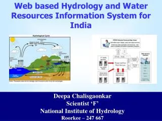
Common GIS-based reporting for Water Information System in Europe European requirements - EEA’s views Philippe CROUZET EEA
Legal reporting Technical and scientific reporting Assessed by Commission Prepared by EEA Etc. Etc. Nitrate directive reporting Support to Commission WFD reporting SoE Report Basis for European information needs Inspire framework
Scientific reporting specific tasks (encompassing WFD requirements)
Main relevant European information needs • To measure environmental status and provide information by integrating all relevant data, the spatial information system must be: • European in extension and homogeneous across Europe sensu lato, scale to be adjusted c.a., 1:250000 • Functional, mixing adequately geometrical data and attributes values, allowing to deal with small features of high environmental importance, • Effective, encompassing all reasonable applications required by EEA, not focussed only on immediate deliveries, • Shared, allowing data validation, provision and information dissemination for all users.
Base 1975 1925 1950 2000 1900 Example of spatial integrated application • In France, increase in dam commissioning resulted in sealing of large areas of catchments, thus modifying SS transport patterns. • Requires at least nested catchment, nested rivers, dam commissioning, SS data and run-off Source: Eurosion project
Large catchments European and Functional related needs Same data sets and unique GIS allow, for example, to sectoral / trend analysis and status assessment • “European” relates to the extend of the system, and “Functional” imposes practical solutions at EU level: • Catchments are described as nested areas, with robust codification (updates should not spread to neighbour catchments), having one drain at certain scales (e.g., length of smallest drains is attribute), • Only main drains have geometrical data, accurate in length. Other information is handled as attribute, not as topographic objects (e.g., bank length of braided rivers, etc.), • Nomenclature and organisation of the system must be redundant enough to allow validation with partners (MS, etc. ) and positioning different objects (e.g., gauging st., dams, etc.)
Effective and Shared related needs • “Effective” relates to system sustainability and versatility, whereas “Shared” makes it necessary to organise co-operation with partners: • Stepwisedesign and populating of the system, allowing reuse of current production in parallel with correction of inaccuracies, • It must cope with wide spectrum of applications, bridging physical and administrative data layers. • Access to GIS must be open, to ease data sharing and involvement of partners in adjusting geometry according to scale and populating attributes data. • Host and process water body related information provided by MS, • Compute and provide public relevant and synthesis information. • Building the system by improving CCM is cost effective and leads to meeting all European requirements
Road map for implementation and contribution to GIS Working Group • Build the data model of a comprehensive spatial reference system jointly with JRC, embedding Reporting GIS guidelines, draft final end 12/04 • Prepare MS cooperation procedure to be initiated within the EEA MS network (starting with Eionet) early 2005 • Prepare complementary data collection, with EEA Topic Centres (W, NC, TE), etc. start ~01/05 • Carry out applications large scale assessments on water quality and ecosystems fragmentation planned end 2005 as test and result production.


![Geographic Information System [GIS]](https://cdn2.slideserve.com/5315378/geographic-information-system-gis-dt.jpg)