Download
1 / 29
290 likes | 311 Views
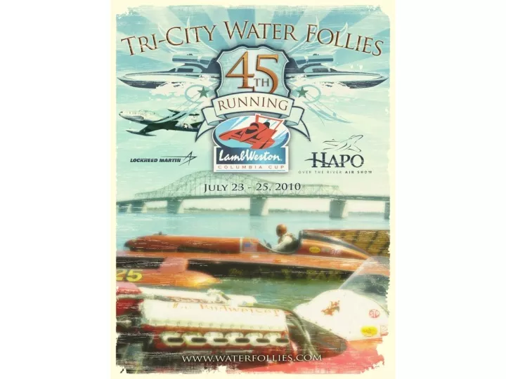
2010 Tri-City Water Follies Air Show. Air Crew Briefing. Introductions. Air Show Dir/ Air Boss – Scott Meyer Assistant Air Boss – Jim Gibson Tower Liaison – Hyrum Wadsworth FAA FSDO – Jim Bening Bergstrom POC – Malin Bergstrom.

E N D
2010 Tri-City Water Follies Air Show Air Crew Briefing
Introductions • Air Show Dir/ Air Boss – Scott Meyer • Assistant Air Boss – Jim Gibson • Tower Liaison – Hyrum Wadsworth • FAA FSDO – Jim Bening • Bergstrom POC – Malin Bergstrom
Roll call-Viper West-USN VF-125-John Klatt-Bill Stein-Ace Maker T-33-Bad Yak -Boat Race Director-FSDO-Official’s Helicopter-Banner Tow-Bergstrom POC’s
We are not your typical Airshow • We are a remote show over water, with crowds on both North & South sides of the river. • The boat race dictates what happens during the course of the day. • Delays due to boat crashes, etc may affect your performance scheduled time.
Waiver • Standard provisions • Don’t hit the bridge • Don’t fly under the bridge unless you are a boat • Don’t break the sound barrier
Frequencies • ATIS 125.65 • Ground 121.8 • Tri-Cities Tower 135.3 • Show Control 123.45 • Discreet 123.15
Temporary Flight Restriction • Location: PSC 190 @ 2.5nm • Radius: 5nm • Height: Surface to 17,000’ msl • Times: • 7/23 Friday • 1120-1150L (Modified) • 1415-1445L • 1515-1545L • 7/24 Saturday • 1130-1145L (Modified) • 1415-1445L • 1515-1545L • 7/25 Sunday • 1150-1220L (Modified) • 1415-1445L • 1515-1545L • Entry: By ATC authorization only. • Purpose: High performance/ military jet aerial demonstrations.
Safety Issues • Knock it off! – Go wings Level • We will advise what comes next • Let us know if you see something • KIO Loss of Radio Contact • Flare from the Barge • Rescue Boats go in circles on course
Exit Routes Columbia River Escape Low: AOB 2500’ Hi: 8000-10000’ PSC TWR: 135.3 / 323.3 APCH: 128.75 / 380.2 Snake River Escape Low: AOB 2500’ Hi: 8000-10000’ PSC TWR: 135.3 / 323.3 APCH: 128.75 / 380.2 135.3
Alternate Emergency Landing Field Grant County Airport (MWH) 57nm NW PSC Elev: 1185’ Primary Runway: 32R Length/Width: 13,001 x 100’ Grant County Approach: 126.4/ Tower: 118.25 Ground: ATIS: 119.05 MWH VORDME: 115.0
Points of Contact • Bergstrom Aircraft 509-547-6271 • Malin Bergstrom 509-521-7117 • Michel Pelletier 509-531-4647 • Hyrum Wadsworth 509-830-7419 • Scott Meyer 509-492-6049
The End! • Have a great, safe and fun show !