Download
1 / 79
840 likes | 1.06k Views
Maps and GIS. Historical Maps. The oldest map?. Konya town map, Turkey, c. 6200 BC. Milestones Project http://www.math.yorku.ca/SCS/Gallery/milestone/. The First World Map. Anaximander of Miletus, Turkey, c. 550 BC. Milestones Project http://www.math.yorku.ca/SCS/Gallery/milestone/.

E N D
The oldest map? • Konya town map, Turkey, c. 6200 BC Milestones Project http://www.math.yorku.ca/SCS/Gallery/milestone/
The First World Map • Anaximander of Miletus, Turkey, c. 550 BC Milestones Project http://www.math.yorku.ca/SCS/Gallery/milestone/
First Route Map • Roman road map, c. 366-335 BC Milestones Project http://www.math.yorku.ca/SCS/Gallery/milestone/
South Sea Islander’s Map Based on slide from B. Tversky
Ptolemy’s World Map • First use of longitude, c. 150 AD Milestones Project http://www.math.yorku.ca/SCS/Gallery/milestone/
First Weather Map • Halley’s wind map, 1686
Galton’s Weather Map Measurements 1861 Milestones Project http://www.math.yorku.ca/SCS/Gallery/milestone/
First Contour Map • Halley’s lines of equal magnetic declination, 1701
Park Map (contour) wikipedia.org
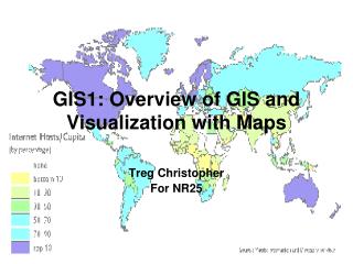
Mapping geographic data • Visualizing information which has a spatial component • Graphical representations of our environment • Examples of types of maps: • Chloropleth (single variable displayed using color, texture on accurate geographic region) • Cartogram (area used to display value) • Topographic (accurate detailed depiction of cultural and natural features) • Nautical charts (same for bodies of water) • Image (pictures from sky of land/water) • Thematic (tell a story) • Abstractions (driving directions) • etc. etc.
Maps, Earth and Projection • Many properties can be measured on the Earth's surface independently of its geography. Some of these properties are: • Area • Shape • Direction • Bearing • Distance • Scale • Map projections can be constructed to preserve one or more of these properties, though not all of them simultaneously. Each projection preserves or compromises or approximates basic metric properties in different ways. The purpose of the map determines which projection should form the base for the map. Because many purposes exist for maps, many projections have been created to suit those purposes. http://en.wikipedia.org/wiki/Map_projection
Cont’d • Another major concern that drives the choice of a projection is the compatibility of data sets. Data sets are geographic information. As such, their collection depends on the chosen model of the Earth. Different models assign slightly different coordinates to the same location, so it is important that the model be known and that the chosen projection be compatible with that model. On small areas (large scale) data compatibility issues are more important since metric distortions are minimal at this level. In very large areas (small scale), on the other hand, distortion is a more important factor to consider. • http://en.wikipedia.org/wiki/Map_projection
Map Projections • When mapping the earth, we must consider how to transform the 3D sphere (geoid) into a 2D plane that can be displayed on computer screen or print map. • Map projections are geometric transformations which do this. There are an infinite number of possible projections, but three major variants: • Conic, using a cone touching the sphere on a line (or two) • Planar (azimuthal), contact at one point on the sphere, accurate at that point • Cylindrical, contact at a line
Projection Surface • Cylinder wikipedia.org wikipedia.org
Preserving spatial characteristics There are four major features we may wish to preserve on a map: • Shape – feature shapes are maintained (conformal) (but we lose accuracy of size) • Area – the size of features are the same as in reality (lose shape) • Distance – the distance from a point to other points is preserved (typically on azimuthal projections) • Direction – the way to get from A to B is preserved as a straight line
Map Projection Choices • How does this affect our thinking? • Question #1: What is the smallest area? • China • US • Africa • Western Europe • Argentina
Question #2: What is the biggest area? • China • US • Africa • Western Europe • Argentina By how much is it bigger?
http://strangemaps.wordpress.com/2006/11/20/35-the-size-of-africa/http://strangemaps.wordpress.com/2006/11/20/35-the-size-of-africa/
Two different cylinderical map projections http://exploringafrica.matrix.msu.edu/ students/curriculum/m1/exercise1.php
Direction-preserving: Mercator map projection Question #3: Which is bigger: South America or Greenland?
Direction-preserving: Mercator map projection • Problem with this projection: • Area of Greenland: 2,166,086 sq km • Area of South America: 17,819,000 sq km – around 8 times larger! • This projection has often been accused of furthering tensions between North and South
Latitude-Longitude Snyder, “Flattening the Earth” Based on slide from Hanrahan
Sinusoidal: Equi-Area Snyder, “Flattening the Earth” Based on slide from Hanrahan
What does most use look like? • Small scale, web based (route planning, local map (Google Maps), or sometimes larger extent (Google Earth)). • Main issue is to provide tools and interactions that operate accurately with respect to reference scale size. • How far is the airport? • What is the area of the property? • and that data from multiple sources aligns properly.
What are the big issues? • While many folks concentrate on whole earth projections, here’s what I think are the “big” issues: • Democratization of access to maps and individual control of maps • Ubiquitous GPS • Personal maps (Google My Maps) • Interactive Maps • Displaying multivariate data on maps
Biggest Change #1: GPS • Use of GPS systems is transforming maps in that individual users have accurate spatial location information (x,y coordinates on surface of earth). Think about • Explorers just click button to record where they are. Lost hikers locations are know. • Giving your home address as spatial coordinates • Recording spatial information with everyday actions (pictures taken, location of your people via cellphone, location of your car, geocaching, geoURL) • Marking property lines by GPS not landmarks and line of sight surveyors.
Biggest Change #2: Personal Maps • With the advent of the web, and dynamic maps, access to public information and mobile devices that supply GPS information, everyone can now interact with maps. They can both use, and contribute to maps. They can do it dynamically, and interact with maps and share maps and information on maps.
Personal Maps Examples • Route finding • MapMyRun • HousePrices (Zillow) • You suggest!
Interactive Maps • Music Box (video, URL), visualization with faceted browsing, multiple selection techniques • Snake Oil (URL), map as an informative layout of categorical/nominal items, with rollover for detail. • Newcomers to New York (URL), standard spatial map but including time, and telling story about people living in neighborhoods, supports indexing searching • American Museum of Natural History map (URL), good HCI interface for visualizing exploring/understanding layout of museum with multiple floors. • Spotfire (URL): Airline Incident Analysis, Fantasy Football show multiple panes, trellis style, with linked updates. As we go through these examples, identify the visualization techniques (combined with HCI techniques) used to effectively (or ineffectively) to present the data.
Map Basics • Datatypes • Raster • Vector
Geographic Data Models - Raster • Models spatial areas by recording the locational extent of a variable • Uniformly spaced grid of discrete cells (pixels) • Simple model, simple storage, 1-1 mapping with display devices • Examples: digital photography, passive and active remote sensors (Landsat, Radarsat) • Terraserverexample
Vector Data Models • Based on the objects that populate a space • Typically broken into four categories • Points – a city on a small-scale map • Lines - a hiking trail • Areas - a wildlife area • Volumes – 3d modelling (TINs) • Spatial objects have topological relationships • Near, beside, inside, intersection, bounds… • We can also operate at a higher level of abstraction: • Composition, etc.
Geographic Information Systems • A computer-based approach to managing digital spatial data (layering) • Most powerful programs combine vector and raster tools • Using topology, the GIS can be used for spatial query and inference • Show me what features are within 50 meters of object of interest. • In what census tracts > 100 sq km is the median age less than 40?
GIS Links and References • Grass • GeoVRML.org • Terraserver (noww MSR Maps) • GeoURL.org • ArcView (ArcInfo/ArcExplorer) • wikipedia list
Geodata from GPS • http://openstreetmap.org/ • http://geotracing.com/ • http://www.geograph.org.uk/ • http://realtime.waag.org/ (Amsterdam RealTime)
Spatial Information Visualization • Information visualization is well suited to spatial data • Large volumes of data • Novice users can receive clear explanations • Expert users can access high level of detail (e.g. Napoleon’s march), and especially if interactive • Map design process • 1 – visualize different solutions • 2 – specific plan: classes, symbols, etc. • 3 – implementdetails on map construction • Emphasis for symbols • Point, line, area, volume emphasis • Is 3D a viable visualization metaphor? Why or why not?
Cartographic Design Principles • Enhance legibility • Clear and accurate text and graphics • Leverage familiarity • Ensure visual contrast • Symbols need to be distinguishable • Maintain figure-ground organization • Differentiation • Gestalt principles • Use hierarchical organization • Good graphic structure essential
Cartographic abstraction • Generalization is the technique of abstracting information at various levels • Four major techniques in cartography • Classification – order, scale, group • Simplification – reduce amount of information • Exaggeration – enlarge to capture essence • Symbolization – stylize attribute values (Bertin)
Maps and Interaction • Static maps – historical images (Baghdad), translations of paper maps, limited interactions (e.g. mouseoverpopups) • Fixed Animations – movies such as Flash, video, user has control of playback (forward, reverse, speed) • Dynamic maps – user has control of maps. Zoom/Pan selection/removal of objects, control of time/animation, filtering, etc. Really leverage the power of the computer. Dynamic maps, like other web technologies, allow us to move from a push model to a pull model, where the user is in control of what they want to see, how they want to see it, and when they want to see it.
Web mapping tools • Flash and SVG – the vector drawing packages • Internet map servers. • ESRIIMS • MapInfo • Where is this area headed? • OpenGIS.org • 3D viewers (mars) • VRML / X3D
Scale Area by Data Dent, “Cartography” Based on slide from Hanrahan


![Making maps, many maps! [What is GIS?]](https://cdn1.slideserve.com/3592384/making-maps-many-maps-what-is-gis-dt.jpg)