Download
1 / 7
70 likes | 202 Views
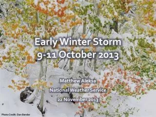
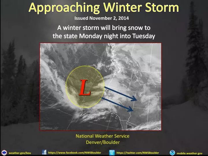
Approaching Winter Storm. Issued November 2, 2014. A winter storm will bring snow to the state Monday night into Tuesday. National Weather Service Denver/Boulder. https://www.facebook.com/NWSBoulder. https://twitter.com/NWSBoulder. weather.gov/ bou. mobile.weather.gov.

E N D
Approaching Winter Storm Issued November 2, 2014 A winter storm will bring snow to the state Monday night into Tuesday National Weather Service Denver/Boulder https://www.facebook.com/NWSBoulder https://twitter.com/NWSBoulder weather.gov/bou mobile.weather.gov
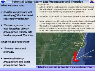
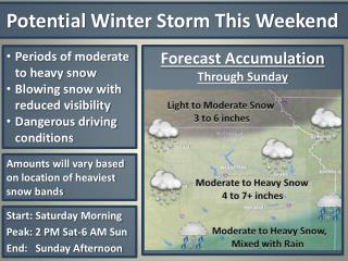
Winter Weather Briefing Key Points • Considerable uncertainty on storm track and strength. • Late tonight and Friday Morning: • Snow is expected to develop north of Fort Collins by midnight and then spread south into the Denver Metro area between 3am to 5am. • Northeast wind to 10 mph expected to increase 15 to 30 mph and gusty by 6am. • Snow is expected to become heavy by 9am with visibilities reduced to less than 1 mile. • 3 to 6 inches of snow expected over the plains by 9am. • Moderate to Heavy snow continues through afternoon before diminishing this evening. National Weather Service Denver/Boulder https://www.facebook.com/NWSBoulder https://twitter.com/NWSBoulder weather.gov/bou mobile.weather.gov
Winter Weather Briefing IMPACTS • Hazardous morning and evening commute. • Reduced visibilities to less than one half mile at times. • Dangerous wind chill values less than 10 below. • Total Snowfall amounts ranging 36 to 48 inches, with local amounts to 60 inches near the foothills. National Weather Service Denver/Boulder https://www.facebook.com/NWSBoulder https://twitter.com/NWSBoulder weather.gov/bou mobile.weather.gov
Winter Weather Briefing Timing/Snow Accumulation MountainValleys Plains Northern Mountains Foothills 8 to 14 inches 8 to 14 inches 8 to 14 inches 8 to 14 inches Monday Night - Tuesday Monday Night - Tuesday Tuesday Tuesday National Weather Service Denver/Boulder https://www.facebook.com/NWSBoulder https://twitter.com/NWSBoulder weather.gov/bou mobile.weather.gov
Approaching Winter Storm Issued November 2, 2014 National Weather Service Denver/Boulder https://www.facebook.com/NWSBoulder https://twitter.com/NWSBoulder weather.gov/bou mobile.weather.gov
Approaching Winter Storm Issued November 2, 2014 National Weather Service Denver/Boulder https://www.facebook.com/NWSBoulder https://twitter.com/NWSBoulder weather.gov/bou mobile.weather.gov
Winter Weather Briefing KEY POINTS RECAP • Hazardous morning and evening commute. • Reduced visibilities to less than one half mile at times. • Dangerous wind chill values less than 10 below. National Weather Service Denver/Boulder https://www.facebook.com/NWSBoulder https://twitter.com/NWSBoulder weather.gov/bou mobile.weather.gov