Download
1 / 58
610 likes | 842 Views
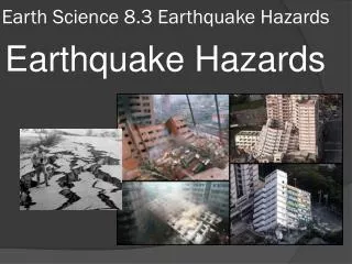
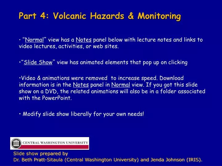
Part 4: Volcanic Hazards & Monitoring. “ Normal ” view has a Notes panel below with lecture notes and links to video lectures, activities, or web sites. “ Slide Show ” view has animated elements that pop up on clicking

E N D
Part 4: Volcanic Hazards & Monitoring • “Normal” view has a Notes panel below with lecture notes and links to video lectures, activities, or web sites. • “Slide Show” view has animated elements that pop up on clicking • Video & animations were removed to increase speed. Download information is in the Notes panel in Normal view. If you got this slide show on a DVD, the related animations will also be in a folder associated with the PowerPoint. • Modify slide show liberally for your own needs! Slide show prepared by Dr. Beth Pratt-Sitaula (Central Washington University) and Jenda Johnson (IRIS).
Volcanoes are… An opening on the planet’s surface where molten rock, ash, or gases escape from below Aleutian Islands, AK; International Space Station photo http://earthquake.usgs.gov/monitoring/anss/regions/hi/
Volcano Prior Knowledge Survey TRUE/FALSE –> thumbs up OR down 1. Volcanoes are steep-sided and ooze hot runny lava FALSE - “Hot runny” volcanoes are mostly flat or shield like
Volcano Prior Knowledge Survey TRUE/FALSE –> thumbs up OR down 2. The biggest eruptions flatten topography. TRUE – largest volume eruptions lead to flood basalt plateaus; most explosiveeruptions lead to mountains getting blown to bits
Volcano Prior Knowledge Survey TRUE/FALSE –> thumbs up OR down 3. Magma chambers are…big chambers of liquid rock FALSE - Magma “chambers” form when lava is injected in cracks and crevasses and pushes against existing rock. They are usually more of a plumbing system than a chamber.
SHOW ANIMATION “Mesozoic Subduction” from URL below. http://emvc.geol.ucsb.edu/2_infopgs/IP1GTect/cSubduction.html
Some volcano stats ~1,500 active volcanoes • How many active volcanoes on Earth? • How many volcanoes erupt per year? • How many people are killed by volcanoes? ~60 volcanoes erupt per year ~200,000 in the last 200 years
Where does molten rock come from? Modified from USGS Graphics MANTLE IS NOT LIQUID!!
Where do volcanoes form? • Subduction zones • “Hot spots” • Mid-ocean ridges • Continental rift zones
Rocks melt under certain circumstances • Heating • Decompression • Reducing melting temp by adding water
Types of Volcanoes Flood Basalts Millions km3 of horizontal basalt layers Columbia Flood Basalts Photo by Thor Thordarsson
Why do different magmas behave differently & make very different volcanoes? • VISCOSITY • VOLATILES • VOLUME “3 Vs” • WATER • CARBON DIOXIDE • Sulfur dioxide • Hydrogen sulfide
Viscosity determines: • The flow rate of magma • VOLATILE trapping vs
Viscosity depends on chemical composition LESS SILICA (=quartz=SiO2) MORE iron & magnesium LOTS O’ SILICA http://volcanoes.usgs.gov/images/pglossary/VolRocks.php
Types of Volcanoes Flood Basalts Millions km3 of horizontal basalt layers Columbia Flood Basalts Photo by Thor Thordarsson
Flood basalts • Extremely low viscosity • Few volatiles (non-explosive) • Very very large volume http://www.fas.org/irp/imint/docs/rst/Sect17/Sect17_3.html
Flood basalts - HAZARDS • Bury your state in lava • Huge green house gas release • Geologic ennui (if you find basalt dull) http://www.fas.org/irp/imint/docs/rst/Sect17/Sect17_3.html Not a current hazard
Columbia River Flood Basalts Thor Thordarsson • Over 300 separate flows averaging 580 km3 EACH • 3.5 km thick in places • Erupted 17.5-6 Ma • ~90% erupted 16-15 Ma http://geosphere.gsapubs.org/content/4/3/480.full.pdf+html
Shield Volcanoes • Low viscosity • Few volatiles (non-explosive) • Large volume Mauna Loa, Hawaii USGS
Shield Volcanoes - HAZARDS Not hugely hazardous • Lava flows • Volcanic gasses (esp. CO2) Medicine Lake Volcano, CA USGS
Cinder cone (or scoria cone) • Moderate viscosity • Some volatiles • Small volume Lava Butte, OR ~600 m Image released to public domain by Q Myers (English Wikipedia)
Stratovolcano • Mod–high viscosity • Few-many volatiles (mod-very explosive) • Mod-large volume & Mt Rainier and Seattle, WA
Ash cloud Stratovolcano – multiple types of eruption processes Pyroclastic flows USGS Mt Mayon, Philippines, 2006 Lava dome http://www.tulane.edu/~sanelson/geol111/igneous.htm USGS Mt. St. Helens, 1984
Stratovolcano - Mt St Helens USGS Before 1980 eruption built up USGS After 1980 eruption blown to bits
Stratovolcano - HAZARDS DEFINITELY HAZARDOUS!! • Pretty much all types of volcanic hazards USGS
Stratovolcanoes – PACIFIC NW Most Cascade volcanoes are stratovolcanoes (typical for subduction zones) Stratovolcano
shield vs composite Mauna Loa’s full height = 19,000 ft + 13,000 ft = 32,000 ft below sea level above sea level Mt Rainer = 14,400 ft
Caldera formation • High viscosity • Many volatiles (very explosive) • Large volume Coke w/ dry ice Magma chamber partially emptied during eruption Center collapses down and forces out more magma Caldera is formed http://pubs.usgs.gov/fs/2002/fs092-02/
Caldera formation - HAZARDS • Ash falls • Pyroclastic flows • Volcanic landslides • Volcanic gasses !!EXTREMELY HAZARDOUS!! (but infrequent) http://pubs.usgs.gov/fs/2002/fs092-02/
Yellowstone, WY Continental Hotspot Caldera http://pubs.usgs.gov/fs/fs100-03/
Yellowstone Eruptions http://pubs.usgs.gov/fs/2005/3024/ http://www.nps.gov/yell/naturescience/eruptions.htm
Snake River Plain, IdahoPossible Hot Spot Trail from SW to NE over last 16 Ma OR 0.6 Ma 1.3 Ma 2 Ma 5 Ma 10 Ma 16 Ma ID UT NV WY 80 km Image after Smith & Siegel (2000), Windows into the Earth: the Geological Story of Yellowstone and Grand Teton National Parks
Proposed relationship between flood basalts & hotspots Columbia Flood Basalts Yellowstone hotspot track ~16 Ma
Cascade Volcanoes Show real roll-over
Major rock types CLASSIFICATION OF INTRUSIVE ROCKS Gabbro Diorite Granodiorite Granite
Volcanic Hazards • Pyroclastic flow (a.k.a. ash flow) • Lahar (a.k.a. mud flow or debris flow) • Gases • Ash falls • Volcanic Landslides • Lava Flows • Tsunamis USGS
Ash fall hazard USGS
Signs of Volcanic Activity • Scientists look for five signs that volcanic processes are at work • Eruption History • Volcanic Gases • Heat and Hydrothermal Activity • Earthquakes • Ground deformation
Monitoring Scientists use many tools to monitor volcanoes Since erupting volcanoes are dangerous, they prefer tools that can be set up and left Image from USGS (2002) Volcano Hazards Program: Strategy for reducing volcanic riskhttp://volcanoes.usgs.gov/
Volcanic Gases • Volcanic gases are hazardous and hard to sample – they can be detected using : • Spectrometers mounted on ground or airplane • Samples collected by hand and analyzing in a laboratory A scientist collects gas samples (Note the protective equipment) Image from USGS Volcano Hazards Program “Measuring volcanic gases: emission rates of sulfur dioxide and carbon dioxide in volcanic plumes.” http://volcanoes.usgs.gov/About/What/Monitor/Gas/plumes.html
Volcanic Gases • Trees and animals can be effected by gasses and aid detection • Trees at Mammoth Mt, CA died when CO2 suffocated their roots Image from USGS Fact Sheet 172-96“Invisible CO2 Gas Killing Trees at Mammoth Mountain, California” http://pubs.usgs.gov/fs/fs172-96/
Heat & Hydrothermal Activity • Hydrothermal activity demonstrates presence of magma, not necessarily magma movement • Thermal features can be monitored by: • Night aerial observations • Thermal (infrared) imaging • Direct temperature measurements Infrared image of Mt. St. Helens’ new lava dome June 26th 2007 Image from (2007) USGS Mount St. Helens, Washington Forward Looking Infrared Images http://vulcan.wr.usgs.gov/Imgs/Jpg/MSH/MSH07/MSH07_area_new_growth_on_dome_06-26-07_FLIR_med.jpg