Download
1 / 22
220 likes | 384 Views
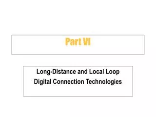
Part VI Precise Point Positioning Supported by Local Ionospheric Modeling. GS894G. Presentation Outline. Research objectives The Benefits of PPP MPGPS™ Software Methodology Experiments and test results Summary and Conclusions. Research Objectives.

E N D
Part VI Precise Point Positioning Supported by Local Ionospheric Modeling GS894G
Presentation Outline • Research objectives • The Benefits of PPP • MPGPS™ Software • Methodology • Experiments and test results • Summary and Conclusions
Research Objectives • Develop precise point positioning (PPP) methodology and algorithms for surveying and navigation applications • Take advantage of the existing IGS products (precise orbits and clock corrections) • Provide local ionospheric maps (LIM) and tropospheric total zenith delays (TZD) from permanent GPS stations to support single-frequency PPP • Evaluate the quality of single and dual-frequency static and kinematic PPP in post processing
MPGPS™ - Multi Purpose GPS software • Developed at The Ohio State University (OSU) • Positioning Modules • Long-range instantaneous (single epoch) RTK GPS • Rapid-static • Static • Multi-station DGPS • Precise point positioning (PPP) • Atmospheric Modules • Ionosphere modeling and mapping • Troposphere modeling • Positioning Solutions • Single-baseline • Multi-baseline (network) • Stand-alone
The Benefits of PPP • Single receiver operation (low-cost) • Can be applied anywhere and anytime under different dynamics (remote areas, space applications, etc) • Not limited by baseline length as relative techniques • Independence on GPS reference stations • Can be applied for static and kinematic platforms
MethodologyError Sources in PPP Errors affecting the GPS observations • Satellite orbit and clock corrections, (provided by IGS) • accuracy < 5 cm and <0.1 ns (3 cm) • Relativistic effects (included in the IGS orbits, except for the periodic relativity, which is modeled in MPGPS™) • periodic relativity - up to30 ns (~9 m) • Receiver and satellite antenna phase center offsets (provided by IGSor NGS) • satellites - up to 1.023 m, receiver up to - 0.2 m • Satellite P1P2 and P1-C1 differential code biases (DCBs) (provided by IGS) • up to2 ns (0.6 m), accuracy 0.1 ns (3 cm) • Receiver DCB (GPS receiver calibration in MPGPS™ or IGS) • up to20 ns (6 m), accuracy 0.1 ns (3 cm) • Phase wind-up • up to1 cycle (~0.2 m) of carrier phase data
MethodologyError Sources in PPP Errors affecting the GPS observations (cont.) • Ionospheric refraction • Ranges from <1 m to >100 m • Tropospheric refraction • TZD = ~ 2.3 m (for standard atmosphere) Errors affecting the station coordinates • Atmospheric loading • correction: vertical < 1 cm • Ocean loading • corrections : horizontal < 2 cm, vertical < 5 cm • Solid Earth tides • correction: horizontal <5 cm, vertical <30 cm • Earth Rotation Parameters, i.e., pole position and UT1-UTC (included in the IGS orbits)
MethodologyAdjustment Model GLS – Generalized Least Squares adjustment • All parameters in the mathematical model are considered pseudo-observations with a priori information (σ = 0 ÷ ) • Two groups of parameters (pseudo-observations) of interest: • instantaneous parameters (e.g., ionospheric delays) • accumulated parameters (e.g., ambiguities) • Flexibility, easy implementation of: • stochastic constraints • fixed constraints • weighted parameters • filters
MethodologyPPPFunctional Model • undifferenced carrier phase and code observations (in meters) • geometric distance (satellite-receiver) • constant bias, where • integer carrier phase ambiguity and non-zero initial fractional phase • - receiver and satellite clock offsets • - tropospheric total zenith delay (TZD) • - troposphere mapping function • - slant ionospheric delay • receiver and satellite code and phase hardware delays • corresponding carrier wavelength • - speed of light • - random error or residual
MethodologyPPP- Functional Model Unknowns • Permanent GPS station solution for local ionosphere maps (LIM) • receiver clock • tropospheric TZD • slant ionospheric delays • bias parameters (non-integer ambiguities and hardware delays) • Single-frequency positioning solution • rover coordinates • receiver clock • bias parameters • Dual-frequency (ionosphere-free) positioning solution • rover coordinates • receiver clock • tropospheric TZD • bias parameters
Methodology Local Ionospheric Model (LIM) Supports PPP in case of single-frequency receiver • Single layer model (SLM) ionosphere approximation • Slant ionospheric delays estimation from dual-frequency GPS data at the neighboring permanent stations • Slant ionospheric delays conversion to vertical total electron content (VTEC) at ionosphere pierce points (IPPs) • Kriging interpolation to produce LIM in a form of a grid using the calculated vertical TEC values at IPPs
MethodologyLocal Ionospheric Model (LIM) SLM – Single Layer Model z - zenith angle H - SLM height R - Earth radius 1 TECU = 1016 ellectron/m2 = 0.162 m delay/advance SLM assumes that all free electrons are contained in a shell of infinitesimal thickness at altitude H
Methodology PPP Models • Three PPP MPGPS™ models were tested in post processing mode • Static PPP – dual-frequency (ionosphere-free) • Static PPP – single-frequency supported by LIM • Kinematic PPP – single-frequency supported by LIM • Adaptive filter for kinematic solution • Follows the dynamicvariations of the system estimates and stochastic models • Propagates the coordinate and ionosphere residuals together with their stochastic characteristics • Forwardandbackwardfilters
Experiments and test resultsData Source • Four stations, IGS/EPN (EUREF permanent network) • Three stations were used to derive LIM and TZD (BOR1, GOPE, KRAW) • One station was selected as a rover (WROC) • Two three-hour sessions • 01 - 04 UTC (nighttime - lowest TEC level) • 13 - 17 UTC (daytime - highest TEC level) • 30-second sampling rate (i.e., 360 epochs per session) • Phase-smoothed pseudoranges • Distances between permanent stations ~330 km (average) • Distances to the rover ~130–230 km
Experiments and test resultsTest Area Map N ____________________________________________________ Rover - LIM/TZD - PPP (rover) Poland Czech Republic
Experiments and test resultsSatellite Geometry - Station WROC ____________________________________________________ 13-17 UTC daytime 4-5 satellites 01-04 UTC nighttime 4-7 satellites GDOP =~1000 GDOP = ~80 Poorsatellite geometry, high GDOP - usually over 5 A short period with very poor geometry occurred in both sessions
Experiments and test resultsExample LIM-derived ionospheric delays _______________________________________________________ 13-17 UTC daytime highest TEC 01-04 UTC nighttime lowest TEC Station WROC (rover)
Experiments and test resultsStatic PPP Analysis – Station WROC ____________________________________________________ Daytime, dual-frequency (ionosphere-free LC) Nighttime, dual-frequency (ionosphere-free LC) Nighttime, single-frequency supported by LIM Daytime, single-frequency supported by LIM
Experiments and test resultsStatic PPP Analysis – Station WROC • Ionosphere-free solution • Horizontal - sub-decimeter-level position accuracy • Vertical - decimeter-level • Nighttime - convergence after 40 minutes • Daytime - convergence after 25 minutes • Single-frequency solution supported by LIM • Good agreement with its ionosphere-free counterpart • Similar accuracies and convergence times • LIM proved to be efficient in removing the ionospheric delays
Experiments and test resultsKinematic PPP Analysis – Station WROC ____________________________________________________ 13-17 UTC (daytime) 01-04 UTC (nighttime) Unfiltered single-frequency supported by LIM Filtered single-frequency supported by LIM
Experiments and test resultsKinematic PPP Analysis – Station WROC • The unfiltered solutions are very noisy in both sessions • In the filtered solution the large residuals were smoothed out after a few iterations (3-4) • The filtered kinematic solutions show similar accuracies as obtained in the static case • Sub-decimeter horizontal and decimeter-level vertical position accuracy was achieved
Summary and Conclusions • The sequential GLS adjustment was successfully applied in the PPP algorithm • Single-frequency static and kinematic PPP solutions, supported by LIM, are comparable to the ionosphere-free solutions • The results prove a good quality of the obtained LIM • The effectiveness of the adaptive filter was presented in the kinematic mode, even under unfavorable satellite geometry • This algorithm may be applied in geodeticapplications, where sub-decimeter level accuracy is required