Download
1 / 45
450 likes | 572 Views
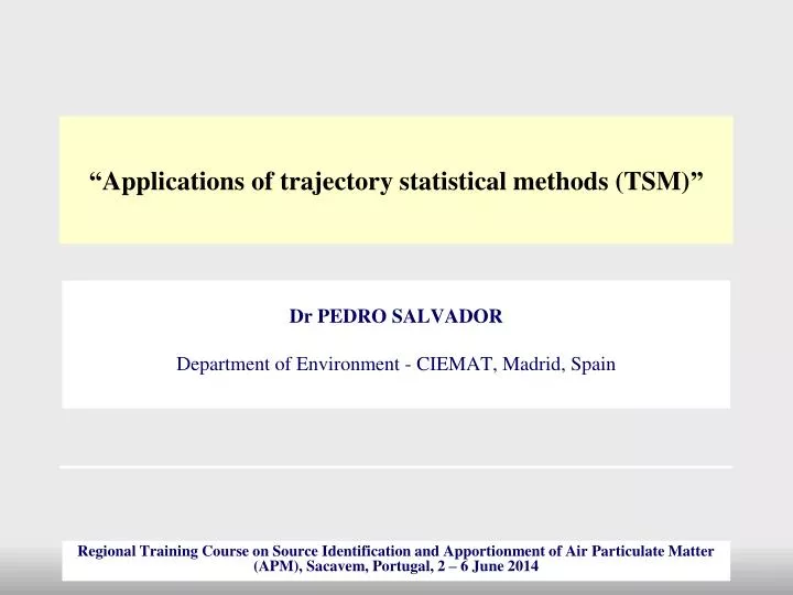
“ Applications of trajectory statistical methods (TSM) ”. Dr PEDRO SALVADOR Department of Environment - CIEMAT, Madrid, Spain. Regional Training Course on Source Identification and Apportionment of Air Particulate Matter (APM), Sacavem , Portugal, 2 – 6 June 2014.

E N D
“Applications of trajectory statistical methods (TSM)” Dr PEDRO SALVADOR Department of Environment - CIEMAT, Madrid, Spain Regional Training Course on Source Identification and Apportionment of Air Particulate Matter (APM), Sacavem, Portugal, 2 – 6 June 2014
STRUCTURE OF THE PRESENTATION • Learning SURFER skills • ClusterAnalysis: Cape Verde, a case study • RTA-CPF: Cape Verde, a case study
MAIN COMPUTER TOOLS • Thealgorithmsof the TSM wereprogrammedwith FORTRAN77 • The final data treatmentwasperformedwith EXCEL • Thegraphicalrepresentation of theproducts(trajectories, meteorologicalfields, RTA maps, RCF…) wereperformedwith SURFER
LEARNING SURFER SKILLS 1- LEARNING SURFER SKILLS SURFER is a comercial software for Windows SURFER is a grid-basedcontouring and 3-D surfaceplottingimages • SURFER willhelpusto: • Plot back-trajectoriesover a regular geographicgrid • Create and represent a regularlyspacedgrid of meteorological variables • Create and representinterpolatedmapsfrom a regularlyspacedgrid of variables • Represent CPF orConcentrationFieldsona regularlyspacedgrid
LEARNING SURFER SKILLS LOADING OUR BASE MAP Base maps are usedto show geographicinformation Wewill load the “World_BM.bln” base mapwhichcontains allcountyboundarieson a Longitude-Latitude XY map Open SURFER program Create a new Plot-Document: File-> New-> Plot -Document Load a Base map: Map-> Base Map Goto: C:\course\Practice1\World_BM.bln
LEARNING SURFER SKILLS REPRESENTING TRAJECTORIES ON THE BASE MAP Post maps show XY locationson a mapwith symbols and labels Goto: C:\course\Practice1\PRACTICE 1.xls Worksheet “3 TRAJECTORIES” containsthe time stepscoordinates of longitude and latitude in columnsfor 3 trajectories Represent a trajectory as a Post Map: Map-> Post Map-> New Post Map
LEARNING SURFER SKILLS REPRESENTING TRAJECTORIES ON THE BASE MAP SelectthePost Mapin theleftcolumn, wherealltheobjects of yourmap are displayed Theproperties of thetrajectory can be changedhere (symbol and size of the time steps, coordinates of othertrajectories…)
LEARNING SURFER SKILLS REPRESENTING TRAJECTORIES ON THE BASE MAP Let’sintegratethetrajectoryoverthe Base Map Select al theobjectsto be integrated: Edit> SelectAll Overlaytheobjects: Map-> OverlayMaps
LEARNING SURFER SKILLS REPRESENTING TRAJECTORIES ON THE BASE MAP SelectthePost Mapin theleftcolumn and improvethetrajectory(red points, 0.03 cm size) SelecttheLimitsoption in thePost Mapproperties and make a zoom (Lon: 50ºW-0º, Lat: 0º-20ºN)
LEARNING SURFER SKILLS REPRESENTING TRAJECTORIES ON THE BASE MAP EXERCISE: Representthe 3 trajectories of PRACTICE 1.xls withdifferentcolours in anappropiatedframe Overlayalltheobjectsafterrepresentingthethreetrajectories SelecteachPost Map(trajectories) and changeitsproperties SelecttheLimitsoption in theBase Mapproperties and make a zoom (Lon: 50ºW-0º, Lat: 10ºS-40ºN) SelecttheAxis properties and modify:Axis attributtes: 0.04 cm – Labels-> Font: 6 points – Ticks-> MajorTicks 0.10 cm - Scaling-> Majorinterval: 10 -> Firstmajortick: 50…
LEARNING SURFER SKILLS REPRESENTING METEOROLOGICAL FIELDS ON THE BASE MAP • SURFER allowscreating and representinga regularlyspacedgrid of variables Wewill use dailyfields of meteorological variables (sea levelpressure, 850 hPageopotentialheight,…) First of allitisnecessarytocreatethegrid file froman XYZ data file Goto: C:\course\Practice1\PRACTICE 1.xls Worksheet “DAILY FIELDS” containsthedialyfields of geopotentialheight at the 850 hPalevelforthe 3 trajectories (13/Jul/2011, 24/Ene/2011 and 31/Jul/2011) at 12 UTC Createthegrid file: Grid-> Data • Select: • thecolumns of data XYZ • thename of the output grid file • theKriginggriddingmethod
LEARNING SURFER SKILLS REPRESENTING METEOROLOGICAL FIELDS ON THE BASE MAP • Thegrid file TRAJECTORY 1.grd has nowbeencreated Createthecontourmapwiththisgrid file: Map-> ContourMap-> New ContourMap IMPORTANT: anymap can be exported as animage file (*.wmf, *.emf,*.jpg,…): File-> Export
LEARNING SURFER SKILLS REPRESENTING METEOROLOGICAL FIELDS ON THE BASE MAP SelecttheContoursMapin theleftcolumn SelecttheLeveland Lineoptionsin theContoursMap -> Levelsproperties: • Changethewidth of theisolines (0.01 cm) • Reduce theintervalbetweenisolinesto 10 hPa
LEARNING SURFER SKILLS REPRESENTING METEOROLOGICAL FIELDS ON THE BASE MAP Select al theobjectsto be integrated: Edit-> SelectAll Overlaytheobjects: Map-> OverlayMaps SelecttheLimitsoption in theBase Mapproperties and make a zoom (Lon: 50ºW-20ºE, Lat: 10ºS-40ºN)
LEARNING SURFER SKILLS REPRESENTING METEOROLOGICAL FIELDS ON THE BASE MAP EXERCISE: Representthe 3 geopotentialheightfields of PRACTICE 1.xls togetherwiththeircorrespondingtrajectories
CLUSTER ANALYSIS 2- CLUSTER ANALYSIS: CAPE VERDE, A CASE STUDY A k-meansclusteranalysiswill be performedwiththe data base of APM obtained at Cape Verde (CV) • 138 data of PM10, Mineral dust and Marine aerosol contributions (PMF) • 138 4-days (96 hourly time steps) back-trajectorieswithorigin at 1500 m agl Each back-trajectory file can be found in: C:\course\Practice2\CA withtheformat yyyyddmm.txt A FORTRAN 77 programwill be usedtoperformtheclusteranalysis Resultswill be representedwith SURFER
CLUSTER ANALYSIS 2- CLUSTER ANALYSIS: CAPE VERDE, A CASE STUDY Open program: Compact Visual Fortran 6 -> Developer Studio Open Workspace: File-> Open Workspace-> C:\course\Practice2\CA\CA.dsw The“FIRST_CCENTERS.txt” file containsthe Time steps of theinitialcluster centers The “DATES.txt” file containsthe Dates of thetrajectorieswiththeformat: yyyymmdd
CLUSTER ANALYSIS 2- CLUSTER ANALYSIS: CAPE VERDE, A CASE STUDY Firstly, a 2-means CA will be performedfor Cape Verde trajectories 2 trajectorieswith a differentbehaviourwereselectedby visual inspection They are the 2 firsttrajectories of PRACTICE 1
CLUSTER ANALYSIS 2- CLUSTER ANALYSIS: CAPE VERDE, A CASE STUDY Goto: C:\course\Practice2\PRACTICE 2.xls Worksheet “2 INITIAL CLUSTER CENTERS” containsthe time stepscoordinates (longitude and latitude) of the 2 trajectories in columns Select and Copythe data Open the“FIRST_CCENTERS.txt” file in the leftcolumn of theWorkspace Copythe time steps data
CLUSTER ANALYSIS 2- CLUSTER ANALYSIS: CAPE VERDE, A CASE STUDY Executetheprogram: Writethenumber of clusters: 2
CLUSTER ANALYSIS 2- CLUSTER ANALYSIS: CAPE VERDE, A CASE STUDY • Theprogramgenerates a number of ASCII (text) files: • “CLUSTER CENTERS.txt” withthe time steps of the final cluster centers • “RESULTS.txt” withtheclusterassignedtoeach date/trajectory • “EXTRA INFORMATION.txt” withthenumber of trajectoriesassignedtoeachcluster and within, between and total variances • “Cluster X.txt” withthe time steps of allthetrajectoriesassignedtocluster X Copyallthese data files and paste in C:\course\Practice2\
CLUSTER ANALYSIS 2- CLUSTER ANALYSIS: CAPE VERDE, A CASE STUDY Open the SURFER program and load theBase map: Map-> Base Map Goto: C:\course\Practice2\World_BM.bln Representthecluster centers as Post Maps: Map> Post Map-> New Post Map Goto: C:\course\Practice2\CLUSTER CENTERS.txt
CLUSTER ANALYSIS 2- CLUSTER ANALYSIS: CAPE VERDE, A CASE STUDY Representthemembers of thecluster centers as Post Maps: Map-> Post Map-> New Post Map Goto: C:\course\Practice2\Cluster 1.txt and Cluster2.txt Cluster 1: Marines air flows Cluster 2: Continental air flows
CLUSTER ANALYSIS 2- CLUSTER ANALYSIS: CAPE VERDE, A CASE STUDY Analizetheclusteringprocess: Goto: C:\course\Practice2\RESULTS.txt and open the file with Excel Theclusterassignmentforeachtrajectoryduringthe 4 iterations are showed In most cases, theclusterassignmentdidnotchangedacrossthe 4 iterations
CLUSTER ANALYSIS 2- CLUSTER ANALYSIS: CAPE VERDE, A CASE STUDY Open the: C:\course\Practice2\PRACTICE 2.xls Excel file Worksheet “PM10” containsthe 138 concentrationvalues of PM10, Mineral dust and Marine aerosol contributions (PMF) Copythe ITER4 columnfromRESULTS.txt and paste in column F of Worksheet “PM10” of PRACTICE 2.xls
CLUSTER ANALYSIS 2- CLUSTER ANALYSIS: CAPE VERDE, A CASE STUDY Workwiththese data and analizethe mean levels of PM10, Mineral dust and Marine aerosol attributedtoeachcluster • Preliminaryresults: • More frequent continental air flows (73%) than marine air flows (27%) • Highercontribution of Saharandust (38.5 µg/m3) attributedto continental air flows • Highercontribution of Sea salt (19.8 µg/m3) attributedtomarine air flows
CLUSTER ANALYSIS 2- CLUSTER ANALYSIS: CAPE VERDE, A CASE STUDY EXERCISE: Perform a 3-means ClusterAnalysis Goto: C:\course\Practice2\PRACTICE 2.xls Page “3 INITIAL CLUSTER CENTERS” containsthe time stepscoordinates (longitude and latitude) of the3 trajectories in columns
CLUSTER ANALYSIS 2- CLUSTER ANALYSIS: CAPE VERDE, A CASE STUDY EXERCISE: Perform a 3-means ClusterAnalysis Goto: C:\course\Practice2\PRACTICE 2.xls Worksheet “3 INITIAL CLUSTER CENTERS” containsthe time stepscoordinates (longitude and latitude) of the3 trajectories in columns Cluster 2: Continental air flows Cluster 1: Southern-Atlantic air flows Cluster 3: Northern-Atlantic air flows
RESIDENCE TIME ANALYSIS 3 – RESIDENCE TIME ANALYSIS: CAPE VERDE, A CASE STUDY A Residence Time analysiswill be performedwiththe data base of APM obtained at Cape Verde (CV) • 138 data of PM10, Mineral dust and Marine aerosol contributions (PMF) • 138 4-days (96 hourly time steps) back-trajectorieswithorigin at 1500 m agl A 2º longitude x 2ºlatitude cellgridwassuperimposedovertheregiondefinedby 2ºN-60ºN and 49ºW-20ºE CPF will be computedforeachcell of thegrid
RESIDENCE TIME ANALYSIS 3 – RESIDENCE TIME ANALYSIS: CAPE VERDE, A CASE STUDY A FORTRAN 77 programwill be usedtoperformthe RTA Open program: Compact Visual Fortran 6 -> Developer Studio Open Workspace: File-> Open Workspace-> C:\course\Practice3\RTA\RTA.dsw The “DATES.txt” file containsthe Dates of allthesamplingdays withtheformat: yyyymmdd The “INCIDENCE_DAYS.txt” file containsthe Dates of the “incidencedays” withtheformat: yyyymmdd
RESIDENCE TIME ANALYSIS 3 – RESIDENCE TIME ANALYSIS: CAPE VERDE, A CASE STUDY Open the: C:\course\Practice3\PRACTICE 3.xls Excel file Worksheet “PM10 data” containsthe 138 concentrationvalues of PM10, Mineral dust and Marine aerosol contributions (PMF) Letusconsider as “incidencedays” for PM10, dayswithconcentrationshigherthanthe 90th Percentile Mean value of PM10 concentrations: 84.8 µg/m3 90th Percentile of PM10 concentrations: 195.0 µg/m3
RESIDENCE TIME ANALYSIS 3 – RESIDENCE TIME ANALYSIS: CAPE VERDE, A CASE STUDY • CopyaparttheDATE and PM10 columns • Re-orderthe data fromthehighesttothelowestvalue of PM10 concentrations • Selectthe dates of theincidencedays: • PM10 concentrations > 195.0 µg/m3
RESIDENCE TIME ANALYSIS CopytheDATEcolumn, open the DATES.TXT file in theleftcolumn of theWorkspace, and paste the data Copythedate values of theincidencedays, open the INCIDENCE DATES.TXT file in theleftcolumn of theWorkspace, and paste the data
RESIDENCE TIME ANALYSIS Executetheprogram:
RESIDENCE TIME ANALYSIS Thisprogramreadseach back-trajectory file (in: C:\course\Practice3\RTA) withtheformat yyyyddmm.txt, forallthesampling dates (DATES.txt) and theIncidencedaysdates (INCIDENCE_DAYS.txt) • Thenumber of time-stepsresidingoneachgridcelliscalculatedforallthesampling dates (TS) and fortheIncidencedays dates (ID) • Thenumber of trajectoriescontributingwith time stepstoeachgridcelliscalculated (Ntr) • Foreachgridcellwith >1 time step-> CPF=(ID)/(TS)
RESIDENCE TIME ANALYSIS • Theprogramgeneratesan ASCII (text) file: • “RTA_CV.txt” withthevalues of Ntr, TS, ID and CPF foreachgridcell
RESIDENCE TIME ANALYSIS Goto: C:\course\Practice3\RTA\RTA_CV.txt and open the file with Excel Copythe 5 columns and paste in theC:\course\Practice3\PRACTICE 3.xls Excel file in a new worksheetcalled “RTA”
RESIDENCE TIME ANALYSIS Copythecolumn B fromworksheet “9 PF” of PRACTICE 3.xlsand paste in column G (nexttothe CPF values) of worksheet “RTA” A 9 pointfilteristhuscomputedtosmooththe CPF map and preserve significantvariations
RESIDENCE TIME ANALYSIS REPRESENTING THE CPF MAP Open the SURFER program and load theBase map: Map-> Base Map Goto: C:\course\Practice3\World_BM.bln Representthe CPF as a Classed Post Map: Map> Post Map-> New Classed Post Map Goto: C:\course\Practice3\PRACTICE 3.xls and pick: RTA worksheet SelecttheClassed Post in theleftcolumnwherealltheobjects of yourmap are displayed Selectthe 9 POINT FILTER column as the Z variable in theGeneraloptions SelecttheClassesoptions : 5 classes BinningMethod: Equalintervals Symbol: square Syze: 0.08 cm
RESIDENCE TIME ANALYSIS REPRESENTING THE CPF MAP Select al theobjectsto be integrated: Edit> SelectAll Overlaytheobjects: Map-> OverlayMaps
RESIDENCE TIME ANALYSIS REPRESENTING THE CPF MAP SelecttheClassed Post Map, clickontheright mouse and OrderOverlay-> Moveto back SelecttheLimitsoption in theClassed Post Mapproperties and make a zoom (Lon: 50ºW-20ºE, Lat: 2ºS-60ºN) Air massespassingover Mali, Mauritania and Senegal entailhighconcentrationevents of PM10 at Cape Verde
RESIDENCE TIME ANALYSIS REPRESENTING THE CPF MAP Representthecomposite 850 geopotentialheightfield of the PM10 “highincidencedays” as a ContourMap: Map> ContourMap-> New ContourMap CreatetheGrid Data file: Grid-> Data Goto: C:\course\Practice3\PRACTICE 3.xls and pick: SYNOP HI PM10 worksheet
RESIDENCE TIME ANALYSIS EXERCISE: Perform a RTA with “lowincidentdays” for PM10 Goto: C:\course\Practice3\PRACTICE 3.xls Worksheet “PM10 data” containsthe 138 concentrationvalues of PM10 Letusconsider as “incidencedays” for PM10, dayswithconcentrationslowerthanthe 10th Percentile Mean value of PM10 concentrations: 84.8 µg/m3 10th Percentile of PM10 concentrations: 23.6 µg/m3
RESIDENCE TIME ANALYSIS Air massespassingoversouthtosouthwesternatlanticareasentaillowconcentrationevents of PM10 at Cape Verde
ACKNOWLEDGEMENTS ACKNOWLEDGEMENTS THANK YOU VERY MUCH FOR YOUR ATTENTION