Download
1 / 13
130 likes | 254 Views
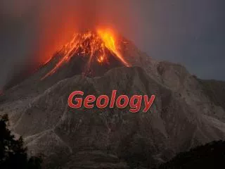
GEOLOGY DISCUSSION. R.M. Easton. ~500 km radius. ~300 km radius.

E N D
GEOLOGYDISCUSSION R.M. Easton Geoneutrino Conference, Sudbury, September 17-19, 2008
~500 km radius ~300 km radius Geoneutrino Conference, Sudbury, September 17-19, 2008
Elliot Lake minesextracted 350 million tonnes of ore with an average grade of 765 ppm U, roughly equal Th (0.09% U3O8 or 1.8 lbs/ton or 136,000 tonnes of uranium metal)Pele Mtn. Pecors Lake prospect 2008estimate 30 million tonnes at 425 ppm U Chalk River~290 km Darlington ~340 km Bruce~260 km Pickering~330 km Geoneutrino Conference, Sudbury, September 17-19, 2008
DATA SETS CURRENTLY AVAILABLE RELEVANT TO ESTIMATING HPE IN THE CRUST IN THE SUDBURY AREA • Determine crustal thickness, estimates of lower, middle, upper crust thickness, depth to Moho • Seismic reflection and refraction data on land and in Great Lakes, for Superior and Grenville Provinces, under Southern Province east of Sudbury (Wanapitei magnetic anomaly) (GLIMPCE, COCRUST, LITHOPROBE) Geoneutrino Conference, Sudbury, September 17-19, 2008
Ground gravity data good for Sudbury and parts of Abitibi, gravity models for Sudbury, Killarney, various parts of the Grenville Province • Actual heat flow measurements and HPE determinations • Data of Jean-Claude Mareschal and co-workers • Regional geology well known, with one exception (crust beneath Manitoulin Island and northern Lake Huron) Geoneutrino Conference, Sudbury, September 17-19, 2008
KNOWN UNKNOWNS Midcontinent Rift axis Superior Grenville unknown Paleozoic atop Grenville Geoneutrino Conference, Sudbury, September 17-19, 2008 KMB
Upper crustal compositional data • Whole-rock geochemical data (modern, high-quality data for Abitibi, Sudbury structure, more limited high-quality data for parts of Huronian, Grenville, Killarney) • Airborne gamma-ray surveys (both low and high-resolution over land) • Ground gamma-ray data in some areas in the Huronian (assay mode K, U, Th) collected in conjunction with a more limited whole-rock geochemistry data set • OGS Meridian 80 surface water and sediment geochemical data along 80W from Lake Erie to James Bay Geoneutrino Conference, Sudbury, September 17-19, 2008
Paleozoic data • OPG Bruce Nuclear diamond drill program collecting core through the Paleozoic from surface to Grenville basement beneath the Bruce site, core is accessible to OGS if we needed to collect K, U, Th data on main Paleozoic units • OPG making 3-D crustal model of Paleozoic for much of southwestern Ontario as part of their nuclear waste management program • Paleozoic stratigraphy well-known • Map of Grenville basement exists based on examining all basement-penetrating exploration holes Geoneutrino Conference, Sudbury, September 17-19, 2008
Extensional Events (± plume) Geoneutrino Conference, Sudbury, September 17-19, 2008