Download
1 / 17
170 likes | 365 Views
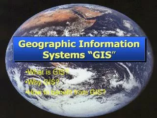
Hans-W. Mindt und Wolfgang Ottow GbR Ingenieurbüro für angewandte Strömungsmechanik Kruppstr. 82 – 100, 45145 Essen, Germany info@a-CFD.de www.a-CFD.de. From GIS to CFD - a CAD solution for data transfer between GIS and CFD-. Hans-Wilfried Mindt (Dipl.-Ing.). Contents.

E N D
Hans-W. Mindt und Wolfgang Ottow GbR Ingenieurbüro für angewandte Strömungsmechanik Kruppstr. 82 – 100, 45145 Essen, Germany info@a-CFD.de www.a-CFD.de From GIS to CFD- a CAD solution for data transfer between GIS and CFD- Hans-Wilfried Mindt (Dipl.-Ing.)
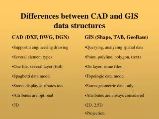
Contents • Problem determination • Point‘s of interrests • Fileformates used by GIS • Model topology • By splines (Points interpolated) • By points (Points exactly by using triangles) • Solution • Summary • Discussion
Problem determination • CFD solution in Environment • Exhaust emission • Condensation • Fresh-air supply for turbines and generators • Catastrophe scenarios
Problem determination • CFD solution in Environment • Power supply station • Residential district • Fresh-air supply for turbines and generators • Catastrophe scenarios
Problem determination • CFD solution in Environment
Model topology • Object based on CAD Points Lines (splines) Surfaces (bicubic)
Model topology • Object based on CAD STL-Data file (output) facett
Model topologic Data-Set from GIS or related programs • Points created opto-photografically • Triangulars transfered into IGES Format • IGES-Format transfered via CAD-System into STL-format • STL-File readeble by PHOENICS • Approximatly 1 day working time
Model topologic Data-Set from GIS or related programs • Rounded shape • Cliffs possible • Facetts
Model topology Data-Set from GIS or related programs • Curved surface as approximation of mountains, but cliffs and sharp rocks are possible to build.
Model topology Data-Set used in Rapid-prototyping branch • Catalytic Reactor Bed
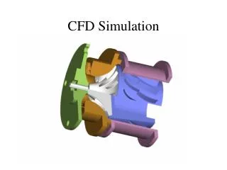
Solution Objects from Library Object form CAD-System Pressure distribution on the surface
Solution • Streamlines • Pressure distribution on surface
Summary • A simple and easy to use data transfer between GIS and CFD is useful. • The STL-Format is not established like in the rapid-prototype branch • All data-sets are sorted in 2 ½ D • We prefere • Triangulation by third party product • Transfer via iges into CAD-system • Cutting and adding of parts inside of CAD-System • Transfer of final geometric landscape (buildings can be included) via STL-File into CFD-System