Download
1 / 14
150 likes | 396 Views
PP 48 Use of GNSS distance instead of DME. B. Rabiller CNS-ATM steering group meeting Gatwick 12-13 February 2008. Overview. Introduction What are the operational needs? Enablers for using GNSS distance in lieu of DME Criteria to be respected Aeronautical information

E N D
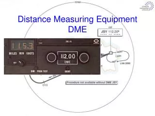
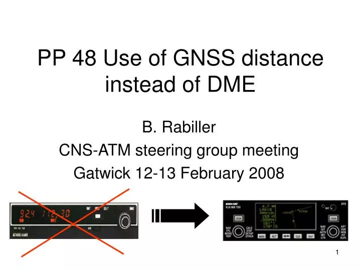
PP 48 Use of GNSS distance instead of DME B. Rabiller CNS-ATM steering group meeting Gatwick 12-13 February 2008
Overview • Introduction • What are the operational needs? • Enablers for using GNSS distance in lieu of DME • Criteria to be respected • Aeronautical information • GNSS aircraft installation • Operational procedures • Conclusion
Introduction • Ground navaid rationalization not conducted within the same timeframe between countries • Conventional navigation will coexist with RNAV for a while • Some airframers have started to design and produce aircraft without DME • Some discussion have already started at the IFPP regarding the use of GNSS distance in lieu of DME distance (Integration WG meeting at Phoenix last month). • Intent of PP 48 is to assess the possibility to use GNSS distance in lieu of DME distance and to identify relevant criteria
What are the operational needs? • Use of GNSS distance in lieu of DME distance for Enroute and terminal operations • Determining A/C position over a DME fix • Flying DME arc • Use of GNSS distance on a conventional approach (e.g. ILS, LOC/DME) • Aircraft longitudinal separation based on GNSS
Use of GNSS distance in lieu of DME distance for Enroute and terminal operations Determining A/C position over a DME fix DME Fix ADDRESSED IN PP 48 Flying DME arc
Use of GNSS distance on a conventional approach (e.g. ILS, LOC/DME) DME with an Offset NOT ADDRESSED IN PP 48 • Not so easy to authorize • Several issues to be solved :Offset DME, DME fix selection, …
Aircraft separation based on GNSS • Longitudinal separation minima based on GNSS instead of DME • PANS-ATM amendment approved (15th edition 2007). And/or collocated waypoint And/or collocated waypoint Could be acceptable from an airborne point of view if criteria proposed in this position paper (chapter 3.4) are respected
Enablers for using GNSS distance in lieu of DME • DME • DME TSE less than 0.2 NM (95%) • GNSS • GNSS NSE for IFR certified A/C less than 0.124 NM (95%) • No FTE in longitudinal axis • PDE should be constrained through quality assurance process (LOA type 2) and crew procedure • Longitudinal GNSS TSE less than 0.124 NM (95%) • Slant range error: • DME computes “slant” distance from the DME station whereas GNSS provides “ground” distance to the station. • Error negligible in particular when high accuracy is necessary (like in terminal area) • Examples: DME arc at 23 NM from the facility flown at FL 070 : dist error=0.03 Nm; DME arc at 12 Nm flown at 4000 ft: error=0.02Nm.
Criteria to be respected Proposalsfor the Aeronautical information • General rule authorising GPS substitution in the state AIP or the published procedure indicates that GNSS distance could be used in lieu of DME. • The DME fix should be at least referenced by the facility establishing this point. • The facility (DME ground navaids) should be clearly indicated on the chart for crew selection • A DME fix identified by a five-letter name could also be used directly if this waypoint is in the airborne navigation data base. • Coordinates should be in WGS 84.
Criteria to be respected Proposal for the GNSS aircraft installation • RNAV/GNSS IFR certified system (e.g. BRNAV, PRNAV) • Integrity provided by at least Enroute RAIM or equivalent. • Identification of the facility establishing the DME fix or the DME fix itself (e.g. 5 letter name) should be clearly indicated to the crew when used. • E.g. indicated on the RNAV/GNSS Control Display Unit • Distance to the DME fix or to the facility establishing the DME fix continuously displayed in the pilot primary field of view • Distance to the DME fix or to the facility establishing the DME fix should be indicated in 1/10th of NM when distance is less than 100 NM
Criteria to be respected Proposal for Operational procedures (1/3) • Procedure should be defined to address RAIM outages • In case of RAIM outage : reliance on other approved equipment or flight should be reconsidered • A “non-GNSS approach” should exist: • at the alternate airport when one is required or • at the destination airport if alternate is not operationally required. • If the “non-GNSS approach” requires DME, aircraft must be equipped with DME.
Criteria to be respectedProposal for Operational procedures (2/3) • To determine aircraft position over a DME fix : • If the fix is identified by a five-letter name and contained in the nav database • Select either the named fix as the active GPS WPT or the facility establishing the DME fix as the active GPS WPT. • If the fix is identified by a five-letter name which is not contained in the nav database, or if the fix is not named • select the facility establishing the DME fix. • When selecting the named fix as the active GPS WPT, a pilot is over the fix when the GPS system indicates the overfly of the active WPT. • When selecting the facility establishing the DME fix as the active GPS WPT, a pilot is over the fix when the GPS distance from the active WPT equals the charted DME value.
Criteria to be respectedProposal for Operational procedures (3/3) • To Fly a DME Arc : • Select from the nav database the facility providing the DME arc as the active GPS WPT. • The only acceptable facility is the DME facility on which the arc is based. If this facility is not in the airborne database, crew is not authorized to perform this operation. • Maintain position on the arc by reference to the GPS distance instead of a DME readout.
Conclusion 1/ Criteria have been proposed to authorise the use of GNSS distance instead of DME distance for Enroute and Terminal operation • Issuance of an EASA operational guidance addressing this use is strongly recommended and consideration of MEL DME item alleviation within this context. 2/ Regarding the use of GNSS distance on conventional approaches (ILS, LOC/DME) no criteria have been proposed so far in this position paper but concerns to be addressed have been identified • a feedback from the group is necessary on this topic 3/ For the aircraft separation based on GNSS distance it is proposed to use the « position paper criteria » to address this operational need. • It’s up to the ANSP to implement such longitudinal separation based on the amended PANS ATM criteria