Download
1 / 27
270 likes | 379 Views
Lab 4. Orographic Lifting, Apparent Temperature, Satellite Imagery, Radar Imagery, Surface Patterns of Pressure and Wind , Constant Pressure Surfaces. On labs and stuff…. Please read/answer the whole problem. Use units. Come to my office hours/ask me anything

E N D
Lab 4 Orographic Lifting, Apparent Temperature, Satellite Imagery, Radar Imagery, Surface Patterns of Pressure and Wind, Constant Pressure Surfaces
On labs and stuff… • Please read/answer the whole problem. • Use units. • Come to my office hours/ask me anything • Review for midterm: 10/1 7:30-8:30
Orographic Lifting • Orographic - of or related to mountains; associated or induced by the presence of mountains • Orographic Lifting - lifting of air by terrain • Clouds form when air rises • Clouds disperse when air sinks
Orographic Lifting erh.noaa.gov
Apparent Temperature • What the temperature “feels like” to the average person if the effect of moisture content of the air is taken into account • AKA “Heat Index,” AccuWeather’s “RealFeel” • Apparent Temperature = Air Temperature + (Vapor Pressure -16) • Find the Apparent Temperature: • T = 80°F, Td= 70°F • Equilibrium Vapor Pressure at 70°F is 25mb • Ta = 80 + (25-16) = 89°F
Satellite Imagery - Visible • Uses visible radiation from the sun back-scattered off objects on the earth • Meteorologists are able to distinguish between different cloud types because of differences in albedo • Thick clouds (i.e. Cumulonimbus) have higher albedo than thin, wispy clouds (Cirrus) • Since it uses radiation from the sun, it’s only useful with daylight
Satellite Imagery - Infrared • Uses infrared radiation emitted by the earth and objects near the surface (i.e. clouds) • Distinguish between high and low clouds based on temperature and the amount of radiation the cloud emits • Useful day and night since objects always emit radiation
Satellite Imagery - Water Vapor • Water vapor is the dominant emitter of infrared radiation around 6.7 microns • Satellites are calibrated to measure this radiation so we can get a sense of water vapor in the atmosphere • BUT...a radiometer attuned to radiation at wavelengths near 6.7 microns can only detect water vapor residing in the upper or middle regions of the troposphere
Radar Imagery • RAdio Detection And Ranging • Ground-based remote-sensing instruments • First successfully used in World War II • Radar works by transmitting pulses of radio waves from an antenna. The pulse is reflected off a “target,” such as a rain shower, and returns to the radar’s receiver giving us the size and distance of the target
Radar Imagery - Complication Height of radar beam increases with distance from radar Sometimes overshoots shallow clouds/precipitation
Surface Patterns of Pressure and Wind • 3 Forces that Control the Wind • Pressure Gradient Force (PGF) • Coriolis Force • Friction
Pressure Gradient Force (PGF) • The wind is caused by differences in air pressure • Pressure Gradient Force - force that sets the air in motion in a determined effort to erase the pressure gradient “THE WIND WILL BLOWFROM HIGH TO LOW” -Mr. Anderson
Coriolis Force/Coriolis Effect • The force that deflects objects moving along the surface of the earth to the right in the northern hemisphere and to the left in the southern hemisphere • Caused by the rotation of the earth • CCW rotation around lows • CW rotation around highs
Friction • The Earth’s surface is not smooth (mountains, hills, trees, buildings, etc.) • Acts to slow wind speeds and reduce the effect of coriolis Lake Erie Wx
Correcting to Sea Level Pressure • Air pressure decreases with increasing altitude • What city has a higher surface pressure: Miami, FL or Denver, CO? • We correct to sea-level pressure because it removes the effect of elevation
Constant Pressure Surfaces (Heights) • Surfaces (height) at which pressure is constant • The same pressure does not occur at the same height everywhere, so these surfaces are not flat
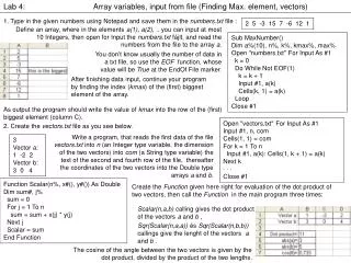
Lab 4 • 4.14(a,b) • 4.15(c) • 5.4(a,b,c) • 5.10(a,b) • 5.18 • 6.2(a,b) • 6.7(a,b) • 6.9(a,c,d) • 7.9(a,b)