Download
1 / 29
310 likes | 543 Views
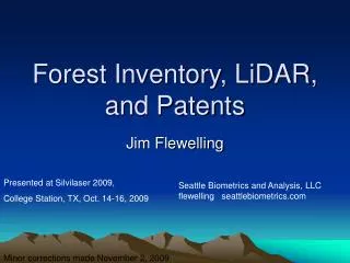
CLICK : The USGS Center for LIDAR Information Coordination and Knowledge. Jordan Menig SAIC, contractor to U.S. Geological Survey (USGS) Earth Resources Observation and Science Center, Sioux Falls, SD. Work performed under USGS contract 03CRCN0001. CLICK: Background.

E N D
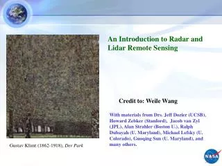
CLICK: The USGS Center for LIDAR Information Coordination and Knowledge Jordan Menig SAIC, contractor to U.S. Geological Survey (USGS) Earth Resources Observation and Science Center, Sioux Falls, SD. Work performed under USGS contract 03CRCN0001.
CLICK: Background • In February 2006, the U.S. Geological Survey launched the Center for LIDAR Information Coordination & Knowledge (CLICK). • Virtual center, but housed at EROS. • CLICK fills a niche that no one has “taken the lead” on, public or private. • Need has been expressed by universities and other agencies. • Take advantage of existing LIDAR data and information for scientific (non-mapping) research needs nationwide.
CLICK: Mission • CLICK’s mission is to facilitate data access, coordinate user requirements, and promote education about the use of LIDAR data (both "raw" and classified full return point clouds) for scientific needs.
The Need for Source Data • Depending on the system, recording method, and cover type, between 20 and 90 percent of the raw source data could be filtered out to generate a bare earth DEM. • Large amounts of discarded data can be used for other purposes. • “Data Dumpster Diving”
The Need for Coordination • Because of the high cost of collecting LIDAR, many programs and applications that could benefit cannot afford it. • Interested parties need a place to find out if LIDAR data is publicly available. • CLICK would like to acquire data to make accessible to the public for further research opportunities.
CLICK: Good for Science • LIDAR data has not been widely used by scientists and managers because of its cost and difficulty of access, and a lack of awareness about available data and acquisition opportunities. • CLICK is designed to foster more use of LIDAR data and to raise awareness of LIDAR's availability and applications. • Limited amount of LIDAR-related resources for those who are interested in incorporating data into science.
http://lidar.cr.usgs.gov • Web portal • Allows LIDAR users to ask and answer questions, and coordinate with others who are looking for data or have data available to share. • Identify scientists, cartographers, and geographers who could help with someone’s LIDAR needs. • Downloadable raw point cloud data. • Provide information on where data exists, including metadata.
CLICK: Structure The CLICK virtual center Web portal is broken into three parts: 1. Information 2. Coordination 3. Knowledge
CLICK: Structure Information – (Data Viewer) • Provides access to download available raw point cloud data. • Data currently distributed in ASCII X, Y, Z and LAS file formats. • Seamless and Google Earth viewers. • NASA EAARL Google Earth viewer. • ExperimentalAdvancedAirborneResearchLIDAR
CLICK: Structure Coordination – (Bulletin Board) • Heart of the virtual center. • Place for users from ALL disciplines to ask and answer LIDAR-related questions. • We do request that users register in order to ask and answer questions. • Has become a great place for users in the LIDAR community to communicate.
CLICK: Structure Knowledge – (Websites / References) • Dynamic list of LIDAR-related Web pages, along with a growing list of peer-reviewed articles. • Users may also submit their own LIDAR-related web pages or peer-reviewed journal articles if they do not see it on the list.
National Digital Elevation Program NASA FEMA USFS BLM NGA NSGIC www.ndep.gov USGS NRCS USACE NOAA A consortium of agencies coordinating the collection and application of high-resolution, high-accuracy elevation data
CLICK together with NDEP • Active participant in monthly National Digital Elevation Program (NDEP) meetings. • Representatives from USGS, FEMA, NRCS, USACE, NOAA, NGA, BLM, and more…. • NDEP has become a major source of LIDAR tracking information nationwide through metadata submissions or leads from NDEP members.
CLICK Tidbits • Currently have 548 members from 43 different countries. • Official TerraSolid Support Forum. • Official Applied Imagery Support Forum (QT Modeler) • Highlighted and on front cover of the June 2006 edition of PE&RS.
Current NED Development • Multi-resolution (nested layers) • 1-arc-second (30 meters) • 1/3-arc-second (10 meters) • 1/9-arc-second (3 meters) • High resolution, “non-standard” source data • Lidar (grids, TINs, or points) • Photogrammetric (mass points and breaklines) • Cartographic (contours and hydrography) • IFSAR (grids)
Source Data Resolution 3 meters or better (4%) 10 meters or better (71%) 30 meters (25%) NED Source Data June 2007 release: over 75% 10-meter DEM source or better (June 2000 release: 17% 10-meter DEM source)
Multi-resolution NED: West Virginia 1-arc-second (30 meters) 1/3-arc-second (10 meters) 1/9-arc-second (3 meters)
Multi-resolution NED: LA (lidar source) 1-arc-second (30 meters) 1/3-arc-second (10 meters) 1/9-arc-second (3 meters)
Questions? jmenig@usgs.gov CLICK email: lidar@usgs.gov