Download
1 / 49
490 likes | 496 Views
James C. Gibeaut Bureau of Economic Geology Jackson School of Geosciences The University of Texas at Austin Funding From: Galveston Bay Estuary Program, NOAA through the Texas Coastal Coordination Council, Texas General Land Office, Army Research Office, NASA

E N D
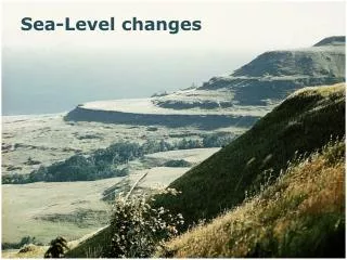
James C. Gibeaut Bureau of Economic Geology Jackson School of Geosciences The University of Texas at Austin Funding From: Galveston Bay Estuary Program, NOAA through the Texas Coastal Coordination Council, Texas General Land Office, Army Research Office, NASA Texas A&M Sigma Xi Symposium, March 30, 2006 CHANGES IN BARRIER ISLAND ENVIRONMENTS DURING SEA-LEVEL RISE
( a ) B A Y B A R R I E R I S L G U L F O F M E X I C O B a y m a r g i n R i d g e a n d s w a l e F o r e - i s l a n d B e a c h o r d u n e s v e g e t a t e d b a r r i e r f l a t s B e r m B a c k - b e a c h S w a s h M a r s h a n d t i d a l f l a t C o p p i c e V e g e t a t e d Z o n e O f f s h o r e d u n e s d u n e s A q u a t i c b e d s b a r s F o r e b e a c h ( b ) B A Y P E N I N S U L A G U L F O F M E X I C O V e g e t a t e d b a r r i e r f l a t s I n c i p i e n t d u n e M a r s h a n d t i d a l f l a t B a c k - A q u a t i c b e d s F o r e b e a c h b e a c h Q A d 3 1 7 ( a ) c Regressive Barrier Island Transgressive Barrier Island
Color IR Mosaic Gulf of Mexico
University of Texas Airborne Topographic Lidar System(Optech model ALTM1225)
Habitat Classification Map From Color IR Photography Data from White et al., 2002
Average Heights and Standard Deviations of Barrier Island Habitats
Change Induced by Rising Sea Level From Brinson, Christian, and Blum, 1995
Pier 21 - Galveston 180.0 160.0 140.0 120.0 100.0 Average water level (cm) y = 0.652x - 1145.6 Global ocean-level rise 80.0 2 R = 0.9436 60.0 4.36 + 2.16 = 6.52 mm/yr 40.0 20.0 Local land subsidence 0.0 1900 1910 1920 1930 1940 1950 1960 1970 1980 1990 2000 2010 Year Relative Sea-Level Change
Land Subsidence Relative to Pier 21, 1958 – 1978, mm/yr Pier 21 tide gauge
Maximum rate = 0.0064 m/yr Vertical Accretion Function Evidence for decreasing rate and max rate from Callaway et al., 1997
Change Rate = 0.0064 m/yr 2.5 Tide Gauge Record Annual Averages of MHHW at Pier 21, Galveston 2 ) m ( l e v e l e d i t h g i H 1.5 H i s t o r i c a l l e v e l L i n e a r f i t P r o j e c t e d l e v e l 3 - y r m o v i n g a v e r a g e 1 1900 1920 1940 1960 1980 2000 2020 2040 2060 2080 2100 Y e a r
Model Flow Future date reached? DEM (original) Classify elevation by environment types Environment grid Yes No Adjusted DEM Apply vertical accretion adjustment Output habitat grid 1-year loop Shoreline change data Retreat shoreline Apply sea level adjustment Compute statistics of habitat status Apply local subsidence adjustment Maps Statistics Graphs