Download
1 / 44
460 likes | 853 Views
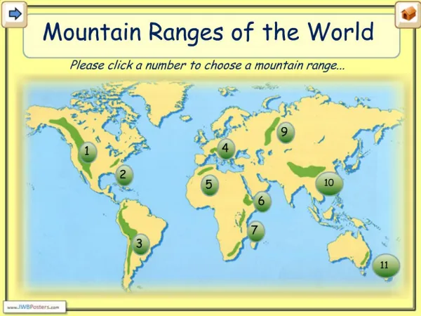
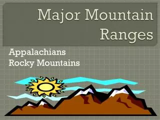
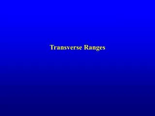
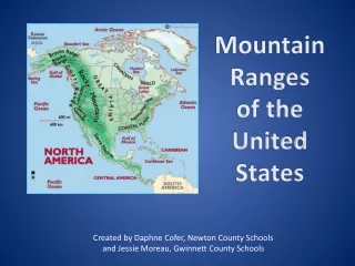
MOUNTAIN RANGES. Front Range Park Range San Juan-Most rugged in the contiguous US Sangre de Cristo-”Blood of Christ” Sawatch. Park Range. MOUNTAIN RANGES. Front Range. Sawatch. San Juans. Sangre de Christo. Front Range.

E N D
MOUNTAIN RANGES • Front Range • Park Range • San Juan-Most rugged in the contiguous US • Sangre de Cristo-”Blood of Christ” • Sawatch
ParkRange MOUNTAIN RANGES FrontRange Sawatch San Juans Sangre de Christo
Front Range • A mountain range of the Rocky Mountains that is located in the north-central portion of Colorado. • The Front Range is so named because, moving west along the 40th parallel north across the Great Plains of North America, it is the first mountain range encountered. • The name "Front Range" is also applied to the Front Range Urban Corridor, the populated region of Colorado and Wyoming just east of the mountain range and extending from Pueblo north to Cheyenne, Wyoming.
Park Range • A mountain range in the Rocky Mountains of northwestern Colorado. • The range forms a relatively isolated part of the continental divide, extending north-to-south for approximately 40 miles along the boundary between Jackson (east) and Routt counties.
San Juan • A rugged mountain range in southwestern Colorado. • The area is highly mineralized (the Colorado Mineral Belt) and figured in the gold and silver mining industry of early Colorado.
Sangre de Christo • Spanish for "Blood of Christ" • the southernmost sub range of the Rocky Mountains • located in northern New Mexico and southern Colorado • The name is said to come from the red color of the range at some sunrises and sunsets, especially when the mountains are covered with snow, alpenglow.
Sawatch • In central Colorado • Includes eight of the twenty highest peaks in the Rocky Mountains • Includes Mount Elbert, at 14,440 feet elevation, the highest peak in the Rockies.
RIVERS • Colorado • Arkansas • Platte • Rio Grande • Gunnison • More rivers begin in Colorado than in any other state
Platte River RIVERS ColoradoRiver GunnisonRiver ArkansasRiver Rio Grande River
Colorado River • a river in the southwestern United States • approximately 1,450 mi long • draining a part of the arid regions on the western slope of the Rocky Mountains. • The natural course of the river flows into the Gulf of California
Arkansas River • A major tributary of the Mississippi River. • traverses the U.S. states of Colorado, Kansas, Oklahoma, and Arkansas • At 1,469 miles (2,364 km) it is the sixth longest river in the United States, the second-longest tributary in the Mississippi-Missouri system • Its origin is in the Rocky Mountains in Lake County, Colorado, near Leadville, and its outlet is at Napoleon, Arkansas.
Rio Grande • Known as the Rio Grande in the United States and as the Río Bravo in Mexico, • 1,885 miles long • the fourth longest river system in the United States • serves as a natural boundary along the border between the U.S. and Mexico
Gunnison • A tributary of the Colorado River • approximately 180 mi long • the fifth largest tributary of the Colorado River
MOUNTAIN PARKS • Were at one time lakes • Elevation between 7,000 and 8,000 feet; too high for tended agriculture so people make a living with grazing • All are centrally located
MOUNTAIN PARKS • North Park-Walden • Middle Park-Granby, Kremling and Frazier • South Park-Fairplay • San Luis Valley-Alamosa and Monte Vista; has some tended agriculture
NorthPark MiddlePark MOUNTAIN PARKS SouthPark San Luis Valley
Colorado Piedmont GEOGRAPHIC FEATURES Continental Divide
Colorado Piedmont • the geologic term for an area along the base of the foothills of the Front Range in north central Colorado. • The region consists of a broad hilly valley, just under 5000 ft in elevation, stretching north and northeast from Denver, as well as southward from Colorado Springs. • The region includes much of the populated and cultivated area of Colorado.
Continental Divide • The largely mountainous, hydrological divide of the Americas that separates the watersheds that drain into the Pacific Ocean from: • 1) those river systems which drain into the Atlantic Ocean • 2) along the northernmost reaches of the Divide, those river systems which drain into the Arctic Ocean
COLORADO GEOGRAPHY The state divides itself into three parts: - Eastern Plains - Mountains - Western Slope
EASTERN PLAINS • An extension of the Great Plains • Gradual incline from the Eastern border • Comes to an imaginary line where the cities of Fort Collins, Denver, Colorado Springs and Pueblo are located • Not much rainfall; windy spring, dust storms, heat and summer drought
Called “The Great American Desert” by early visitors who were used to the green of the Eastern United States • Native grasses grown here-good for grazing • Native animals would be buffalo and antelope • Colorado Piedmont-Center of population, education and industry
MOUNTAINS • 54 mountains are over 14,000 feet • 79% of the 14ers in the contiguous US are in Colorado • Called the “crest of the continent” • Continental Divide is a ridge of mountains that divide the water flow from east to west; East to the Mississippi River and the Gulf of Mexico and west to the Pacific Ocean
Pikes Peak Mt Evans Some of Colorado’s 14’ers Longs Peak
CONTINENTAL DIVIDE CONTINENTALDIVIDE TRAIL
MOUNTAINS • The continental divide is called “the backbone of the Rockies” • Rockies reach their highest and widest points in Colorado (in the contiguous US) • Most impressive canyon is the Royal Gorge in Canyon City. At one point it is 30 feet wide and has a drop of 1200 feet • Trappers first drawn here by beavers • Other animals include grizzlies, black and brown bear, mule deer, big horn sheep and mountain lions
Beaver Mule Deer Mountain Lion
Big Horn Sheep Grizzly Black Bear
WESTERN SLOPE • Contains some mountain towns-Ouray, Silverton, Telluride and Aspen • Last area to be settled in Colorado • Far west is semi-arid and at times almost desert-like • Unique geographic features are mesas and plateaus • Largest mesa is Grand Mesa • Part of Colorado Plateau
Colorado National Monument near Grand Junction
Mesa Verde is located in the southwestern portion of this area • Black Canyon of the Gunnison is located here (near Montrose). Walls extend to 2425 ft. This was recently made into a national park • Northwest Colorado was the last to be settled • Four Corners located here-Colo., NM, Arizona and Utah
Black Canyon of the Gunnison