Download
1 / 37
370 likes | 541 Views
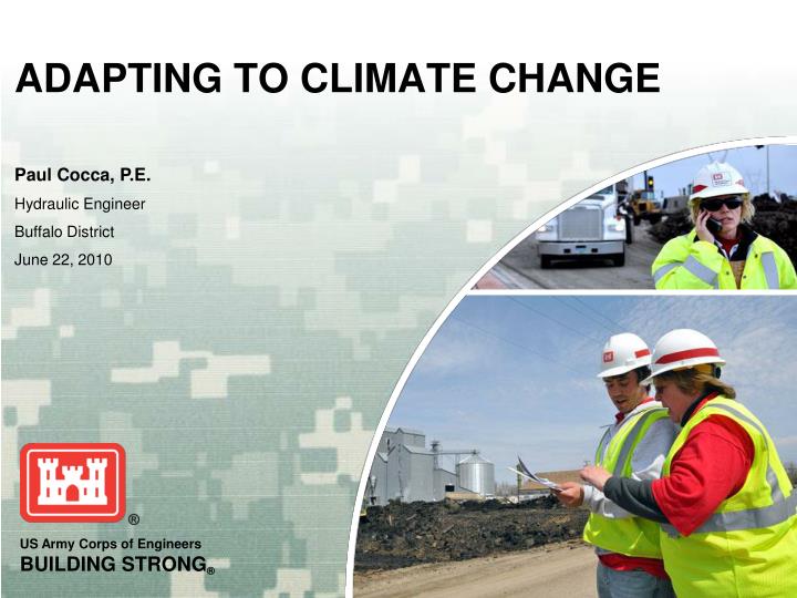
Paul Cocca, P.E. Hydraulic Engineer Buffalo District June 22, 2010. ADAPTING TO CLIMATE CHANGE. Presentation Overview. The case for climate adaptation Precipitation and streamflow trends Use of precipitation and streamflow data in USACE projects

E N D
Paul Cocca, P.E. Hydraulic Engineer Buffalo District June 22, 2010 ADAPTING TO CLIMATE CHANGE
Presentation Overview • The case for climate adaptation • Precipitation and streamflow trends • Use of precipitation and streamflow data in USACE projects • Possible approaches to adjusting H&H analyses to account for climate change • Other agencies: studies and recommendations
The Case for Climate Adaptation Marian Koshland Science Museum of the National Academy of Sciences http://www.koshland-science-museum.org/exhibitgcc/historical02.jsp
Projected Trends in CO2 Concentrations • Greenhouse Gases remain in the Atmosphere for 100 years or more • Consequently, mitigation methods alone will not reverse Climate Change already underway • Therefore, we will need to Adapt to ongoing Climate Change
Climate Change Impacts on Precipitation and Streamflow in NYS • Precipitation • Increase in annual precipitation • Increase in storm intensity and frequency of intense storms • Stream flow • Trends in peak flow varies by location • Shift in peak flows to earlier in Spring
Trends in Annual Precipitation • Northeast: Increase of 20+% over the last 100 years (USGCRP, 2004) • Great Lakes Basin (U.S.): Average increase of 13% since 1915. (USGS, 2008) • Buffalo: Increase of 44% New England Integrated Sciences and Assessment: http://neisa.unh.edu/Climate/BuffaloNYPPT.html
Trends in Intensity of Infrequent Precipitation Events • 99th percentile precipitation events generally increasing • Some locations show decrease Spierre and Wake, 2009 Draft Document
Trends in Frequency of Heavy Precipitation Events - Nationally “One of the clearest trends in the United States observational record is an increasing frequency and intensity of heavy precipitation events.” National Study: U.S. Climate Change Science Program, 2008
Trends in Frequency of Heavy Precipitation Events – Locally Monroe County: USGS, 2008
Changes in Annual Maximum Streamflow • 15% of sites show increase • 13% of sites show decrease • 400 sites with data for period 1941-1999 Sites with significant (p<=0.05) changes in mean annual maximum daily streamflow between periods 1941-1970 and 1971-1999. (McCable & Wolock, 2002)
Streamflow Changes by Flow Quantile 395 stations with continuous daily records over the period 1944-1993 Lins & Slack, 1999
Trends in Flood Flows—National Study • 396 unimpaired USGS stream gages • Trend in annual maximum flood series: • Upward:46 sites • Downward:29 sites (Kashelikar and Griffis, 2008)
Trends in High Flows—Monroe County, NY • Urban streams • Increasing frequency of peak flows • Increasing 7-day high flows • Rural streams • No discernible trend in 7-day high flows • Urban/rural differences due to percent imperviousness (USGS, 2008)
Shift in Winter/Spring Flows Smoothed Winter/Spring Center of Volume Dates 13 longest-record rural, unregulated rivers in New England G.A. Hodgkins et al. / Journal of Hydrology 278 (2003) 244–252
Changes in Seasonality of Flow • For areas with snow in winter (IPCC, 2007): • Peak Spring flow to occur at leasta month earlier • Winter flow increases;Summer flow decreases • Greatest effect at lower elevations
Design Flow Determination • Hydrologic models such as: Rational Method, TR-55, HEC-HMS, and SWMM • Regression Equations • Streamgage data • Historical Data
Hydrologic Models • Calculates peak runoff from: • 24-hr rainfall, rainfall distribution type • Watershed and reach characteristics such as: • watershed area, slope, and soil characteristics • reach dimensions, slope, and roughness • assumed initial conditions • 24-hr Rainfall from: • Technical paper No. 40 (1961) - NY • NOAA Atlas 14 (2004) – OH • Northeast Regional Climate Center Atlas (1993) – NE & NY
Regression Equations • Developed for regions (usually ~5-10 per state) • For either rural or urban/developed watersheds • Include drainage basin and channel parameters, such as: • Drainage area • Channel slope • Percent wetlands • Forested area • Average annual precipitation • Basin Development Factors
Annual Flow Rate (cfs) Exceedance Probability Statistical Analysis of Streamgage Data • Bulletin 17B: Guidelines for Determining Flood Flow Frequency (Interagency Committee on Water Data, 1982) • Fit annual maximum flows to a Log Pearson Type III distribution • “In hydrologic analysis it is conventional to assume flood flows are not affected by climatic trends or cycles. Climatic time invariance was assumed when developing this guide.” (Bulletin 17B)
Historical Event Data • Used to check or verify flood values produced by the other three methods • "Maximum Known Stages and Discharges of New York Streams 1865 - 1989, with Descriptions of Five Selected Floods, 1913-85“ (USGS, 1993)
Updating Precipitation Data http://www.nws.noaa.gov/oh/hdsc/index.html
Updating Precipitation Frequency Atlasfor Northeastern United States • Current Atlas Information for New York State and other Northeast States is between 32 and 48 years old. • The age of the atlas data along with climate change trends are indicators that the atlas data should be updated. • The National Oceanic and Atmospheric Administration (NOAA) and the Federal Highway Administration (FHWA) have recently signed an agreement to update the Precipitation Frequency Atlas • New York State will provide some of the funding for this update. • [NY converting to NOAA Atlas 14???]
Precipitation Intensity-Frequency Data Annual Maximum Precipitation Series • Tests for linear trends at 1865 stations: • positive trend at 244 • negative trend at 62 • Tests for shifts in means (pre-1958 vs. post-1959): • positive shift at 102 • negative shift at 11 • Conclusion: • No consistent observed impact of climate change on the annual maximum series • Use entire period of record to increase robustness of the results
Intergovernmental Panelon Climate Change • Climate change is a very complex issue: policymakers need an objective source of information about the causes of climate change, its potential environmental and socio-economic consequences and the adaptation and mitigation options to respond to it • Set up by the World Meteorological Organization (WMO) and by the United Nations Environment Programme (UNEP) in 1988 • Primary source for Global ClimateChange forecasts
United States Department of Transportation • Established a Transportation and Climate Change Clearinghouse to serve as a one-stop source of information for the transportation community on transportation and climate change issues • Sponsors research on Climate Change issues related to transportation • http://climate.dot.gov/index.html
Federal Highway Administration • FHWA is committed to improving transportation mobility and safety while protecting the environment, reducing greenhouse gas emissions, and preparing for climate change effects on the transportation system • FHWA is actively involved in efforts to initiate, collect, and disseminate climate-change-related research and to provide technical assistance to stakeholders. • Publication, Integrating Climate Change into the Transportation Planning Process available on WEB Site. • http://www.fhwa.dot.gov/hep/climate/index.htm
Transportation Research Board • The mission of the Transportation Research Board is to provide leadership in transportation innovation and progress through research and information exchange, conducted within a setting that is objective, interdisciplinary, and multimodal • Publication, Potential Impacts of Climate Change on U.S. Transportation available on WEB Site. • http://tris.trb.org/climatechange
NYSDOT Climate Change Adaptation Workgroup • Recommended that the Department partner with other organizations in studying climate change adaptation issues • Recommended that the same climate change science be used by all studies to avoid conflicts with future recommendations • Contracting for a researcher to identify adaptation issues that will need to be addressed by the various program areas within the Department • [any update on last bullet from Sanderson???]