Download
1 / 11
110 likes | 244 Views
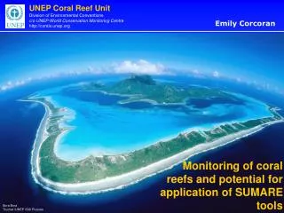
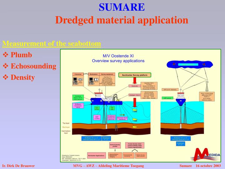
SUMARE Dredged material application. Measurement of the seabottom. Plumb. Echosounding. Density. Ir. Dirk De Brauwer MVG – AWZ – Afdeling Maritieme Toegang Sumare 16 octobre 2003. Measurement of the seabottom.

E N D
SUMAREDredged material application Measurement of the seabottom • Plumb • Echosounding • Density Ir. Dirk De Brauwer MVG – AWZ – Afdeling Maritieme Toegang Sumare 16 octobre 2003
Measurement of the seabottom SUMAREDredged material application • Echosounding Singlebeam Ir. Dirk De Brauwer MVG – AWZ – Afdeling Maritieme Toegang Sumare 16 octobre 2003
Measurement of the seabottom SUMAREDredged material application • Density Density measurement technic Ir. Dirk De Brauwer MVG – AWZ – Afdeling Maritieme Toegang Sumare 16 octobre 2003
Measurement of the seabottom SUMAREDredged material application • Density Navitracker Ir. Dirk De Brauwer MVG – AWZ – Afdeling Maritieme Toegang Sumare 16 octobre 2003
Measurement of the seabottom SUMAREDredged material application • Density Fluid mud density Navigation depth Ir. Dirk De Brauwer MVG – AWZ – Afdeling Maritieme Toegang Sumare 16 octobre 2003
1. Introduction Can ROV/AUV give the solution for dredging strategy? Objective: sage navigation needs a enough waterdepth Waterdepth: - sealevel (tides) - bottom How to measure the bottom? - Characteristics of the bottom: + point of vieuw navigation: hard bottom resistance method: plumb inconvenients: - points - take time + Analog characteristics: reflection echosounding
2. Ships needs greater waterdepths - Dredging works starts their “perpetual motion” live - Struggle between man and nature: sedimentation increases Nature: sedimentation needs time Men: “time is money” - Mud Layers appears - thickness: 1 feet 3 m (after 4 years) - more dredging more mud - Fluid mud layer - echosounding 210 kHz top of the Layer 33 kHz near the hard bottom - New definition “Nautical depth”: 33 kHz
3. Fluid mud layer and navigation - The low planning 33 kHz to much depending of the operator. - Density - Density measurement method (nuclear source) - Navitracker (semi- ROV) - New definition “Nautical depth”: 1,15 (or 1,20) - After 5 years of dredging: layer thickness 3 m.
4. New Challenges - Next characteristic of the fluid mud layer after: - penetration resistance - reflection - density - “Nautical depth” : definition must assure safe navigation ship under control - How to measure the changing of the reology of the fluid mud? (shear-stress?)
5. Conclusion The dream: a low east autonomus system performing all necessary measurement to follow up - Dredging and sedimentation activities Dredging strategy Lower cost
The solution: ROV/AUV which has/is: - easy to use system - accurate underwater positioning system - enough power to penetrate into fluid mud - Low-cost (risk to lose the system) - Shock resistant (unknow obstacles) - Quick data collection system - Large data storage capacity - High speed movement for large area covering - Low maintenance costs P.S.: Dredging costs Zeebrugge: 5.000.000 € Survey costs Zeebrugge: 150.000 € So what means ‘low costs”?