Download
1 / 31
310 likes | 311 Views
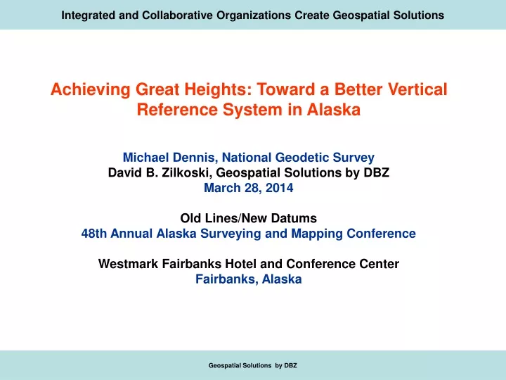
Integrated and Collaborative Organizations Create Geospatial Solutions. Achieving Great Heights: Toward a Better Vertical Reference System in Alaska Michael Dennis, National Geodetic Survey David B. Zilkoski, Geospatial Solutions by DBZ March 28, 2014 Old Lines/New Datums

E N D
Integrated and Collaborative Organizations Create Geospatial Solutions Achieving Great Heights: Toward a Better Vertical Reference System in Alaska Michael Dennis, National Geodetic Survey David B. Zilkoski, Geospatial Solutions by DBZ March 28, 2014 Old Lines/New Datums 48th Annual Alaska Surveying and Mapping Conference Westmark Fairbanks Hotel and Conference Center Fairbanks, Alaska Geospatial Solutions by DBZ
Integrated and Collaborative Organizations Create Geospatial Solutions • Determining Reliable Orthometric Heights is Often Challenging But That Is Especially The Case In Alaska • Some of the Things That Make Alaska Such a Challenge Include: • Sparseness and Age of the Geodetic Leveling Network • Vertical Tectonic Movement • Large Areas With No Road Access • Lack of Terrestrial Gravity Data • Poor Digital Models of Topography (Used for Gravitation Calculations) Geospatial Solutions by DBZ
Integrated and Collaborative Organizations Create Geospatial Solutions • Determining Reliable Orthometric Heights is Often Challenging But That Is Especially The Case In Alaska • This Presentation Will Describe Some New and Future Developments Related to Height Determination in Alaska • Condition of the existing NAVD 88 leveling network in Alaska • The latest NGS scientific and hybrid geoid models (USGG2012 and GEOID12A) • Bench marks used to develop GEOID12A • Status of the Gravity for the Redefinition of the American Vertical Datum (GRAV-D) Project • The new vertical datum planned for completion in 2022 • What is needed to meet future surveying and mapping requirements in Alaska • Discuss How Alaskans Can Help NGS Make a Better, More Accurate Geoid Model Geospatial Solutions by DBZ
Integrated and Collaborative Organizations Create Geospatial Solutions Determining Reliable Orthometric Heights is Often Challenging But That Is Especially The Case In Alaska • Condition of the existing NAVD 88 leveling • network in Alaska Geospatial Solutions by DBZ
Integrated and Collaborative Organizations Create Geospatial Solutions Geospatial Solutions by DBZ
Integrated and Collaborative Organizations Create Geospatial Solutions Geospatial Solutions by DBZ
Integrated and Collaborative Organizations Create Geospatial Solutions Geospatial Solutions by DBZ
Integrated and Collaborative Organizations Create Geospatial Solutions Geospatial Solutions by DBZ
Integrated and Collaborative Organizations Create Geospatial Solutions Geospatial Solutions by DBZ
Integrated and Collaborative Organizations Create Geospatial Solutions Geospatial Solutions by DBZ
Integrated and Collaborative Organizations Create Geospatial Solutions Determining Reliable Orthometric Heights is Often Challenging But That Is Especially The Case In Alaska • The latest NGS scientific and hybrid geoid models • (USGG2012 and GEOID12A) Geospatial Solutions by DBZ
Integrated and Collaborative Organizations Create Geospatial Solutions Analysis of GEOID12A Above a LMSL Datum Above a LMSL Datum Geospatial Solutions by DBZ
Integrated and Collaborative Organizations Create Geospatial Solutions Analysis of GEOID12A Geospatial Solutions by DBZ
Integrated and Collaborative Organizations Create Geospatial Solutions Analysis of GEOID12A Rejected Geospatial Solutions by DBZ
Integrated and Collaborative Organizations Create Geospatial Solutions Analysis of GEOID12A Rejected Geospatial Solutions by DBZ
Integrated and Collaborative Organizations Create Geospatial Solutions Analysis of GEOID12A Geospatial Solutions by DBZ
Integrated and Collaborative Organizations Create Geospatial Solutions Geospatial Solutions by DBZ
Integrated and Collaborative Organizations Create Geospatial Solutions Geospatial Solutions by DBZ
Total Post-1964 Postseismic Uplift 1964 to present Units: cm Cohen and Freymueller (2004)
Integrated and Collaborative Organizations Create Geospatial Solutions Determining Reliable Orthometric Heights is Often Challenging But That Is Especially The Case In Alaska • Status of the Gravity for the Redefinition of the American Vertical Datum (GRAV-D) Project Geospatial Solutions by DBZ
Integrated and Collaborative Organizations Create Geospatial Solutions Determining Reliable Orthometric Heights is Often Challenging But That Is Especially The Case In Alaska • The new vertical datum planned for • completion in 2022 Geospatial Solutions by DBZ
Integrated and Collaborative Organizations Create Geospatial Solutions • Determining Reliable Orthometric Heights is Often Challenging But That Is Especially The Case In Alaska • What is needed to meet future surveying and mapping requirements in Alaska Prevent Earthquakes and Crustal Motion from Occurring • New Leveling Observations • Better Knowledge of the Vertical Tectonic Movement • More Gravity Data • Better Digital Models of Topography Geospatial Solutions by DBZ
Integrated and Collaborative Organizations Create Geospatial Solutions Challenging But That Is Especially The Case In Alaska Determining Reliable Orthometric Heights is Often • How Alaskans can help NGS make a better, • more accurate geoid model Geospatial Solutions by DBZ
Integrated and Collaborative Organizations Create Geospatial Solutions Challenging But That Is Especially The Case In Alaska Determining Reliable Orthometric Heights is Often How Alaskans can help NGS make a better, more accurate geoid model Educate Leaders and Visionaries about the Issues and Problems Associated with Alaska’s Vertical Control Network • Obtain New Leveling Observations • Obtain Better Knowledge of the Vertical Tectonic Movement • Obtain More Gravity Data • Obtain Better Digital Models of Topography Geospatial Solutions by DBZ
Integrated and Collaborative Organizations Create Geospatial Solutions Challenging But That Is Especially The Case In Alaska Determining Reliable Orthometric Heights is Often Leveling Observations Along Entire Line GPS Observations GPS Observations How Alaskans can help NGS make a better, more accurate geoid model GPS Observations • Provide New Leveling Data to NGS Using NGS Locus Tool • Provide GPS Data on New Leveling Stations Using NGS OPUS-Projects Tool GPS Observations GPS Observations Geospatial Solutions by DBZ
Integrated and Collaborative Organizations Create Geospatial Solutions Geospatial Solutions by DBZ