Download
1 / 12
120 likes | 380 Views
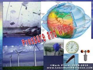
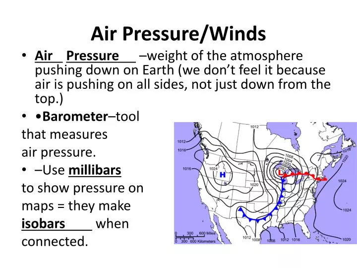
Air Pressure/Winds. Air Pressure –weight of the atmosphere pushing down on Earth (we don’t feel it because air is pushing on all sides, not just down from the top.) • Barometer –tool that measures air pressure. –Use millibars to show pressure on maps = they make

E N D
Air Pressure/Winds • Air Pressure –weight of the atmosphere pushing down on Earth (we don’t feel it because air is pushing on all sides, not just down from the top.) • •Barometer–tool that measures air pressure. • –Use millibars to show pressure on maps = they make isobars when connected.
So why does air pressure change? • Elevation – in general, the higher the elevation, the lower the pressure (less pressure to push down on, since you are higher) • Temperature warm air lowers pressure (it rises and particles move farther apart), and may get rain . Cool air gives increase in pressure, and weather is clearer . • Humidity – the more water vapor air contains, the lighter the air is = so low pressure. (Remember: warmer air can hold more water vapor and is low pressure)
Reading Pressure on a Map • Isobars = lines showing air having the same pressure. • High pressure area (or a High ) –Rotates clockwise . • Low pressure area (or a Low ) –Rotates counterclockwise . • Pressure gradient = • –Lines close together show that pressure is quickly changing (and we will have strong winds). Lines further apart shows weak pressure gradient (and we will have weak winds).
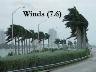
Winds Blow Because… • Air flows from an area of High pressure to an area of Low Pressure Hto L • Coriolis Effect -the apparent curve of a moving object due to the Earth’s rotation –Causes curve to the right in the Northern Hemisphere –Causes curve to the left in the Southern Hemisphere • Jet Stream – fast moving winds near the top of the troposphere (winds 120-240 kph) –In the US the jet streams supplies energy to storms and directs their paths. • Anemometer–tool that measures wind speed .
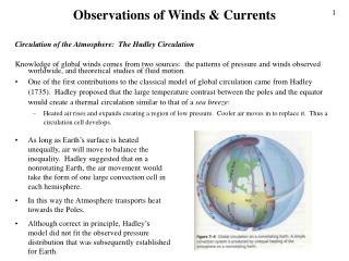
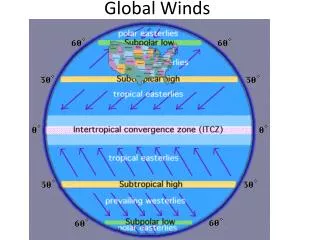
Global Wind Patterns • Doldrums or Intertropical Convergence Zone (ITCZ) –Low pressure in tropics –Hot, humid, little to no wind, rain is common. • Subtropical highs or Horse Latitudes –between 20-35 degrees –Deserts –because sinking cooler air with no precipitation is near. • Tradewinds–between 35-60 degrees latitude –Warm, steady, winds • Polar highs –High pressure above 60 degrees latitude (in the poles) –Where cold air sinks at the poles, usually easterly surface winds.
Questions • Which global wind pattern do we live in? The westerlies • How are the winds named? from the direction they came from
Effects of seasons on winds… • With a change in air pressure the direction of winds changes • So winds change direction with the seasons . –Monsoons • Occur southern Asia • Heavy rains
Local Winds: Land Breeze –vs- Sea Breeze • Sea Breeze - occurs during the day • Coastal land is warmer than water, causing decrease in pressure over land • So breeze flows from High to Low/from Sea to Land . (cool breeze from sea blows inland) • Land Breeze – Occurs at night • Air over land is colder than air over water, causing decrease in pressure over the water. • So, breeze flows from High to Low/from Land to Sea__ (cool breeze from land blows to sea)