Download
1 / 28
280 likes | 439 Views
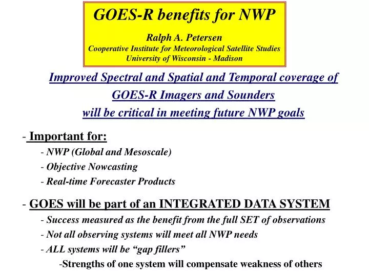
GOES-R benefits for NWP Ralph A. Petersen Cooperative Institute for Meteorological Satellite Studies University of Wisconsin - Madison. Improved Spectral and Spatial and Temporal coverage of GOES-R Imagers and Sounders will be critical in meeting future NWP goals Important for:

E N D
GOES-R benefits for NWP Ralph A. Petersen Cooperative Institute for Meteorological Satellite Studies University of Wisconsin - Madison Improved Spectral and Spatial and Temporal coverage of GOES-R Imagers and Sounders will be critical in meeting future NWP goals Important for: NWP (Global and Mesoscale) Objective Nowcasting Real-time Forecaster Products GOES will be part of an INTEGRATED DATA SYSTEM Success measured as the benefit from the full SET of observations Not all observing systems will meet all NWP needs ALL systems will be “gap fillers” Strengths of one system will compensate weakness of others
Where will NWP models be in 2012-2020? Model Resolution improvements will have neared limit by then Domestic models at ~ ½ to 1 km grid spacing Cloud and local circulation simulating BUT – Resolution is not the solution Major improvements in model physics In the Atmosphere - Realistic Non-Hydrostatic Processes Detailed Moisture/Cloud Characteristics Over Land Detailed Surface/Sub-Surface Processes Need to know surface emissivity!! Probabilistic Forecasts Will need better measures of analysis (and therefore data) confidence Ensembles of physics packages will use detailed cloud, moisture, aerosol and surface specifications, as well as tendencies New Service Areas Air Quality, Human Health, Energy Management, Major Development Efforts Need TRULY Mesoscale Assimilation More complex than simply adapting global techniques to finer resolution Major needs for new observations - Domestically & Internationally -
Role of Future GOES compared to other data systems Surface Based Systems: Radiosonde- A primary source of wind, temperature and moistureStrengths - High absolute accuracy and vertical resolution Weaknesses - Land only, twice(?) daily, ~400 km spacing, $s Aircraft- Increasingly important for Wind / Temperatures / Moisture Strengths - Good accuracy, vertical resolution, multiple obs per day, moisture on the way, $s Weaknesses – “Tropospheric” only, Ascent/Descent Land bias, Airport spacing, Not truly “all weather” Winds from Profiler/88D- Becoming integral to NWS operations Strengths - Good accuracy, good vertical and temporal resolution Weaknesses – Profiler network underfunded Radar - Essential observations of Precipitation Process Strengths – Precip. location, intensity, vertical/horizontal structure Weaknesses - Clouds and “reflectors” only, no temperature or RH
Role of Future GOES compared to other data systems Satellite Sounding Systems: Polar (NPOESS)-A primary global data source Strengths - “All Weather”, Global coverage, Increasing vertical resolution, Moderately course horizontal resolution Weaknesses - 2-4 (6) times daily, Gaps in coverage 1-Microwave - Coarse vertical/horizontal resolution, rain contamination, ALL WEAHTER – Critical to Global NWP 2-IR (AIRS) -Finer vertical resolution, Cloud contamination - Major component to NWP - Underutilized by forecasters GOES- Major source of hemispheric/domestic forecaster information Strengths - High temporal and spatial resolution, Increasing vertical resolution, Good cloud/surface detail, Captures diurnal changes, Only observations available of detailed horizontal moisture structure and time changes Weaknesses - IR-only “profile” information, No polar coverage, Limited by “Cloud Contamination”, Underutilized in NWP
GOES-R: Spatial Details and Time Tendencies will make the Difference - Major Source of Moisture Observations - Horizontal and vertical moisture gradients - GOES-R will observe 6-8 individual layers - Essential to resolve convective instability - Moisture fluxes possible with sufficient horizontal resolution - Wind and Moisture --- Need identified by NAOS - Cloud properties - Location, top height, ice vs. water, . . . - Surface Properties - Land - Vegetation, Surface emissivity, - Oceans - SST, Ocean color, Surface motion, . . . - Trace gases, etc. - Fire, Smoke, Dust, O3, CO2, . . .
Improvements can be seen in GOES Sounder Emulation TEST • Compared: • - A ‘TRUTH’ atmosphere - (based on available Rawinsondes and high spectral-resolution ground-based observations - AERI) with • Simulate observations which emulated • Current (GOES) & Advanced Geostationary Interferometers (GOES-R/GIFTS) Time series of Lifted Index During 9 hours preceding Oklahoma/Kansas Tornadoes - 3 May 1999 - Lifted Index (K) GOES-R will detect LI values / rapid atmospheric destabilization prior to onset of convection MUCH better than current GOES. UW-Madison/CIMSS
Role of GOES-R inFuture Numerical Prediction - Not Just Traditional NWP - Let’s look at 3 categories of use of future GOES observations for Weather Forecasting - Synoptic Scale NWP - - Mesoscale NWP - Objective Nowcasting - - Must remember forecaster use of real-time Image Products - Need to integrate ALL data sources
GOES in NWP for 0-3 Days + - The “Forecast Period” - Supported by ongoing activities of Joint Center for Satellite Data Assimilation - GOES impact on weather forecasts likely to be greatest in first 3 days For precipitation forecasting - Improve specification of moisture/precip. location and intensity - Could be key to location and timing of “Storm Initiation” - Differential moisture flux - Critical for obtaining surface emissivity Assimilation over land “easier” for smaller FOV - Use radiances directly - Need vertical moisture / temperature gradients - Build on AIRS (Channel Selection, …) - Direct use of Cloud Imagery (radiances) - Cloud type, placement, removal, motion, trends - Atmospheric Composition - Dust, ash, trace gases, CO, CO2, O3 . . . Need to learn how to take full advantage oftime tendency information available only from GOES
NWP already using GOES-WV – But only high level channel Not complete yet,
NWP already using GOES-WV – But only high level channel Not complete yet, and some positive impact
NWP already using GOES-WV – But only high level channel --- But not all conclusions are COMPLETELY relevant!!! ---
NWP already using GOES-WV – But only high level channel --- And some conclusions are extremely MISLEADING!!! ---
MSG is showing examples of what can be done with ABI - Observing Motion of a Dust Storm off West Africa - Important to users ranging from Health to Climate How do we get this type of information into operational data assimilation systems?
THE Issue BEFORE GOES-R can be used successfully, we need to determine how to deal with (manage and use) the incredibly huge amount of data from HES & ABI with their rapid refresh rates Potential for recreating FGGE-DST problems all over again: - In 1974, POES radiometers produced so much data, analyses were unable to use it all – or correctly. - Today, for AIRS (which produces only a small fraction of future HES data volume) JCSDA, ECMWF, UKMet . . . are devoting substantial resources to develop algorithms for thinning AIRS data - Reflects realities of operational computer limitations - But -- Eliminates impact of small scale gradients in the IR . *** We can’t afford to let this happen with HES ***
GOES in Mesoscale NWP - The “Warning Period” - The combinations of spatial resolution, temporal resampling and time tendencies from GOES-R will become invaluable * IF we know how to use the data to full advantage * - Emerging new users demand higher space and time detail + accuracy - Energy sector, Air Quality, Health, - Need to develop techniques that preserve observed detail closely - MAJOR Challenge to Data Assimilation - Need to develop general mesoscale assimilation approaches - Not just a single supercells, but everyday weather interactions - Need entirely different concepts of “balanced flow” - Must combine the best of all systems (Key for Moisture Flux) - Combine Raob, Aircraft, Profile winds and GOES RH to produce Moisture Flux - Need to retain both current and past observations - Add/subtract/move clouds, winds near clear spots * We need new IDEAS - JCSDA not there yet* ---- Need to identify areas of “Confidence” in analysis / forecasts ----
50 km 30 km 10 km 4 km CAPE in Cloud-Free Areas for 50, 30, 10 and 4 km FOV (Simulation Time=1 Hour)
50 km 30 km 10 km 4 km CAPE in Cloud-Free Areas for 50, 30, 10 and 4 km FOV (Simulation Time=2 Hour)
Cloud-Free Area for Horizontal Resolution of 4,10,30,50 km(From 1 km RAMS Severe Weather Simulation)Many more ‘Clear Spots’ with GOES-R
Time lapse of low level moisture simulated from MM5 output Shows strengths and identifies problems yet to be addressed T r u t h HES I m p r o v e m e n t G O E S
Warning!!! Model Simulations are good to use as testing tools, but: The real atmosphere is much more complex that model simulations - In many cases, We won’t know what is there until GOES-R sees it!!! - The analyses that drive the models (and therefore the vertical and horizontal gradients of temperature, moisture and winds) come from ‘less than perfect’ systems tuned to synoptic scales. - The models can get forecasts right, but they for the right reason? - By 2012, we have to do more than product THE prefect forecast for one IHOP case – GENERALIZE!!!! --- Moisture FLUX will be THE key. ---
GOES in 0-6 hr “Objective Nowcasting - The “Watch Period” - - By 2012, forecasters will not be able to look at all observations individually - Emerging new users need frequent updates - Expect higher spatial / temporal accuracy and confidence - Need to provide forecaster tools that preserve data closely - Show high-resolution, 4-D depictions of “Gridded Obs” - Less “dynamically constrained” than longer-range NWP - Needs fast turn-around - “Instant integration” – Perishable Information - Combine best of all systems - Different roles of Radiances in NWP and Products in Nowcasting - Merge Raob, Aircraft, Profile winds and POES/GOES RH to produce Moisture Flux - Need to retain both current and past obs. - Add/subtract/move clouds, aerosols, … - Need new ideas / approaches
Direct use of GOES Nowcasts and Products by Forecasters in The “Warning Period” - Will continue to rely on “Products” instead of radiance * Improved Derived Product Image (DPIs) information (observations and nowcast projections) will become increasingly important - Numerical products displayed as “Synthetic DPIs” - Easy to interpret - Easy to integrate Observations and “Nowcasts” - Need techniques for “Auto Alerting” * Applications likely to expand - Pre-convective storm location/intensity - Icing - Fog - Development/Dissipation - Wild fires - What the user needs - especially for products from new sounder * Real-time model verification Lifted Index
Is this Vision Realistic? Test Using Other Existing Data Sets show that it can be IF we apply the necessary resources to the problem – in addition to what is already be applied to POES
How do we get there? AIRS preflight preparation was good – GOES-R needs to be better - Do supporting Research/Development – NOW!!! Include Total Infrastructure - Ground Receivers Data Ingest Systems Applications Development Data Assimilation Product Generation User Information Displays SEEK NEW IDEAS – Seek New Uses Data System Emulations Know what you will see and how Most Importantly - Remember the End User