Download
1 / 34

E N D
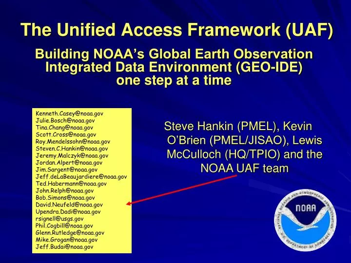
The Unified Access Framework (UAF) Kenneth.Casey@noaa.gov Julie.Bosch@noaa.gov Tina.Chang@noaa.gov Scott.Cross@noaa.gov Roy.Mendelssohn@noaa.gov Steven.C.Hankin@noaa.gov Jeremy.Malczyk@noaa.gov Jordan.Alpert@noaa.gov Jim.Sargent@noaa.gov Jeff.deLaBeaujardiere@noaa.gov Ted.Habermann@noaa.gov John.Relph@noaa.gov Bob.Simons@noaa.gov David.Neufeld@noaa.gov Upendra.Dadi@noaa.gov rsignell@usgs.gov Phil.Cogbill@noaa.gov Glenn.Rutledge@noaa.gov Mike.Grogan@noaa.gov Jeff.Budai@noaa.gov Steve Hankin (PMEL), Kevin O’Brien (PMEL/JISAO), Lewis McCulloch (HQ/TPIO) and the NOAA UAF team Building NOAA’s Global Earth Observation Integrated Data Environment (GEO-IDE) one step at a time
Enterprise-wide integration of datais a very hard problem! (i.e. adopting shared approachesto achieve data interoperability) NOAA/UAF-grid
Why? Different fields have different concepts of ‘data’ … and have developed solutions that make sense to them. Getting people (and organizations) to change habits is difficult! NOAA/UAF-grid
NOAA-world weather forecast (time critical) fisheries management (regulatory concerns) nautical charting climate, ocean, atmosphere research … the list goes on … NOAA management has been reluctant to invest funds in Agency-wide data integration NOAA/UAF-grid
The accepted approach:build a “system of systems” “Wrap” existing systems with loosely coupled, standardized services a Service Oriented Architecture NOAA/UAF-grid
Global Earth ObservationIntegrated Data Environment • GEO-IDE Con-ops outlines such a plan • 2005-06, 66 pages(by “DMIT”) NOAA/UAF-grid
Seed funding٨available last year finally Question:How do you approach a very big problem with a very small amount of money? NOAA/UAF-grid
Tried and true approach … • Generate use cases • Define requirements • Write a Concept of Operations • … and an Implementation Plan • Assemble volunteer teams to implement NOT ! NOAA/UAF-grid
An alternative (‘agile’) approach Don't Solve Problems-- Copy Success "Switch: How to Change Things When Change Is Hard", Chip and Dan Heath (psychologists), 2010 NOAA/UAF-grid
Servicestack: netCDF-CF-DAP-THREDDS-WMS Applications: Matlab ArcGIS Ferret GrADS IDV Google Earth LAS ERDDAP … Dataformats: netCDF GRIB HDF … Projects: (too many to name) What “success” did UAF chose to copy? Year 1 focused on gridded datasets. Users: (too many to name)
UAF(*)-grid(initial focus: gridded data) • netCDF • CF • OPeNDAP • THREDDS • WMS & WCS -- file format/API/data model -- metadata conventions -- network transport -- network topology -- OGC rendering and transport (*) Unified Access Framework NOAA/UAF-grid
THREDDS “network topology”a tree defined as distributed XML NOAA/UAF-grid GEO-IDE/UAF NOAA NOAA Affiliated OAR NMFS NWS NESDIS IOOS National Partners IOOS Regional Partners ESRL OCO PFEG GFDL PMEL NDBC AOML NGDC NODC NAVO AOOS NOMADS GCOOS SCCOOS Coastwatch PACIOOS SECOORA NERACOOS GLOS NANOOS CENCOOS CARICOOS MACOORA
Who is using this approach? • Modelers • IPCC, GFDL, NCAR, … • Satellite programs • GHRSST, PathFinder, CoastWatch, … • NCEP weather and ocean forecasts • GRIB files served via NOMADS • Coastal (“HF”) radar • A growing list of observations programs • Argo, OceanSites, … • Pending adoption by OGC NOAA/UAF-grid
Some rough spots • compliance with CF conventions is inconsistent • individual files often not aggregated into logical datasets • metadata are often in need of enhancement NOAA/UAF-grid
… but excellent repair tools exist:NcML and “virtual files” e.g. Improve CF compliance by adding “standard_name” attribute to GRIB data <variable name="vorticity"> <attribute name="standard_name" value="atmosphere_absolute_vorticity“ /></variable> The file, itself, is untouched. But access to the file through the services is made to conform to standards. NOAA/UAF-grid
NcML for aggregation e.g. Aggregate three 1-year files of the same (say) model run <aggregation type="joinExisting“dimName="TimeAxis"> <netcdf location=“year1.nc" ncoords=“365"/> <netcdf location=“year2.nc" ncoords=“365"/> <netcdf location=“year3.nc" ncoords=“365"/> </aggregation> The files are untouched, but services see a single logical file. NOAA/UAF-grid
The emerging UAF The UAF Team • 8-10 active participants • self-selected (volunteers) 1 year into the project … The UAF THREDDS catalog: • ~500 “clean” datasets • .. growing as the team aggregates and configures using ncML • team members become coaches lasting solutions must be implemented at the data provider sites NOAA/UAF-grid
How to reach users?Through their preferred tools (without downloading files) NOAA/UAF-grid
Desktop access in Matlab Model 1: UMASS-ECOM Model 2: UMAINE-POM Data: SST 2008-Sep-08 07:32 NOAA/UAF-grid
Access in ArcGISusing the Environmental Data Connector (EDC) NOAA/UAF-grid
Desktop access in Ferret NOAA/UAF-grid
Desktop access in GrADS NOAA/UAF-grid
Desktop access in IDV NOAA/UAF-grid
Google Earth Scripts Take differences Web browser examples … Live Access Server (LAS) NOAA/UAF-grid
WMS can be used by many GIS applications NOAA/UAF-grid
.kml REST URL access to data subsetsin several simple formats(accessible through home-grown scripting of many types) .mat .nc .mat NOAA/UAF-grid
How can users find the datasets?(less mature) • Web crawlers • extract metadata from files (and elsewhere) • ingest into a data bases and from there: • formal metadata records generated (ISO 19115) • data discovery portals harnessed(e.g. RAMADDA, GeoNetwork, GI-Cat, …) • metadata made available for harvesting • GCMD, Geospatial One-Stop, GEOSS, data.gov NOAA/UAF-grid
UAF home page Instructions for end users: how to access data through their favorite applications UAF is experimenting to see how documentation may be shared by other projects… NOAA/UAF-grid
From the THREDDS catalog “viewers” may also be called up • netCDF Java Tools • LAS • ERDDAP • GODIVA NOAA/UAF-grid
File-internal metadata accessible directly from THREDDS catalogs NOAA/UAF-grid
The coming year’s target:Integrating “1-d grids” (observations) Collections of time series & profiles in netCDF-CF format are already on-line NOAA/UAF-grid
UAF team met just 3 weeks ago (Seattle) • Preliminary plans: • Some initial target collections of in situ obs: • Argo, OceanSites, ICOADS • stream gauge data from USGS • atmospheric profilers (NCDC) • … • Common denominators for accessing the collections: • UAF year-1 techniques allow 1-at-a-time access • ERDDAP tables (ASCII and OPeNDAP Sequence) • a gateway for IOOS/SOS, RDBMS, DAPPER, … • Year 1 metadata techniques largely applicable to obs Still largely volunteer-powered NOAA/UAF-grid
Thank you NOAA/UAF-grid