Download
1 / 24
240 likes | 386 Views
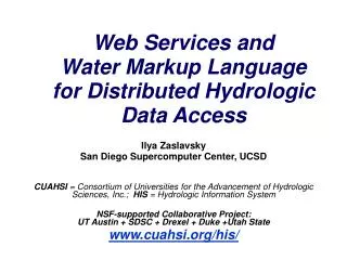
Hydrologic Data Access Using Web Services. David R. Maidment Center for Research in Water Resources University of Texas at Austin. Canadian Water Resources Association Conference St John’s, Newfoundland, 28 June 2011. http://www.cuahsi.org.

E N D
Hydrologic Data Access Using Web Services David R. Maidment Center for Research in Water Resources University of Texas at Austin Canadian Water Resources Association Conference St John’s, Newfoundland, 28 June 2011
http://www.cuahsi.org • CUAHSI is a consortium representing 125 US universities • Supported by the National Science Foundation Earth Science Division • Advances hydrologic science in nation’s universities • Includes a Hydrologic Information System project
How the web works Catalog(Google) Catalog harvest Search Web Server (CNN.com) Browser (Firefox) Access HTML – web language for text and pictures
Services-Oriented Architecture for Water Data Catalog Service registration Search Catalog harvest Server User Data access WaterML – web language for water data
WaterML as a Web Language Discharge of the San Marcos River at Luling, TX June 28 - July 18, 2002 USGS Streamflowdata in WaterML language The USGS now publishes its time series data as WaterML web services
Colorado River at Austin I accessed this WaterML service from USGS at 9PM last night http://waterservices.usgs.gov/nwis/iv?sites=08158000&period=P7D¶meterCd=00060 And got back these flow data from USGS which are up to 8PM Central time
CUAHSI Water Data Services Catalog 66 public services 18,000 variables 1.9 million sites 23 million series 5.1 billion data values And growing The largest water datacatalog in the world maintained at the San Diego Supercomputer Center
Point Observations Information Model Niagara Peninsula Conservation Authority Information is transmitted through the internet in WaterML as web services Data Source Water Quality Network GetSites BA001 Sites GetSiteInfo GetVariableInfo Total Phosphorus Variables GetValues 0.89 mg/L, 20 April 2009 Values {Value, Time, Metadata} • A data source operates an observation network • A network is a set of observation sites • A site is a point location where one or more variables are measured • A variable is a property describing the flow or quality of water • A value is an observation of a variable at a particular time • A metadata quantity provides additional information about the value
Niagara Peninsula Conservation Authority http://www.his.npca.ca/waterdataservices_quality/cuahsi_1_1.asmx?WSDL • 71 Observation sites • 76 water quality variables • 3797 time series • 148, 693 data values
HydroDesktop – Desktop HIS Metadata Catalog Data
Three Categories of Data Services • Data Services – which convey the data • Metadata Services – which convey metadata about specific collections or series of data • Search Services– which enable search, discovery, and selection of data and convey metadata required for accessing data using data services Data Metadata Search Services Metadata Search Data
Open Geospatial Consortium Web Service Standards • Map Services • Web Map Service (WMS) • Web Feature Service (WFS) • Web Coverage Service(WCS) • Catalog Services for the Web (CS/W) • Observation Services • Observations and Measurements Model • Sensor Web Enablement (SWE) • Sensor Observation Service (SOS)
Jointly with World Meteorological Organization Evolving WaterML into an International Standard Meets every 3 months Teleconferences most weeks Hydrology, Meteorology, Climatology, and Oceanography November 2009 WaterML Version 2 standard proposed Vote for adoption later this year
OGC/WMO Hydrology Domain Working Group • This is now an accepted forum for international evolution of water data sharing standards • September 2011 OGC Technical Committee meeting in Boulder, CO, includes a “Hydrology Summit” • March 2012 OGC Technical Committee meeting will be in Austin, Texas
Organize Water Data Into “Themes” Integrating Water Data Services From Multiple Sources . . . Across Groups of Organizations WaterML WaterML WaterML WaterML WaterML
Streamflow Data Services 2 services 7 variables 4,363 sites 11,484 series 9,493,968 records
Water Temperature Data Services 6 services 11 variables 11,158 sites 22,953 series 1,546,841 records
Bacteria Data Services 1 service 21 variables 4,801 sites 15,483 series 297,849 records
Local Information during Tropical Storm Hermine(7-8 Sept 2010) Upper Brushy Creek (Round Rock) LCRA Bring data together into one system http://hydromet.lcra.org http://ubcwcid.org/Overview/Overview.aspx?id=1 TV City of Austin http://coagis1.ci.austin.tx.us/website/COAViewer_fews/viewer.htm
Real-Time Observations Map Layer • Real-Time WaterML service • Map Query Layer • Query Script to acquire observations • Output Map Layer for results • Output Map Service • Viewing System http://waterservices.usgs.gov/nwis/iv?sites=08158000&period=P1D¶meterCd=00065 Stage Height Map Service (USGS and City of Austin) http://129.116.104.176/ArcGIS/rest/services/RealTime/COA_REALTIME/MapServer NEXRAD Map Servicehttp://129.116.104.176/ArcGIS/rest/services/RealTime/COA_NEXRAD/MapServer Continually updating Common Operating Picture Viewer: http://129.116.104.176/PublicSafetyCOP/index.html
ESRI Public Safety Situational Awareness Viewer Continuously updated maps of rainfall and stage height from multiple web services
Outputs Web Services HUB Inputs USGS LCRA NWS COA Observation Data Services (WaterML) AHPS Web Services HUB Observation Data Services (WaterML) Mapping Services (WFS) Channel Data Services (WFS) Mapping Services (WFS) Data Services (WFS) Modeling Services Models Maps
Conclusions • Water web services are operational • There are three levels • Publishing individual time series (USGS) • Publish an observations network (NPCA) • Publishing a collection of networks (Texas Water Development Board, CUAHSI) • Thematic maps can be built from time series • This is all supported and endorsed by WMO