Download
1 / 19
190 likes | 191 Views
Explore the factors affecting industrial location, including raw material availability, labor and energy availability, market proximity, and transportation. Learn about the urban spatial changes in Canada and the United States, from the frontier-staples era to the era of global capitalism.

E N D
INDUSTRIAL LOCATION FACTORS • Location of raw materials • Labor availability • Energy availability • Location of market • Transportation • Relative importance of factors change: • INDIVIDUAL SECTORS • NATURE OF THE ECONOMY
FUEL RESOURCES
2% 65% 15% 18% Primary United States Secondary Tertiary 4% Quaternary 74% 22% Tertiary & Quaternary Combined Canada SECTORS OF THE ECONOMY
POSTINDUSTRIAL LOCATION FACTORS • 300 days of sunshine per year • Recreational water within 1 hour drive • Affordable housing • Start up capital ($1 billion) • Low risk environment • Tax breaks • Cooperative state & local governments • Lenders • Businesses
POSTINDUSTRIAL OCCUPATIONS ATTRACTIONS FOR HIGH-TECH COMPANIES • Major University (Graduate Engineering Program) • Economic enterprises • Government • Social-services complexes • Military
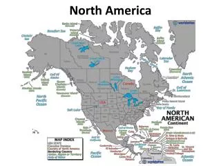
Canada Nunavut Yukon Northwest Territories Newfoundland Manitoba BC Alberta Quebec Ontario PEI Saskatchewan Nova Scotia New Brunswick
C A N A D A
Quebec City Toronto Montreal Detroit Windsor Main Street Cluster
URBAN SPATIAL CHANGESMacroscale (Interurban) • MAURICE YATES • Developed a model to explain Canada’s urban system • Views cities as points in a network that interact with one another and serve the hinterlands • Similar to Borchert’s model • Included 3 developmental eras
URBAN SPATIAL CHANGESMacroscale (Interurban) • Frontier-Staples Era (<1935) • Economic transition from mercantile economy to one oriented to staples (raw materials and agricultural goods for export) • Growth of the industrial heartland • Montreal and Toronto emerged as dominant cities.
URBAN SPATIAL CHANGESMacroscale (Interurban) • Era of Industrial Capitalism (1935-1975) • Increase in manufacturing and tertiary sectors of the economy • Increase in urbanization • Large investment by US corporations in Canadian branch-plant production (auto industry) • Alberta experiences growth due to oil and natural gas production.
URBAN SPATIAL CHANGESMacroscale (Interurban) • Era of Global Capitalism (since 1975) • Rise in foreign investment from western Pacific Rim and Europe • Canada’s movement into the Postindustrial Society • Country achieves 77% urbanization
REGIONS OF THE REALM • MARITIME NORTHEAST • FRENCH CANADA • CORE • CONTINENTAL INTERIOR • SOUTH • SOUTHWEST • WESTERN FRONTIER • NORTHERN FRONTIER • PACIFICHINGE
REGIONS OF THE REALM