Download
1 / 41
430 likes | 668 Views
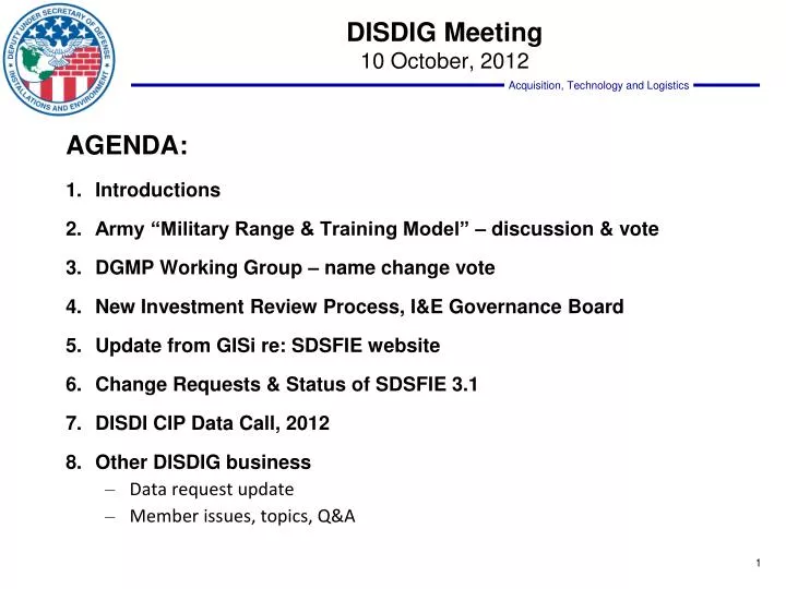
DISDIG Meeting 10 October, 2012. AGENDA: Introductions Army “Military Range & Training Model” – discussion & vote DGMP Working Group – name change vote New Investment Review Process, I&E Governance Board Update from GISi re: SDSFIE website Change Requests & Status of SDSFIE 3.1

E N D
DISDIG Meeting 10 October, 2012 AGENDA: • Introductions • Army “Military Range & Training Model” – discussion & vote • DGMP Working Group – name change vote • New Investment Review Process, I&E Governance Board • Update from GISi re: SDSFIE website • Change Requests & Status of SDSFIE 3.1 • DISDI CIP Data Call, 2012 • Other DISDIG business • Data request update • Member issues, topics, Q&A
SDSFIE Army AdaptationMilitary Range & Training Module Vince Nicchitta OACSIM IGI&S Program Manager
SDSFIE Overview & Background SDSFIE Vision:To be the single DoD spatial standard that supports common implementation and maximizes interoperability for Installation, Environment, and Civil Works Missions • SDSFIE provides a set of geographically referenced feature types and attributes sufficient to meet a majority of the collective DoD I&E business needs • SDSFIE focuses on a geospatial representation of features and maintains a minimum number of attributes to link business databases for attribute data, while not duplicating those in business databases
Army Pilot Projects Goals & Objectives • Obtain an estimated level of effort to convert an installation geospatial dataset from SDSFIE v2.6 to SDSFIE 3.0 • Determine the extent of data loss that might occur when moving from 2.6 to 3.0 & propose an Army Adaptation to prevent data loss or corruption of data • Capture information that will inform the planning and execution of SDSFIE 3.0 training, migration timeline, and data management Results • Test installations (Fort Bragg, JBLM, & Camp Ripley) discovered: • Level of effort required to convert to SDSFIE 3.0 is significant • Data conversion tools have rigid SDSFIE 2.61 compliancy requirement. • Manual conversion is the most viable option for Army
Army Implementation Plan Outlines document purpose and provides SDSFIE overview Provides driver references and defines key terms and common acronyms Defines implementation roles and responsibilities throughout Army IGI&S Details exact adaptation process for each level of Army IGI&S (HQ, Army Organizations, & Installations) Outlines all physical implementation rules as mandated by DISDI & OACSIM Provides brief overview of way forward
Army Quality Assurance Plans • Set of documents defining geospatial data & metadata content specifications, validation methodology, acceptable data sources, internal handling controls and how GIS data is aligned with Army business systems • Living documents reviewed & updated annually by HQDA Proponent • Outlines all acceptable geometry types • Written to SDSFIE 2.6 but contains preliminary SDSFIE 3.0 Army Adaptation information • Prepares for business system alignment
Foundational Attributes • All SDSFIE Gold Foundational Attributes are included within the Army Adaptation. • Additional Army Adaptation foundational attributes were added to all applicable feature types. All are Army IGI&S or Army Real Property requirements.
Army SDSFIE Working Group SDSFIE 3.x Army Adaptation Development Work Flow Purpose: To finalize the SDSFIE 3.0 Army Adaptation, establish best management practices for implementing the Army Adaptation, and to manage change. • Consists of Army IGI&S staff & SMEs from all levels of the Army • Has met quarterly since Jan 2011 • Responsible for: • Establishing subgroups with specific focuses • Create common feature type, attribution, and enumeration recommendations • Document and provide justification for all additional Army requirements
Army SDSFIE WG Subgroups Objective:Identify requirements for feature types, attributes, enumerations, and relationships to make up the SDSFIE 3.0 Army Adaptation. Requirements are provided to IGI&S Working Group for approval. Current Subgroups:
Army SDSFIE WG MRT Subgroup • All decisions made during meetings are • being used to update existing SRP QAPs in • preparation for distribution to the SRP • community with the new SDSFIE 3.0 Army • Adaptation Module. • Additional coordination was completed • following completion of meetings to iron out • final modeling details, justifications, etc. Military Range and Training Subgroup began on March 3, 2011 and concluded meetings on June 15, 2011. Meetings consisted of HQ SRP, Installation IGI&S, Installation DPW, Installation SRP, USACE, and SRP SME staff. Each Sustainable Range Program QAP was reviewed and compared to SDSFIE Gold to identify definition, attribute, and concept matches.
Army Adaptation Documentation • Offical documentation required by DISDI for Adaptation approval • Extensions, Profiles, Enumerations, Subclasses, Justifications, etc. • Army Documentation • Written Data Dictionary • Visualization of Model • Physical, Distributable Geodatabase
Composition of Final Model Adaptation Process: Adaptation Results:
Questions/Comments? Vince Nicchitta IGI&S Program Manager 571-256-8160 Vincent.H.Nicchitta2.civ@mail.mil Chris Schulze IGI&S Specialist 571-256-8161 Christopher.L.Schulze2.civ@mail.mil Martina Harmon Quality Assurance & Communications Lead / SDSFIE Coordinator 571-256-8158 Martina.S.Harmon.ctr@mail.mil Visit IGI&S: AKO Portal: https://www.us.army.mil/suite/page/igis Email: usarmy.pentagon.hqda-acsim.mbx.igi-s@mail.mil
Metadata Working Group September 25, 2012 Meeting Summary: • State of DGMP • NSG Metadata Framework (NMF) insights • ArcGIS 10.1 Template • Implementation Guidance • Potential Additions to DGMP 1.1 • Name Change • Recommendations concerning the way forward
Metadata Crosswalk (for ArcGIS 10.1) • The new Metadata Crosswalk is complete and is under final DISDI Program review • Once the Crosswalk is finalized by the DISDI Program it will be distributed to the DISDI Group for its review • After review and approval by the DISDI Group, an ArcGIS metadata template(s) will be produced and distributed to the DISDI Group
Metadata Standard - Name Change Recommendations: • SDSFIE Metadata Profile (SMP) • SDSFIE Metadata Framework (SMF) • SDSFIE Metadata Foundation (SMF) • ACTION: As discussed at the most recent Metadata Working Group meeting, the DISDIG concurs with changing the name of the DISDI Geospatial Metadata Profile (DGMP) to SDSFIE Metadata Foundation (SMF).
FY2012 NDAA • Section 901 of the Fiscal Year 2012 National Defense Authorization Act (FY2012 NDAA) continues to refine the IRB Process: • Single cross-functional, enterprise-wide IRB/Defense Business Council (DBC), chaired by the Deputy Chief Management Officer (DCMO) to certify investments • Defense Business Systems (DBS) that will have a total cost in excess of $1M over the period of the current future–years defense program (FYDP) • New investment management process intended to: • Emphasize Business Process Reengineering (BPR) • Strengthen and influence the Business Enterprise Architecture (BEA) • Become the foundation for the Enterprise Transition Plan (ETP)
New IRB Process – Functional Business Strategy • Requires the development of a functional business strategy from each business area which: • Defines the business area’s strategic vision, goals, and targeted outcomes based on the Quadrennial Defense Review (QDR) and the Strategic Management Plan (SMP) • Is developed by the Principal Staff Assistants(PSAs) • Provides general direction for business area as a whole or may focus on specific sub-functions within a business area • Will be used to drive the BEA • Ensures Component Organizational Execution Plan (OEP) to functional strategy • Requires submission to the IRB/DBC and approval
I&E Sub-FunctionsBusiness Functions tied to Joint Capability Areas • General Engineering • The ability to employ engineering capabilities and activities, other than combat engineering, that modify, maintain, or protect the physical environment. Examples include: the construction, repair, maintenance, and operation of infrastructure, facilities, lines of communication and bases; terrain modification and repair; and selected explosive hazard activities. • Real Property Life Cycle Management • The ability to acquire, operate, sustain, recapitalize, realign, and dispose of real property assets to meet the requirements of the force. • Installation Services • The ability to deliver selected services not related to real property (or personnel services) to meet the requirements of the installation population and mission. • Geospatial Engineering • The ability to portray and refine data pertaining to the geographic location and characteristics of natural or constructed features and boundaries in order to provide engineer services. Examples include: terrain analyses, terrain visualization, digitized terrain products, nonstandard tailored map products, facility support, and force beddown analysis. Source: http://www.bta.mil/products/bea_7_0/BEA/iwp/bealist_jointcapabilityarea_na.htm
I&E Functions and Capabilities Map to BEA Business Enterprise Architecture (BEA 9.0) I&E Functional Strategy End-to-Ends I&E Process Models I&E Capabilities Sub-Functional Area Functional Area Core Capabilities Order to Cash (O2C) Acquire to Retire (A2R) Procure to Pay (P2P) Environmental Liabilities (EL) Manage Property and Materiel General Engineering Develop and Maintain Facilities Installation and Environmental Management Master Facility Design Perform Build and Make and Maintenance and Sustainment Repair and Restore Infrastructure Real Property Life Cycle Management Provide Installation Assets Manage Property and Materiel Sustainment of Installation Assets Real Property Acceptance Perform Receipt, Acceptance and Return Recapitalization of Installation Assets Perform Build and Make and Maintenance and Sustainment Disposal of Installation Assets Real Property Inventory Economic Adjustment Activities Facilities Support Installation Services Environmental Liabilities Identification and Valuation Security Services Perform ESOH Services Emergency Services Housing Services Perform Installations Support installation Safety Hazardous Materials Process Controls and Information Management Range & Airfield Management Port Services Manage Geospatial Information and Services Geospatial Engineering Utilize Geospatial Data
New IRB Process – Component OEP • Requires development of OEPs, which: • Are developed by each Component • Requires review and submission to the IRB/DBC through the component Pre-Certification Authority (PCA) for approval • Helps to identify and balance technology needs and align to the BEA • Must be linked with the business area functional strategy • Are used for review, evaluation and certification • Assists Components with grouping DBS into portfolios
I&E Organizational Execution Plans (OEP)Review Process Take Aways • Data Quality Critical • DoD Information Technology Portfolio Repository • Select and Native Programming Data Input System – Information Technology • OEP and Assertion Memo • I&E Preview and Discussion Sooner in Process • Update Functional Business Strategy • Better define weak areas (e.g. Installation Support, Energy) 25
New IRB Process - IPTs • IRB/DBC establishes Integrated Product Teams (IPTs): • Standing I&E IPT are proposed and would: • Be responsible for assisting the AT&L IRB/DBC member in assessing portfolio investments by determining compliance with laws, identifying redundancies and gaps, and validating business value of portfolios • Address all I&E functions and capabilities covered by the BEA • I&E representation from Component and Defense agency
Charter - I&E Functional Business Governance Board • Charter establishes I&E Functional Governance Board: • As authoritative governance body for DUSD • As main governance body for oversight, direction and support to provide single integrated I&E approach to enable interoperability and manage data quality for enterprise capabilities across I&E • As support for functional responsibilities IAW U.S.C. Title 10, the DISP and the I&E Functional Business Strategy • As responsible to ensure compliance with DCMO guidance and in accordance with OEPs. 27
As a result of the SDSFIE Working Group meeting… CHANGE REQUESTS *Special Case CRs – see next slide
Change Requests – Further Review • DISDI PM e-mail, 4 October: Special case CRs that need further collaboration between one or more services in order to finish the CR recommendation for final group review/action
Change Request Status IMPORTANT DATES: October 17 – Comments DUE for all CRs October 24 - Final vote for implementation into 3.1
DISDI CIP Feature List - 2012 * Based on SDSFIE 3.0 Gold LDM so…what is new? REPISITES! Readiness and Environmental Protection Initiative – What is it?
Data Call Features & Geometry *As defined in SDSFIE 2.X Prior Release
Next Steps • Data call to Components • 60 days to complete • DISDI team compiles data, coordinates with Components to resolve issues
next Future DISDIG Meetings 15* Aug 2012 - Wednesday, 1300 – 1500 12 Sep 2012 - Wednesday, 1300 – 1500 10 Oct 2012 – Wednesday, 1300 – 1500 14 Nov 2012 – Wednesday, 1300 – 1500 13 Dec 2012 – Wednesday, 1300 – 1500