Download
1 / 46
470 likes | 704 Views
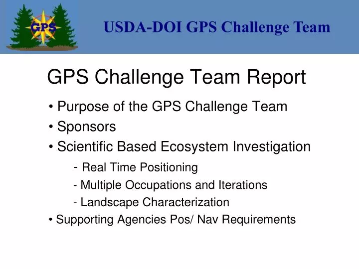
USDA-DOI GPS Challenge Team. GPS Challenge Team Report. Purpose of the GPS Challenge Team Sponsors Scientific Based Ecosystem Investigation - Real Time Positioning - Multiple Occupations and Iterations - Landscape Characterization Supporting Agencies Pos/ Nav Requirements.

E N D
USDA-DOI GPS Challenge Team GPS Challenge Team Report Purpose of the GPS Challenge Team Sponsors Scientific Based Ecosystem Investigation - Real Time Positioning - Multiple Occupations and Iterations - Landscape Characterization Supporting Agencies Pos/ Nav Requirements
USDA-DOI GPS Challenge Team Observation Methodology Gary Hallbauer, USDA-NRCS Point Characterization Wayne Dulaney, USDA-ARS U.S Forest Service Findings Gary Boyack, USFS–CO Dick Karsky, USFS-MTDC National Park Service Findings Karl Brown, NPS Tim Smith, NPS
USDA-DOI GPS Challenge Team Observation Methodology
USDA-DOI GPS Challenge Team The approach… Uniformity of procedures Consistency of applications Redundancy of equipment Availability of signal
USDA-DOI GPS Challenge Team Uniformity Set protocols for: Data format: NMEA 0183 Collection type: Static File naming: Point designator, receiver & antenna model Signal type (Autonomous, WAAS, NDGPS) Collector
USDA-DOI GPS Challenge Team Uniformity Additional protocols for: Collection duration: 20 – 45 minutes at less challenged sites 45 minutes to > 1 hour at more challenged sites Equipment placement: Perpendicular to point and sky, level
USDA-DOI GPS Challenge Team Consistency Protocols consistently applied: To each project location To each point To each file collected
USDA-DOI GPS Challenge Team Redundancy Duplicate equipment in some cases Multiple dates, multiple ecosystems Acadia NP (2) Bakerville, CO Hoosier NF, IN (3) Fort Worth, TX (Many) Powell, ID and Lubrecht, MT (Many) Multiple archival sites
USDA-DOI GPS Challenge Team Availability of signal Set survey controlled points in: Variety of canopy types Variety of slopes Variety of stand densities Signal availability inferred from ability to resolve positions over time Autonomous WAAS } With & without external antenna
USDA-DOI GPS Challenge Team Other considerations… Logistics of: Shipping equipment to the locale Transporting the equipment to site Powering the equipment Returning equipment Safety in the woods
USDA-DOI GPS Challenge Team GPS Site Characterization Purpose: • Provide data to assess impact of vegetation cover on GPS performance. Tools: • Hemispherical or “Fish-eye” photography • LI-COR LAI-2000 Plant Canopy Analyzer
USDA-DOI GPS Challenge Team Digital Hemispherical Photography • Two (2) different camera systems • Fish-eye lens with 183O field of view (FOV) • Images georeferenced to magnetic north Canopy Composition: Species mix – Ecoregions (Domain/Division) Canopy Architecture: Obstruction or attenuation of GPS signals
USDA-DOI GPS Challenge Team Arapaho NF, Colorado El Yunque NF, PR Dry: Temperate Steppe Humid Tropical: Savanna
USDA-DOI GPS Challenge Team Acadia NP, Maine Hoosier NF, Indiana Humid Temperate: Warm Continental Humid Temperate: Hot Continental
USDA-DOI GPS Challenge Team Tongass NF, Alaska Redwood NP, California Humid Temperate: Marine Humid Temperate: Mediterranean
USDA-DOI GPS Challenge Team Leaf Area Index (LAI) Definition: one-sided leaf area per unit ground area In forest canopies, more accurately defined as a foliage area index -- area includes opaque canopy elements (e.g., trunks and branches)
USDA-DOI GPS Challenge Team LAI-2000 Plant Canopy Analyzer Optical sensor After LI-COR, Inc., Lincoln, NE “Fish-eye” lens projects diffuse sky radiation at five (5) zenith angles onto corresponding concentric silicon detectors
USDA-DOI GPS Challenge Team LAI-2000 PCA Methodology • Coincident, intercalibrated measurements acquired above and below the forest canopy • “Above” sky measurements logged automatically in forest clearing • Canopy light interception calculated at each zenith angle – BELOW / ABOVE • Foliage amount determined from transmittances using a radiative transfer model
USDA-DOI GPS Challenge Team LAI-2000 PCA Data Quality Previous research: LAI-2000 measurements are significantly and linearly correlated with direct LAI measurements Spatial averaging: transect of six (6) below-canopy LAI-2000 measurements made at each GPS site High degree of repeatability: provided confidence in usefulness of LAI-2000 data for characterization of GPS sites
USDA-DOI GPS Challenge Team LAI acquired two (2) days apart
USDA-DOI GPS Challenge Team LAI acquired ten (10) months apart
USDA-DOI GPS Challenge Team Ascending order of LAI values
USDA-DOI GPS Challenge Team Conclusions Forest mean LAI values follow expected trend suggested by ecoregion domain designations: Dry Humid Temperate Humid Tropical Quantitative information on forest canopy structure provides an analytical framework to better evaluate the impact of vegetation cover on GPS receiver and antenna performance.
USDA-DOI GPS Challenge Team Forest Service Concerns The Forest Service must conserve resources but still has to manage their lands. Overwhelming financial resources are going to fire activities Low cost materials are being harvested In spite of reduced funding, resource mapping still needs to done
USDA-DOI GPS Challenge Team With data collected from this study and the software developed to query that data, a tool is available to help the USFS choose the correct receiver for the job and environment encountered. This query tool also provides the user with a better understanding of the variables affecting accuracy such as canopy effect, signal differences, etc. Forest Service GPS Concerns
USDA-DOI GPS Challenge Team Anchorage – Chugach NF High Latitude – typically medium softwood Juneau– Tongass NF High Latitude – typically large softwood Lubrecht Test Course – Lolo NF high latitude – small to medium softwoods Acadia NP – before and after WAAS change high latitude --- small to medium - softwood and hardwood Powell Test Course – Clearwater NF typically very large softwoods Redwoods NP typically very large redwoods Bedford Test Course - Hoosier NF small, medium and large – softwood and hardwood Fort Collins, CO Mixed hardwood – softwood urban forests Caribbean Test Course - El Yunque NF low latitude – small to large – softwood and hardwood Bakerville Test Course - Arapaho NF north slope – small to medium softwood
USDA-DOI GPS Challenge Team NMEA: Raw Data to Final Information Define Filename Format with Parameters Properly Name Collected NMEA Data Parse the Many NMEA Strings To One Single Row Construct Control Coordinate Files Create Site Environment File Create Spread Sheet Join Create Views and Queries
USDA-DOI GPS Challenge Team 4128,N,10548.5442,W,223316,A,D*58 $GPBOD,,T,,M,,*47 $PGRME,1.9,M,2.9,M,3.5,M*2B $PGRMZ,9864,f,3*28 $PGRMM,NAD83*29 $GPRTE,1,1,c,*37 $PSLIB,,,K*23 $PSLIB,,,J*22 $GPRMC,223318,A,3941.4128,N,10548.5444,W,0.0,175.8,120705,10.4,E,D*33 $GPRMB,A,,,,,,,,,,,,A,D*0E $GPGGA,223318,3941.4128,N,10548.5444,W,2,05,1.5,3006.6,M,-20.4,M,1,0201*78 $GPGSA,A,3,,,,,13,16,20,23,,25,,,2.7,1.5,2.3*33 $GPGSV,3,3,11,24,06,256,00,25,18,067,40,27,16,262,00*47 $GPGLL,3941.4128,N,10548.5444,W,223318,A,D*50 $GPBOD,,T,,M,,*47 $PGRME,1.9,M,2.9,M,3.5,M*2B $PGRMZ,9864,f,3*28 $PGRMM,NAD83*29 $GPRTE,1,1,c,*37 $GPRMC,223320,A,3941.4128,N,10548.5442,W,0.0,175.8,120705,10.4,E,D*3E $GPRMB,A,,,,,,,,,,,,A,D*0E $GPGGA,223320,3941.4128,N,10548.5442,W,2,05,1.6,3005.9,M,-20.4,M,1,0201*7A $GPGSA,A,3,,,,,13,16,20,23,,25,,,3.0,1.6,2.6*33 $GPGSV,3,1,11,01,18,113,00,03,12,140,00,04,05,294,00,06,00,029,00*76 $GPGLL,3941.4128,N,10548.5442,W,223320,A,D*5D $GPBOD,,T,,M,,*47 $PGRME,2.0,M,3.3,M,3.8,M*27 $PGRMZ,9862,f,3*2E $PGRMM,NAD83*29 NMEA Data to Information
USDA-DOI GPS Challenge Team Northeast Northwest North South East West Southeast Southwest
USDA-DOI GPS Challenge Team Hemisphere (Fisheye) Information ARS Information --- LAI is also available
USDA-DOI GPS Challenge Team Receiver Comparisonunder various forest canopies. Query tool helps Forest Service personnel determine which receiver configuration will meet a specified need.
USDA-DOI GPS Challenge Team Mapping versus Recreation Receivers The query tool can be used to determine which GPS receivers and procedures are suitable for various positioning and navigation operations such as: timber cruising (high accuracy) sample plot location fire boundary noxious weed, pest damage location, etc. (low accuracy) At the same time, these measurements can be quantified
USDA-DOI GPS Challenge Team Military Equipment PLGRs and DAGRs were also observed as there are some being used within the agency.
USDA-DOI GPS Challenge Team Canopy Cover Considerations What are the observed influences of canopy cover? What are affects of boles, stems, foliage?
USDA-DOI GPS Challenge Team Signal Difference Augmentation signal helps improve measurement accuracy, but by how much? NDGPS can be received under canopy but the WAAS signal is sometimes blocked.
USDA-DOI GPS Challenge Team Measurements Improved by WAAS Change WAAS is becoming more available for use in lighter canopy by the Forest Service. There were observed improvements at Bar Harbor relative to the WAAS satellite change.
USDA-DOI GPS Challenge Team Antenna Influence How much does an antenna improve the measurement? External antenna usually speeds up data collection under canopy.
USDA-DOI GPS Challenge Team Leaf On versus Leaf Off Hoosier Natl. Forest experience shows little difference in accuracy between leaf on / leaf off conditions but collection efficiency improved significantly with leaf off.
USDA-DOI GPS Challenge Team Tree Bole Influence With the limited data collected, it appears that accuracy may be influenced more by the bole density than the foliage density.
USDA-DOI GPS Challenge Team Field Procedure Improvement FS requires averaging fixes to help determine measurement quality From this work it appears we might have a procedure that allows reducing field time by half This still needs to be studied more thoroughly.
USDA-DOI GPS Challenge Team Forest Unit Area Expanded Volumes Timber cruising needs to know the area accuracy for an entire unit that is being measured with a specific GPS configuration. This is done by comparing the timber unit being measured to similar control courses. Area based sampling methods can then be used to better quantify timber, biomass, carbon sequestration or similar volumes. The information from this project is invaluable.
USDA-DOI GPS Challenge Team Forest Service Gratitude The USDA Forest Service has come a long way in positioning and navigation to manage our nations timber and range resources --- We express our thanks to the Defense Department and those associated with making GPS available to the civilian community. Painting credit: Barry Nehr
USDA-DOI GPS Challenge Team GPS Use In The DOI“Soup to nuts” • Safety-of-Life operations – Search-and-Rescue, Fire, Homeland Security, Transportation, etc. Law Enforcement • Natural and Cultural Resource data collection and monitoring • Facilities management • Navigation for many other activities
USDA-DOI GPS Challenge Team Why Do This? • Saves the government money • Provides accurate receiver specifications information under actual field conditions • Helps develop efficient workflows based on real world field conditions
USDA-DOI GPS Challenge Team Which tool? Requirement: “I need a hammer.” • Provides information to users on the right tools to meet their requirements • Helps to validate manufacturers performance specifications