Download
1 / 18
200 likes | 573 Views
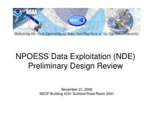
NPOESS Conical Scanning Microwave Imager/ Sounder (CMIS) Overview. David Kunkee June 23, 2002. Background. NPOESS Conical Scanning Microwave Imager Sounder (CMIS) Continues and Improves on the Missions of SSM/I, SSMIS Next Generation Polar-orbiting Operational Radiometer MISSION:

E N D
NPOESS Conical Scanning Microwave Imager/ Sounder (CMIS) Overview David Kunkee June 23, 2002
Background • NPOESS Conical Scanning Microwave Imager Sounder (CMIS) • Continues and Improves on the Missions of SSM/I, SSMIS • Next Generation Polar-orbiting Operational Radiometer • MISSION: • Provide a variety of data-products: 22 Environmental Data Records (EDRs) • An integral part of the NPOESS constellation • Design • CMIS design was optimized with respect to an Integrated Requirements Prioritization List (IRPL) and risk
CMIS Design Overview • CMIS primary design drivers: • Cat I EDRs, Cat II EDRs and Cost • Current CMIS Design • 77 Channels: 37 channels with 40 FFT channels • Two main reflectors: • Low Frequencies (LF): 2.2 m • High Frequencies (HF): 0.5 X 0.7 m • Two feedhorn clusters • LF cluster: 12 feedhorns, 6 – 89 GHz • HF cluster: 4 feedhorns, 166 and 183 GHz • >0.9 reliability after 7 years on orbit + 8 years storage • Substantial redundancy • 257 kg mass; 280 kb/s data rate; 291 W orbital average power
CMIS Channel Set * *Polarizations: V=Vertical, H=Horizontal, P=+45 degrees, M =–45 degrees, L=Left-hand Circular, R=Right-hand Circular
Antenna Beam Sampling • Co-registration of footprints • Requires up to 9 scan rotations • High Frequency observations are offset in elevation to overlay Low Frequency antenna beam footprints • Antenna Beam Sampling • CMIS Provides Nyquist sampling for all channels along scan • Nyquist sampling achieved cross-scan beyond ~20 degrees of the center of scan • Head-to-toe (contiguous) sampling along track
CMIS Data Products and Algorithms • Atmospheric and Environmental Research (AER) • All EDRs (and intermediate data products) except Ocean EDRs • Remote Sensing Systems (RSS) • Ocean EDRs • Microwave Operational Algorithm Team (MOAT) • Government/University advisory board to CMIS • Shares latest science and techniques with AER/RSS • Sea Surface Wind Direction: • 10, 18, 37 GHz (V,H) 18, 37 GHz (–45, +45) 10, 18 GHz (LH, RH) • Temperature Sounding: • 60 GHz (9 channels from 50.3 to 59.94 GHz, V-pol) • 40 FFT channels centered on 7+ O2 line (60.434776 GHz)
CMIS EDR Algorithms • AER uses a unified retrieval approach • All available radiometric & auxiliary/ancillary data supplied to a physical retrieval scheme • Optimizes solution based on the internal model • Retrieval produces vertical moisture profile and vertical temperature profile • Output generated at predetermined altitudes • Includes Surface Temperature & Emissivity • Output is supplied algorithms that produce remaining non-ocean EDRs
CMIS EDR Algorithms (Cont’d) • Ocean EDRs Remote Sensing Systems • Based on CMIS calibrated brightness temperatures • Ocean EDRs are supplied as input to the unified retrieval • Sea-Surface Wind Direction (SSWD) is a key development of CMIS
Heritage Radiometers • Several sensors qualify as “heritage” • SSM/I (special-sensor, microwave imager) • Only Operational Conical-Scanning microwave imager on orbit • SSMIS (microwave imager/sounder) • Not yet launched – scheduled for October 2002 • Includes temperature and moisture sounding channels • Other ‘pathfinders’ • AMSR-E • Includes imaging channels 6 – 89 GHz 1.6 m reflector • WINDSat • Sea surface wind direction from polarimetric microwave measurements • Full polarimetric capability at 10, 18 and 37 GHz • Risk reduction for CMIS
SSM/I Scan Geometry J.L Hollinger, J. L. Peirce and G. A. Poe, “SSM/I Instrument Evaluation”, IEEE Trans. Geosci. Remote Sensing, 28(5), Sept 1990
SSM/I and CMIS Imaging Channels SSM/I CMIS Imaging
Conical Scanning Radiometers (II) Advanced Microwave Scanning Radiometer (EOS) (AMSR-E) Special Sensor Microwave Imager Sounder (SSMIS)
Summary • CMIS offers: • New operational data products • Sea Surface Wind Direction • Soil Moisture • Cloud Base Height • Quantifiable improvements in heritage data products • Spatial Resolution • Measurement Range