Download
1 / 69

E N D
Most volcanoes occur in narrow belts or are grouped together in small clumps. This is because they usually occur at plate boundaries. One such ‘belt’ of volcanoes is called the Ring of Fire, which runs around the edge of the Pacific Ocean, where, amongst others, the Pacific Plate meets the Eurasian Plate, the Indo-Australian Plate, the Antarctic Plate, and the Nazca Plate. Forecasting involves probable character and time of an eruption in a monitored volcano. The character of an eruption is based on the prehistoric and historic record of the volcano in question and its volcanic products. For example, a violently erupting volcano that has produced ash fall, ash flow and volcanic mudflows (or lahars) is likely to do the same in the future. Determining the timing of an eruption in a monitored volcano depends on measuring a number of parameters, including, but not limited to, seismic activity at the volcano (especially depth and frequency of volcanic earthquakes), ground deformations (determined using a tiltmeter and/or GPS, and satellite interferometry), and gas emissions (sampling the amount of sulfur dioxide gas emitted by correlation spectrometer, or COSPEC
Many kinds of volcanic activity can endanger the lives of people and property both close to and far away from a volcano. Most of the activity involves the explosive ejection or flowage of rock fragments and molten rock in various combinations of hot or cold, wet or dry, and fast or slow. Some hazards are more severe than others depending on the size and extent of the event taking place and whether people or property are in the way. And although most volcano hazards are triggered directly by an eruption, some occur when a volcano is quiet.
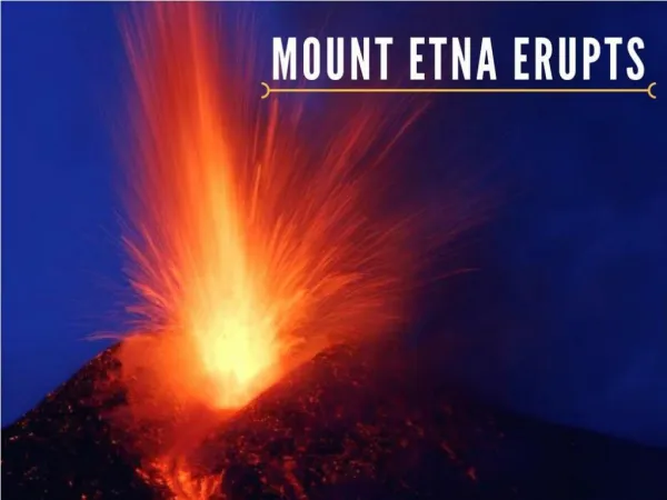
Anatahan Volcano eruption, May 11, 2003 Northern Mariana Isles
Long before the Hawaiian Isles were formed, at the end of Cretaceous there were massive volcanism on the Earth. Mass extinction of dinosaurs is attributed to those changes, at the Cretaceous-Tertiary Boundary (KT) 65 million years ago.
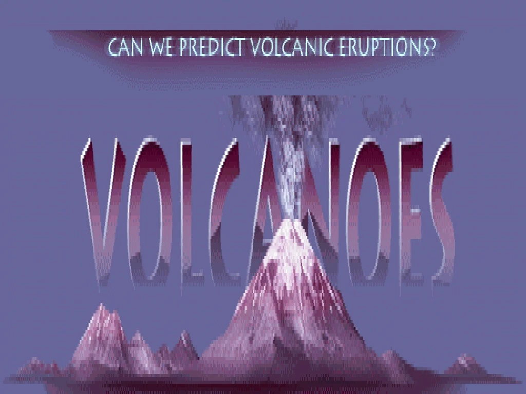
But what will those signals be? Millions live in the shadows of nature's ticking time-bombs--volcanos. An apocalyptic volcanic blast will not come unheralded. No volcano is going to suddenly produce one of these humongous eruptions without giving a lot of signals. But what will those signals be?
Historic Record of Eruption and Lahar, Japan: About 1-m thick mud including many blocks drapes the present topography 300-m west of Aramaki Campus, Gunma University at Maebashi. This deposit is emplaced by the Kambara hot lahar originated from the northern flank of Asama on August 5, 1783. Outcrop exposed by urban development.
Forecasting a Volcanic Eruption As the world's population grows, more and more people are living in potentially dangerous volcanic areas. Volcanic eruptions continue--as they have throughout history--posing ever-greater threats to life and proper There are mainly two internal heat sources that drive plate tectonics and volcanic eruptions: heat left over from the formation of the earth, and decay of radioactive elements within the earth. Volcanic eruptions account for a large proportion of the internal heat that is dissipated from the interior of the earth. Are Volcanic Eruptions Tied to Lunar Cycle? Gravity is one of Earth's strongest forces, so you can't ignore the moon. The challenge is to find out just how it's playing a role
Glaciers and Volcanoes Climate and environmental change can trigger volcanic eruptions. Over the past 800,000 years, a new study shows, glaciers prompted eruptions after they retreated north. One possibility is that all the extra weight of the glacial ice holds the magma, or molten rock, in place. Then when the ice melts and the water evaporates, less weight on the Earth's crust triggers volcanoes to erupt.
Hazardous volcanic activity poses a threat to people and property. Unlike most other natural hazards, the damage inflicted by volcanoes can be significantly mitigated if volcanic behavior is assessed rapidly, as dangerous situations develop. • Volcanic Hazards • Local volcanic hazards : The magnitude of the proximal threat is much larger. There is the potential for many (perhaps thousands) of deaths and of extensive or total destruction of buildings, roads, dams, pipelines, or any other structures in the area. The surface drainage pattern may be disrupted, and arable land or forest temporarily or permanently destroyed. • Proximal hazards require evacuation of people, livestock, any other movable property, to appreciable distances from their homes, for uncertain lengths of time, often weeks or months. • 2. Local and Distant Tsunamis in the Coastal and Oceanic Volcanic Eruptions • Atmospheric Disseminated ash-plume, Aviation hazard • Pollution, Vog, Haze, Global cooling
Scientists monitor temperature changes, volcanic gases, seismic activity, and apparent "ground uplifts" in the volcano and nearby fields to detect warning signs of a coming eruption, The key thing is to cross-correlate as many different observations as possible. Strengths in the event of a volcanic crisis are (1) familiarity with the eruptive history and probable behavior of the local volcano(es), (2) previously established local credibility based on that knowledge, and (3) established connections with relevant local government officials and emergency responders.
There are two distinct circumstances in which volcanologists monitor activity at volcanoes: (1) unrest at a volcano that has been dormant, but which may be preparing to erupt and (2) activity at a volcano during an eruption, particularly a long-term eruption with spurts of accelerated activity or pauses (as at Kilauea, or Etna, or the slow dome-building eruptions of Montserrat or Unzen). In the first instance, the volcano will erupt only if there is renewed influx of magma from deep within the earth. Magma movement triggers earthquakes and tremor, hence the widespread use of seismic networks as the monitoring method of first resort. Satellite monitoring can come into play only when the magma is near enough to the surface to produce surface deformation, or enhanced heat flow or gas emissions. At this later stage of reawakening, volcanologists need all the information they can get to evaluate the probability of an eruption, and it is here that remote sensing may usefully contribute. The best tool for public education found so far is videos of actual eruptions and their consequences.
Precursor phenomena as eruption forecasters Precursor: an event that commonly precedes another event - we look for events or phenomena that occur before eruptions and see if eruptions often occur after certain events or sequences of events or phenomena Seismic Signals: the hidden signatures that volcanologists seek in the noise emanating from a restless volcano are measured on a seismograph. . Volcano-Tectonic Event | Long Period Event | Tremor Hybrid
A seismograph is a simple pendulum. When the ground shakes, the base and frame of the instrument move with it, but intertia keeps the pendulum bob in place. It will then appear to move, relative to the shaking ground. As it moves it records the pendulum displacements as they change with time, tracing out a record called a seismogram
Gas composition: monitor the composition of gases that are continually vented from the volcano, and note some unique changes in the gas composition have correlated with eruptions that followed
Forecasting a Volcanic Eruption As the world's population grows, more and more people are living in potentially dangerous volcanic areas. Volcanic eruptions continue--as they have throughout history--posing ever-greater threats to life and proper There are mainly two internal heat sources that drive plate tectonics and volcanic eruptions: heat left over from the formation of the earth, and decay of radioactive elements within the earth. Volcanic eruptions account for a large proportion of the internal heat that is dissipated from the interior of the earth. Are Volcanic Eruptions Tied to Lunar Cycle? Gravity is one of Earth's strongest forces, so you can't ignore the moon. The challenge is to find out just how it's playing a role
Japanese researchers put beakers of potassium hydroxide, a strong, basic solution, on Honshu's Asama volcano, which was beginning to show signs of erupting. As the highly acidic gases released by the crater seeped through holes in a crate covering the beakers, they increasingly altered the solution's composition in the months before a large eruption. Today, volcanologists use so-called "Japanese boxes" routinely, though again they must check the beakers manually.
Inflation begins as magma rises into the summit reservoir. Tiltmeters measure changes in slope of the ground. The Global Positioning System (GPS) is used to measure the position of benchmarks. In order to determine the deformation caused by an episode of inflation, scientists must install and survey the benchmarks and install tiltmeters and GPS receivers (if continuous measurements are desired) before magma moves
Tilt or uplift of the volcanic edifice • inflation of volcano due to upwelling magma, and 2. laser guided tilt-meters can record uplift as small as a few millimeters • Using GPS for Monitoring Volcano Deformation • Global Positioning Satellite (GPS)remote sensing
Peak Inflation : Inflating magma reservoir results in deformation that is measured on the surface. As the magma reservoir becomes inflated, the ground around it cracks to accommodate its increasing volume. Many small earthquakes occur in the area surrounding the magma as the rocks break. As the surface of the volcano changes shape, tiltmeters record tiny changes in slope, distances increase between benchmarks on opposite sides of the caldera, and elevations of the stations increase
Eruption usually leads to deflation The summit magma reservoir begins to deflate when magma moves laterally into a rift zone and either erupts or is stored there. At the summit, tiltmeters record tilt toward the magma reservoir, and GPS stations move toward the reservoir. Near the eruption or intrusion, however, tiltmeters record local ground inflation and GPS stations move away from the erupting vent or intrusion. Deflating magma reservoir.
Before it erupts, a volcano produces many thousands of earthquakes. Some of these happen when rock inside the volcano cracks or slips along a fault. Others are caused by magma (molten rock) and gases trying to move under pressure within channels and cracks
Pressure from a pool of magma has just cracked solid rock, creating a volcano-tectonic (VT) event. This type of quake produces relatively high-frequency shaking, usually between one and five cycles per second
Seismic Signal of Volcano-Tectonic (VT) Event : A VT event occurs when magma under pressure or cooling rock causes rock to crack or slip. The abrupt motion of the rock causes its seismic signal to appear abruptly on a seismogram. Even though the way they are produced is different, seismograms produced by volcano-tectonic earthquakes look like those produced by typical earthquakes (those caused by the motion of tectonic plates at plate boundaries, such as the San Andreas fault and the Mid-Atlantic Ridge). VT events cycle as many as five times a second, particularly if the earthquake is two kilometers (1.2 miles) or more below the surface. The frequency of the VT signal shown here is five cycles per second
Long Period Event : Sudden changes in pressure within magma-filled cracks and channels cause long-period (LP) events. LP events are volcano-related earthquakes that are lower in frequency than volcano-tectonic (VT) events. The frequency of LP events is one half of a cycle to three cycles per second. Unlike VT events, LP events can reveal magma flow and the buildup of pressure within a volcano. This knowledge can help seismologists predict eruptions.
The shaking that causes LP events is similar to the "water hammer" that happens in household water pipes. When water is moving quickly through a pipe and the faucet is turned off, the water is forced to stop. But instead of coming to an abrupt stop, it bounces against the closed valve, creating a wave of pressure that moves back and forth within the pipe. The rate at which the wave bounces is determined by the pipe's resonant frequency, a natural frequency of vibration that is, in turn, determined by several factors, including its length and shape. This bounce causes the pipe to clang loudly. The same thing happens within a volcano's magma channel, except that the channel's end is already closed, and the abrupt change is caused by variations in the magma's pressure. Also, the frequency of the bounce is much slower within the channel.
Tremor: A tremor is a long-period (LP) event, but one that lasts longer than the typical LP event. In fact, a single tremor can last anywhere from several minutes to months. The frequency range of a tremor is the same as that with an LP event: one half of a cycle to three cycles per second. The signal shown here has a frequency of two cycles per second. Like LP events, tremors can also be a good indicator of an impending volcanic eruption.
The source of a tremor can and often is the same crack or channel that produces LP events. The difference is that, with a tremor, the waves of pressure traveling through the magma get a little extra push every so often. This push can be pressure changes coming through magma channels from below. Because the waves creating the tremor travel at the cracks' resonant frequency (see LP section), the signal can appear as a continuous wave moving at a single frequency.
Hybrid Event: Sometimes a volcano-tectonic (VT) event triggers a long-period (LP) event, and vice versa. A seismic signal that contains a mixture of both types is called a hybrid. This hybrid event is a VT event that triggered an LP event. Notice how the signal is bunched up more at the beginning than it is later on. The first part of this signal shows the VT event; later, the less-bunched (lower frequency) signal of the LP event appears
Because LP events often begin with signals that look very similar to those at the beginning of a hybrid, it is usually difficult for seismologists to distinguish between the two. To tell one from the other, seismologists look closely at several seismograms of a single event, as recorded by seismographs placed at various locations. If the first part of the signal looks similar on all of the seismograms, they probably have an LP event.
Devices such as Autonomous Underwater Hydrophone (AUH) mooring, Are used to monitor marine Volcanoes on the seafloor. This helps in monitoring earthqauke generated tsunamis
Hydrophones monitor many sources of oceanographic sounds including marine mammals, earthquakes, ships and waves. Sounds are transmitted over great distances through the SOFAR channel, a unique zone in the water that conserves the sound signal
Emergency management is a broad term and includes the ‘4R’s’: Risk Reduction: looking for ways of reducing the consequences of hazards, such as land use planning, building and safety codes, insurance incentives, to name a few. To do this effectively we need good information about hazards and their impacts on communities. Readiness: increasing the understanding and awareness of hazards through education programmes. Working with the community to develop self-help programmes such as household emergency plans and business continuity plans. Ensuring plans and systems are in place (and tested), that enable agencies and communities to respond effectively to an emergency. Response: actions taken immediately before, during or directly after an emergency to save lives and property. To reduce the damage and make sure we can respond as effectively as possible, we need to have already reduced the risk as much as possible and have good response plans and procedures in place that have been well rehearsed. Recovery: as well as coping with problems immediately after an emergency, recovery programmes extend to rebuilding and restoring the community. We may look at rebuilding a community in a new way to prevent a disaster from occurring again.
Civil Defence is a component of emergency management, relating mainly to Readiness and Response activities. Hazards range from big events such as volcanic eruptions, through to floods and storms, fires, power failure, and disease outbreaks. By working together in all areas of emergency management we can create a community which can reduce the impacts of hazards and can bounce back. For more information contact your local council, civil defence or emergency management office.