Download
1 / 38
380 likes | 386 Views
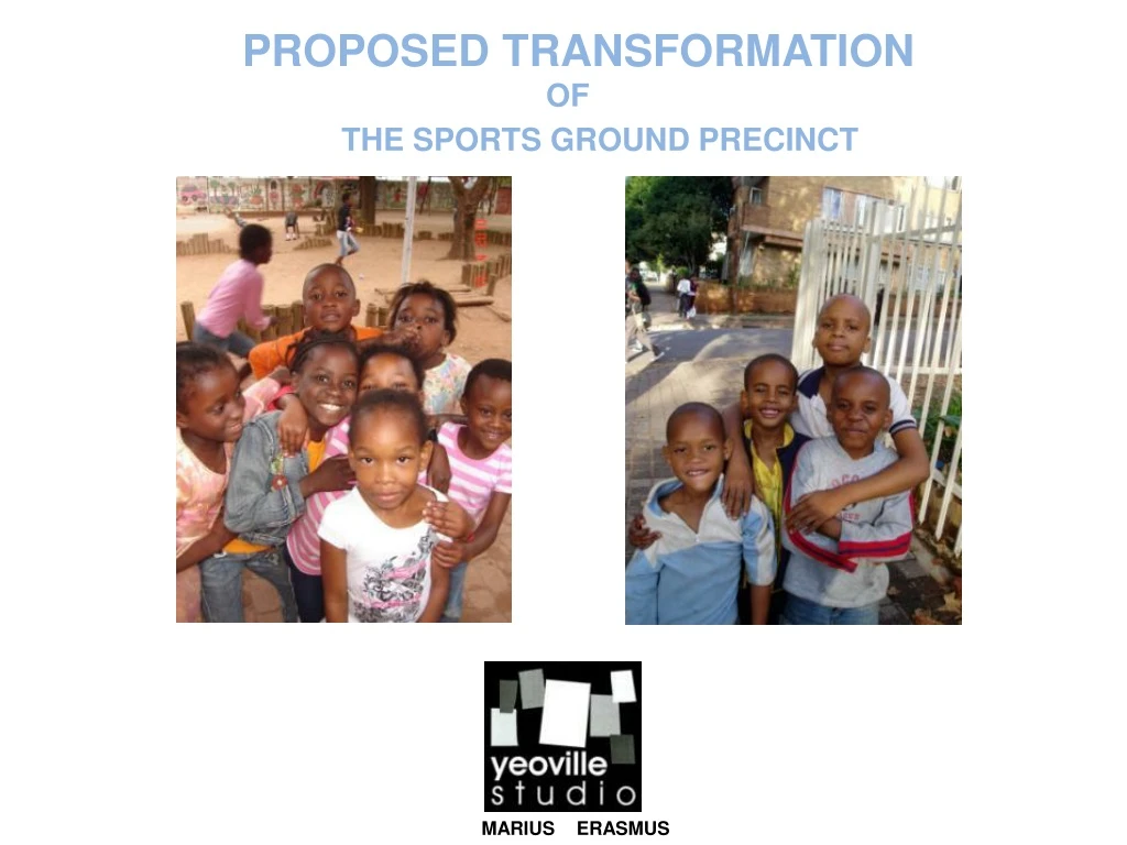
PROPOSED TRANSFORMATION. OF. THE SPORTS GROUND PRECINCT. MARIUS ERASMUS. SPORTS GROUND PRECINCT. www.yeoville.org.za. INTERVIEWS AND SOCIAL MAPPING : THE STAKEHOLDERS. SPORTS GROUND PRECINCT. INTERVIEWS AND SOCIAL MAPPING : THE STAKEHOLDERS. SPORTS GROUND PRECINCT. THE STAKEHOLDERS

E N D
PROPOSED TRANSFORMATION • OF • THE SPORTS GROUND PRECINCT • MARIUS ERASMUS
SPORTS GROUND PRECINCT www.yeoville.org.za • INTERVIEWS AND SOCIAL MAPPING : THE STAKEHOLDERS
SPORTS GROUND PRECINCT • INTERVIEWS AND SOCIAL MAPPING : THE STAKEHOLDERS
SPORTS GROUND PRECINCT • THE STAKEHOLDERS • Department of public works • Gauteng Department of Education • Yeoville Boys School • Yeoville Community School • Yeoville Sports ground Management Committee • The Catholic Church • The Yeoville Market • Yeoville community. • JRA • GABRIEL THE CARGUARD • INTERVIEWS AND SOCIAL MAPPING : THE STAKEHOLDERS
SPORTS GROUND PRECINCT • MEETING WITH YEOVILLE SPORTS GROUND MANAGEMENT COMMITTEE • The following items discussed in the meeting was very relevant to our first design ideas: • The sport grounds belong to the ‘’Department of Public Works’’. They don’t have to go through any channels to make discussions about the sports field and often make discussions without the knowledge of the ‘’Sports ground management committee’’. They made the decision to allow Telkom to use part of the sports field for the next 2-3 years until the damages interchange is re-built. • St. Johns school has offered to maintain the sports field as part of teaching their boys to reach out to less fortunate communities. • They discussed the possibility of creating a fan park on the sports field during the World Cup Soccer event, and they are looking at getting sponsors to provide a big screen and to help them control access. • They were looking at approaching the ‘’Telkom foundation’’ for help and funding in this regard. • The Father of the Catholic church is a member of the sports field management committee, and was interested to discuss the proposal for closing Muller road between the community school and the sports field. All present were concerned about the so called technocrats at local Jhb Council with regards to closing the road but felt there was president, as they closed Frances street in the 1960’s to allow the ‘’Yeoville Boys School’’ to be linked to its current sports field. • They also discussed the possibility of having a small soccer tournament on the sports field during Africa week that concludes on the 29th of May 2010. • The most urgent order of business was to set out and paint a full size soccer field. • The YSGMC was approached by the previous Principal of the Yeoville Community School, with a possible sponsor that wants to build a basketball facility on the grounds and manage it for a period of five years. It was decided to invite this possible sponsor to the next meeting. • The possibility of sinking a bore hole on the site was discussed to enable them to irrigate the field without cost. • INTERVIEWS AND SOCIAL MAPPING : THE STAKEHOLDERS
YEOVILLE LOCALITY • OVERALL MAPPING AND SITE SELECTION
YEOVILLE MAPPING PUBLIC AND PRIVATE REALM • OVERALL MAPPING AND SITE SELECTION
YEOVILLE MAPPING PHYSICAL ELEMENTS AND OPEN SPACES • OVERALL MAPPING AND SITE SELECTION
INITIAL STUDY AREAS ORIGINAL STUDY AREAS • OVERALL MAPPING AND SITE SELECTION
YEOVILLE MAPPING GATEWAYS • OVERALL MAPPING AND SITE SELECTION
YEOVILLE MAPPING PUBLIC AND PRIVATE REALM • OVERALL MAPPING AND SITE SELECTION
INITIAL STUDY AREA -FORTESQUE AND HUNTER STREET - INCLUDING YEOVILLE SQUARE • OVERALL MAPPING AND SITE SELECTION
FORTESQUE AND HUNTER STREET INCLUDING YEOVILLE SQUARE • SECTION THROUGH TAVERNA ON CRN HUNTER & FORTESQUE • SECTION THROUGH ARCADE AT SHOPS ON FORTESQUE ROAD PRIVATE AND PUBLIC REALM • SECTION THROUGH APARTMENTS ON • FORTESQUE ROAD • SECTION THROUGH FRONT YARD SPASA • SECTION THROUGH FRONT YARD MINI MARKET • MAP OF STUDY AREA • OVERALL MAPPING AND SITE SELECTION
FORTESQUE AND HUNTER STREET INCLUDING YEOVILLE SQUARE PRIVATE AND PUBLIC REALM • OVERALL MAPPING AND SITE SELECTION
FORTESQUE AND HUNTER STREET INCLUDING YEOVILLE SQUARE • INSTITUTIONAL BUILDINGS • CHURCHES, SCHOOLS, POLICE & CLINICS • BUILDINGS FOUR STOREYS AND HIGHER • RESIDENTIAL -1 HOUSES • OVERALL MAPPING AND SITE SELECTION
FORTESQUE AND HUNTER STREET INCLUDING YEOVILLE SQUARE • PUBLIC AND PRIVATE REALM • OVERALL MAPPING AND SITE SELECTION
FORTESQUE AND HUNTER STREET INCLUDING YEOVILLE SQUARE PRIVATE AND PUBLIC REALM • OVERALL MAPPING AND SITE SELECTION
FORTESQUE AND HUNTER STREET INCLUDING YEOVILLE SQUARE PRIVATE AND PUBLIC REALM • OVERALL MAPPING AND SITE SELECTION
SPORTS GROUND PRECINCT • FINAL SITE SELECTION
SPORTS GROUND PRECINCT • FINAL SITE SELECTION
SPORTS GROUND PRECINCT PRIVATE AND PUBLIC REALM • FINAL SITE SELECTION
SPORTS GROUND PRECINCT PRACTICAL SOLUTION • FINAL SITE SELECTION
SPORTS GROUND PRECINCT VISIONARY SOLUTION • FINAL SITE SELECTION
THE DESIGN • CROSS SECTION NORTH SOUTH THROUGH HUNTER STREET
THE DESIGN • CROSS SECTION EAST WEST THROUGH BEDFORD STREET
THE DESIGN • CROSS SECTION EAST WEST THROUGH CAVENDISH STREET
THE DESIGN SITE PLAN SPORTS GROUND PRECINCT
THE DESIGN TYPICAL CROSS SECTION ACROSS HUNTER STREET AT MARKET LINK
THE DESIGN CROSS SECTION EAST WEST ACROSS BEDFORD AND CAVENDISH
THE DESIGN LONG SECTION NORTH SOUTH ACROSS MULLER AND HUNTER STREET
HOW WILL THE DESIGN BE IMPLEMENTED ? • Consultation with the community. • Consultation with department of public works. • Will most likely not be successful, without the involvement of sports ground committee • Negotiation with local council will be required (JRA) • Negotiation with town planning department. • Traffic impact study to determine the effect of closing roads. PROPOSED PHASES OF PROJECT ? • Initially the sports ground will be used for Africa week to play a soccer tournament. • The field will have to be leveled and mowed. • Soccer field to be set out and lines painted. • Equipment to be sourced and bought….goals balls, line flags. • Secondly the sports ground will be used as a fan park during the world cup (it may not be called a fan park due to FIFA regulations.) • The sports ground management committee have indicated that they would like to strictly control access to the facility. • The fence around the grounds might have to remain. • Field to be set out professionally . • Change rooms and ablutions built for the soccer teams. • Muller street closed and re paved and landscaped. • Levels around field manipulated to create areas for fans to sit and stand during games. • Link between the Yeoville community school and the Sportsgoround created
CONCLUSION • Although green open spaces in an urban areas could add to the vitality of these areas, they could also become dangerous wastelands if not managed effectively. • Although a soccer field can create an opportunity to unify the community around a common interest it could to a certain extent exclude parts of the community. • It would therefore be better utilized as an open park area accessible to all, but managed by community who have an interest in the grounds. • This could be achieved by linking the open grounds to facilities around it, and designing it in such a way that it has activity for most of the day, to ensure community policing and ‘’eyes on the street’’