Download
1 / 7
90 likes | 556 Views
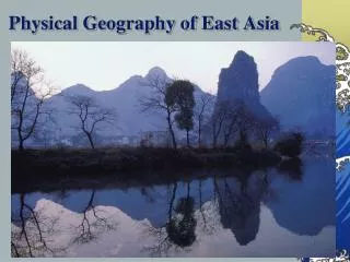
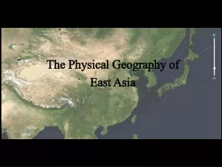
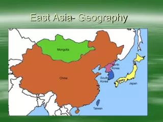
Chapter 26 : Physical Geography of East Asia. East Asia: the Land. Ring of Fire China makes up 80% of East Asia. Mongolia 13%. Japan, Taiwan, North and South Korea. Arc of islands that marks the meeting place of the Pacific, Philippine and Eurasian tectonic plates.

E N D
East Asia: the Land • Ring of Fire • China makes up 80% of East Asia. Mongolia 13%. Japan, Taiwan, North and South Korea. • Arc of islands that marks the meeting place of the Pacific, Philippine and Eurasian tectonic plates. • Japan has about 50 active volcanoes. 1,000 small earthquakes a year. • Peninsulas, Seas, and Islands • Korean Peninsula juts southeast out from China’s Northeast Plain., separating Sea of Japan from the Yellow Sea. • Tectonic activity is cause of many of the seas and islands. • Japan is 4 main islands and hundreds of smaller islands. • Honshu is central and largest. Hokkaido to north, and Kyushu and Shikoku to the south.
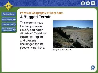
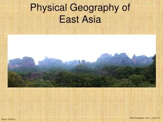
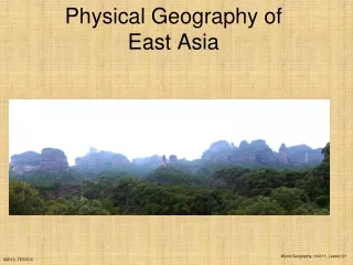
East Asia: The Land • Mountains, Highlands and Lowlands • Pamirs- area of high peaks and valleys. Mountain ranges fan out from here. • Kunlun Shan and Tian Shan. Altay Shan form boundary between Mongolia and China. • Kunlun Shan bends to become QinlingShandi. Changbai Shan of Manchuria extend into Korean to become Northern Mountains. • Mount Fuji- 12,388 ft. • Plateau of Tibet is highest plateau region. Average 15,000 ft. • Gobi desert- less than 3 inches of rain a year.
East Asia: The Land • China’s Rivers • Huang He (Yellow River) is major river system in China. Carries loess which gives it its color. • North China Plan a major wheat and soy bean farming area. • Chinas Sorrow- often floods its banks, killing hundreds of thousands of people. • Chang Jiang (Yangtze River)- longest river. 3,965 miles. Major transportation route. • Xi (West River)- southern China. Huge fertile delta. • China’s Grand Canal- longest artificial waterway. 1,085 mile route. • Rivers in Japan and Korea • Short and swift. Waterfalls. Hydroelectric power. Many diverted for irrigation.
East Asia: The Land • Natural Resources • Unevenly distributed. • China has greatest share and range of minerals- iron ore, tin, tungsten, and gold. • Oil deposits in South China Sea and Taklimakan. • Coal deposits in northeastern China. • Productive farmlands also uneven. Southern China’s rice bowl- two harvests a year. Leading producer of rice. • 25% of land suitable for farming in South Korea produces two crops a year. • Japan not good for farming. Taiwan and Mongolia are not good for farming either. • Japan, South Korea, Taiwan and China have world’s biggest deep sea fishing industries.
East Asia: Climate and Vegetation • Mid latitude • Humid continental- northeastern East Asia. Northern parts of Korea and Japan. • Southeastern part has a humid subtropical climate. • Bamboo is abundant in warm areas. • Desert and Steppe • Inland China and Mongolia. Gobi and Talkimakan are cold and windy. Gobi temps average 73°F in summer and 0°F in winter. • Highland • Changes with elevation. Plateau of Tibet average temps only hit 58°F.
East Asia: Climate and Vegetation • Tropical Wet Climates • Hainan- island. Very rainy summer and year round warm temperatures. Rain forests • Seasonal Weather Patterns • Interaction of prevailing winds and ocean currents. • Air mass above Asian continent meets air mass above Pacific Ocean in East Asia. Results in monsoons. • Summer winds are hot with lots of humidity off Pacific Ocean. April to October rains. Gets 80% of annual rain. November to March is cold, arctic air. • Rely on monsoon rains for their crops. • Ocean currents influence climate. Japan Current- warm water. Adds warm moisture to winter monsoon. • Kuril Current- harsh cold winters to Japan. • Warm humid air gives rise to typhoons.