Download
1 / 46
480 likes | 644 Views
The Weather Makers of the Mid-Latitudes. Air Masses. Fronts, and the Mid Latitude Cyclone. Air masses and their source regions that influence the weather of North America. An air mass is a body of air with similar moisture and temperatures. Air masses of N. America cP cT cA mP mT

E N D
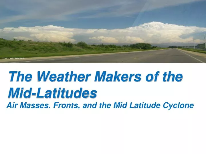
The Weather Makers of the Mid-Latitudes Air Masses. Fronts, and the Mid Latitude Cyclone
Air masses and their source regions that influence the weather of North America An air mass is a body of air with similar moisture and temperatures Air masses of N. America cPcTcAmPmT Continental Polar Continental Tropical Continental Arctic Marine Polar Marine Tropical
Air Mass Modification As a Continental Air mass moves across the great lakes, a Lake Effect Snow is created
Air Mass Modification After crossing several mountain ranges, cool moist mP air from off the Pacific Ocean descends the eastern side of the Rockies as modified, relatively dry Pacific air.This creates a rainshadow on the leeward side
Weather maps provide a “synoptic” view of the weather and the locations of air masses and frontal systems. 500mb Weather Map Surface Weather Map
A surface mapallows for analysis of currentweather variables, weather fronts, air masses, and radar imagery (in some cases)
Pressure Systems and Weather Mapping: Cyclones and Anticyclones
Locating Pressure Systems L From this pattern you should be able to determine the center of the low. The “L” (*) Notice the counterclockwise flow around the Low pressure. (*)
Front- the boundary between two air masses of different densities (temp and moisture dependant) Cold Front Warm Front Stationary Front Occluded Front Fronts are “typically’ associated with a Mid Latitude Cyclone but may be independent Frontal Boundaries
How Do You Locate Fronts on a Weather Map? • Sharp temperature changes • Changes in moisture content (by looking at dew point) • Shifts in wind direction • Pressure and/or Pressure changes • Clouds and precipitation patterns
A Special Front: The Dryline • A dry line is a boundary between warm, moist air and warm, dry air
Observe the conditions surrounding the OccludedLow Locating the Occluded Front
For a stationary front, temperature patterns are not only used but parallel winds are key identifiers! Locating the Stationary Front
Locating Fronts on a Weather Map L From this pattern you should be able to determine the center of the low. The “L” (*) Notice the counterclockwise flow around the Low pressure. (*)
L Locating Fronts on a Weather Map L The next step is to determine the position of the warm and cold fronts. (*)
Be sure and notice the changes in wind direction, temperatures, and cloud cover that these fronts separate. (*) Locating Fronts on a Weather Map L In front of the cold front the air is warmer and moving generally towards the north and northeast (south to southwest winds). See if you can see the leading edge of this warm air. This is the warm front. (Click to see the warm front.) (*) Notice the thunderstorms at ABL, OKC, and KNC. A line of thunderstorms is associated with an advancing cold front. Behind this front the air is colder and the winds are coming from the northwest. (*)
L The Wave Cyclone L cP mT Where is the warm air? Decide where the mT (maritime tropical) air is located. When you have made your decision, advance to the next image. (*) (*) Now decide where the cP (continental polar) air mass is located. (*)
L Locating Fronts on a Weather Map L cP mT To finish the concepts of the wave cyclone, you will make a forecast for the following cities: Springfield, MO; Oklahoma City, OK; Chicago, IL; and Buffalo, NY.
The idealized life cycle of a wave cyclone in the Northern Hemisphere based on the polar front theory. As the life cycle progresses, the system moves eastward in a dynamic fashion. The small arrow next to each L shows the direction of storm movement.
What type of weather do you observe along the cold front? What type of weather do you observe along the warm front?
An occluded front occurs when a faster moving cold front catches a slower moving warm front. Occluded Front
Stationary Front A Stationary front occurs when a cold air mass collides directly with a warm air mass and no low pressure center develops.
An idealized 3-D view of the formation of a mid-latitude cyclone during baroclinic instability. (a) A longwave trough at 500 mb lies parallel to and directly above the surface stationary front. (b) A shortwave (not shown) disturbs the flow aloft, initiating temperature advection (blue arrow, cold advection; red arrow, warm advection). The upper trough intensifies and provides the necessary vertical motions (as shown by vertical arrows) for the development of the surface wave cyclone. (c) As the surface storm moves northeastward, it occludes, and without upper-level diverging air to compensate for surface converging air, the cyclonic storm system dissipates.
L cP mT Forecast for Springfield, Missouri. (*) Think about the forecasts, then advance to the next image. (*) The Wave Cyclone Currently the conditions in Springfield, MO are clear with winds out of the southwest at 11 miles per hour. The temperature is 56oF. BUT, with the advancing cold front, Springfield can expect thunderstorms within a few hours, just as Kansas City, MO is experiencing. Following the thunderstorms, the weather will clear off, winds will shift and come in from the northwest and temperatures will cool into the high 30’s. (All this happens due to the advancing cP air.) (*)
L cP mT Oklahoma City, OK (*) The Wave Cyclone Oklahoma, OKC is currently experiencing a thunderstorm. These storms will end soon. Following the thunderstorms, the weather will clear off and temperatures will cool into the high 30’s. (All this happens due to the advancing cP air.) (*)
L cP mT Chicago, IL (*) The Wave Cyclone Chicago has partly cloudy skies with a temperature of 55oF and winds out of the southwest. This will change in the next few hours as the low pressure system moves in from the west. Clouds will be on the increase and rain is likely. The passage of the cold front will be followed by much cooler temperatures. Within 24 to 36 hours the temperatures will drop into the high 20’s. (*)
L cP mT Buffalo, NY (*) The Wave Cyclone Buffalo is experiencing scattered showers, completely overcast skies, with temperatures only in the high 30’s. But relief is on the way with the advancing warm front to the south. Skies will soon clear off, temperatures will be on the rise as winds shift and come in from the southwest. (*)
Tracking a Storm The 500mb Steering Rule states that a surface Low pressure systems will move at a pace ½ of the upper level wind speeds and travel parallel to the warm sector isobars . Example: If upper level winds are 70 knots, the surface low will move forward at 35 knots.
The Jet Stream Jet streams are relatively narrow bands of strong wind in the upper levels (stratosphere) of the atmosphere. Jet streams follow the boundaries between hot and cold air. Since these hot and cold air boundaries are most pronounced in winter. Jet streams are the strongest for both the northern and southern hemisphere winters.
Putting them Together: Relationships of the Surface and Upper Level (500mb) Upper level convergence and divergence play a large role in the strength of the pressure system.
The surface low-pressure area and fronts are shown for April 17, during an unseasonably hot spell in the eastern portion of the United States. Numbers to the east of the surface low (in red) are maximum temperatures recorded during the hot spell, while those to the west of the low (in blue) are minimums reached during the same time period. The heavy arrow is the average upper-level flow during the period. The faint L and H show average positions of the upper-level trough and ridge.
This Concludes the unit on Air Masses, Fronts, and the Mid Latitude Cyclone