Download
1 / 48
490 likes | 706 Views
Houston / Water. Urban Design Studio Tyler Gentry. RESEARCH. Houston, TX. Population: (2007) 2,208,180 – Metro: 5,628,101 4 th largest city in United States 6 th largest metro in U.S. Density: 3.828/sq. mile - Area: Harris, Fort Bend, and Montgomery Counties, Texas

E N D
Houston / Water Urban Design Studio Tyler Gentry
Houston, TX • Population: (2007) 2,208,180 – Metro: 5,628,101 • 4th largest city in United States • 6th largest metro in U.S. • Density: 3.828/sq. mile - • Area: Harris, Fort Bend, and Montgomery Counties, Texas • City: 601.7 sq. miles • Land: 579.4 sq. miles • Water: 22.3 sq. miles • Districts: Theater District, Museum District, • Climate: Humid subtropical • Mayor: Bill White
History of Buffalo BayouWinding through Houston’s patchwork of diverse landscapes is our very own muddy oasis, Buffalo Bayou. Houston’s rich history has been shaped by those who depended on her waters for their livelihoods, native Texans, foreign businessmen, travelers, soldiers, and seafarers who charted territory and staked their claim in the commercial goldmine that was and still is Houston.
Early SettlersFor centuries, before explorers descended on the Gulf of Mexico, native Indians, such as the Bidais and Akokisa, camped and traded along the lush banks of Buffalo Bayou and prowled its clear clay bottomed waters. The French and the Spanish maintained trade with these tribes, but did not establish settlements along the Bayou until the 1820’s. In the early 1800’s, the city of Harrisburg, located near today’s Ship Channel, was the focal point for shipping along the Gulf, but General Santa Anna burned it to the ground on his march to the Battle of San Jacinto.
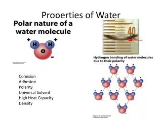
Bayou A bayou is a small, slow-moving stream or creek, or a lake or pool (bayou lake) that lies in an abandonedchannel of a stream. Bayous are usually located in relatively flat, low-lying areas, for example, in the Mississippi River delta region of the southern United States. A bayou is frequently a slack water anabranch or minor braid of a braided channel, that is moving with less velocity than the main stem. Many bayous are the home of crawfish, certain species of shrimp, other shellfish, and catfish. • Wikipedia.com
Flood Damage Reduction Projects The Harris County Flood Control District has a significant number of flood damage reduction projects occurring all over Harris County as part of its on-going Capital Improvement Program (CIP). This is in addition or even complementary to the more visible "Major Projects."
Houston Current Planning May 18, 2009 -- The City of Houston Department of Public Works & Engineering and the City of Houston Parks and Recreation Department are expanding our longstanding partnership with the Harris County Flood Control District to develop a comprehensive plan to construct additional regional detention ponds that will further reduce the risk of flooding in this region. This expanded partnership, supported by detailed regional and sub-regional detention studies, done by the City and the Flood Control District, will accelerate mitigation of possible storm water flooding in flood prone areas. In addition, a regional approach will also help address flooding problems outside of the regulatory floodplain. Mayor Bill White was joined by Harris County Flood Control Officials in making this announcement at one of the region’s newest detention ponds, the Meyer Basin project on Brays Bayou in southwest Houston, just inside Loop 610. Mayor White also announced that thanks to these and other measures, the City of Houston Community Rating in the National Flood Insurance Program, has been upgraded to a “Class 5” from “Class 6”, a move that will reduce rates that property owners pay for flood insurance. - http://www.houstontx.gov/mayor/press/20090518.html
Houston Current Planning • Keith Weiss Park in north Houston is another successful and even broader model for this regional approach which was implemented by the Houston Parks and Recreation Department and Harris County Flood Control District – over 900 acre feet of detention was created there. The facility provides additional benefits including: • Development of 112 acres of underutilized park space for recreation including trails, footbridges, a wetlands boardwalk, fishing pier and signage. • Preservation of existing old forest habitat along the bayou as well as construction of wetlands that improve water quality and habitat value for wildlife. • Reductions in significant flood levels along Halls Bayou (up to 0.8 feet during a 10% storm event). • The result of this more than $10 million effort is a City park that seamlessly takes features that reduce flood damage and integrates them with the land, the neighborhood and the environment. • - http://www.houstontx.gov/mayor/press/20090518.html
Harris County Current Planning Buffalo Bayou & Lower White Oak Bayou Federal Flood Damage Reduction and Ecosystem Restoration Study The Harris County Flood Control District is undertaking the Buffalo Bayou and Lower White Oak Bayou Federal Flood Damage Reduction and Ecosystem Restoration Study to identify ways to reduce damage due to flooding along Buffalo Bayou and lower White Oak Bayou and to explore opportunities to improve the natural environment along these bayous.The study area encompasses Buffalo Bayou from Barker Reservoir eastward through downtown Houston to the Houston Ship Channel Turning Basin, a distance of about 32 miles. Additionally, the study area extends along White Oak Bayou north and west from downtown Houston to Loop 610, a distance of about 7 miles. - http://www.hcfcd.org/buffalolowerwhiteoak/
Buffalobayou.org Master Plan Key Concerns: . Hydraulic destabilization . Poor water quality . Unremediatedbrownfields . Inadequate and inappropriate vegetated cover along Bayou banks, with invasive species displacing more ecologically valuable native species. . Competing demands of recreation and wildlife habitat . Urban heat-island related issues. Principles: . Moderating the time required for stormwater to reach the Bayou, and the quantity of stormwater put into the Bayou. . Modifying the Bayou size to accommodate anticipated stormwater quantities. . Addressing non-point sources of pollution throughout the watershed and at points of entry to the Bayou. . Addressing point sources of pollution along the Bayou. . Eliminating erosion along Bayou banks. . Improving water quality. . Providing habitat for migratory and resident species. . Increasing diversity of native plant species along the Bayou. . Creating habitats that are responsive to the urban hydrology of the Bayou.
Buffalobayou.org Master Plan Proposals: 1. Creating major and minor Green Fingers that apply passive techniques (such as treatment wetlands) to detain, filter and cleanse stormwater before it discharges into the Bayou, and to provide habitat, open space, and visual amenity. 2. Addressing bank erosion by reducing the factors that cause erosion, and by bioengineering in areas requiring extra protection. 3. Establishing a coordinated approach to reducing trash accumulation in the Bayou with educational programs, debris traps at inlets and a regular trash pickup. 4. Converting remediated brownfields to parks. 5. Promoting the use of low-impact development techniques, using a variety of small-scale techniques to reduce and purify stormwater at the site level. 6. Expanding wildlife habitat by expanding and creating habitat areas, including new marsh areas, and replacing invasive species with native plants. 7. Initiating priority demonstration projects to test long-term impacts on Bayou morphology. 8. Expanding rehabilitation efforts to the regional scale by initiating a Regional Eco- Park.
Potential Places of Study • Herman Brown Park • Memorial Park • Spotts Park • Cleveland Park • Clinton Dr. / 610 • Sabine Park • White Oak Park
Resources http://maps.bayoupreservation.org/watersheds/Default.aspx http://www.buffalobayou.org/history.html http://en.wikipedia.org/wiki/Houston,_Texas http://www.downtownhouston.com http://www.houstons-real-estate.com/images/southeast_houston_map_web.jpg http://upload.wikimedia.org/wikipedia/commons/4/45/Old_map-Houston-1873.jpg http://www.uwm.edu/Dept/ETI/integration/houston.htm http://www.met.tamu.edu/ciams/heat/related/yearly_plots.html http://www.houstonhistory.com http://www.houstonculture.org/resources/houstontime.html http://maps2.tsarp.org/tsarp/ http://www.tsarp.org/ http://www.archicentral.com/flood-houses-of-the-future-winners-announced-1260/ http://en.wikipedia.org/wiki/Bayou http://www.bayoupreservation.org http://www.buffalobayou.org/ http://www.houstontx.gov/mayor/press/20090518.html http://www.hcfcd.org/buffalolowerwhiteoak/ http://www.buffalobayou.org/pdf/BBMPreport8.PDF