Download
1 / 13
130 likes | 609 Views
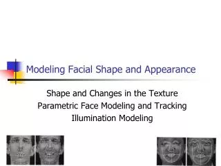
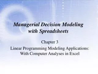
SeaWiFS Views The Galapagos: Islands in the Stream Gene Feldman/NASA GSFC, Laboratory for Hydrospheric Processes, SeaWiFS Project Office ( gene.c.feldman@nasa.gov )

E N D
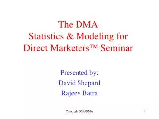
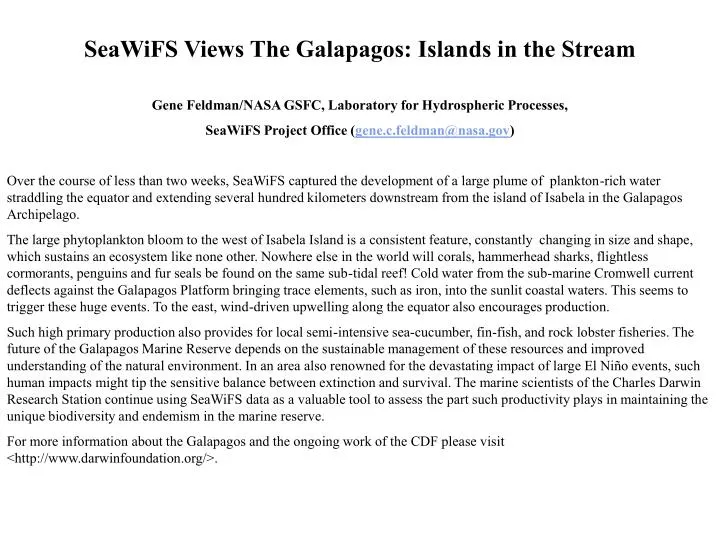
SeaWiFS Views The Galapagos: Islands in the Stream Gene Feldman/NASA GSFC, Laboratory for Hydrospheric Processes, SeaWiFS Project Office (gene.c.feldman@nasa.gov) Over the course of less than two weeks, SeaWiFS captured the development of a large plume of plankton-rich water straddling the equator and extending several hundred kilometers downstream from the island of Isabela in the Galapagos Archipelago. The large phytoplankton bloom to the west of Isabela Island is a consistent feature, constantly changing in size and shape, which sustains an ecosystem like none other. Nowhere else in the world will corals, hammerhead sharks, flightless cormorants, penguins and fur seals be found on the same sub-tidal reef! Cold water from the sub-marine Cromwell current deflects against the Galapagos Platform bringing trace elements, such as iron, into the sunlit coastal waters. This seems to trigger these huge events. To the east, wind-driven upwelling along the equator also encourages production. Such high primary production also provides for local semi-intensive sea-cucumber, fin-fish, and rock lobster fisheries. The future of the Galapagos Marine Reserve depends on the sustainable management of these resources and improved understanding of the natural environment. In an area also renowned for the devastating impact of large El Niño events, such human impacts might tip the sensitive balance between extinction and survival. The marine scientists of the Charles Darwin Research Station continue using SeaWiFS data as a valuable tool to assess the part such productivity plays in maintaining the unique biodiversity and endemism in the marine reserve. For more information about the Galapagos and the ongoing work of the CDF please visit <http://www.darwinfoundation.org/>.
SeaWiFS Views The Galapagos: Islands in the Stream
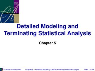
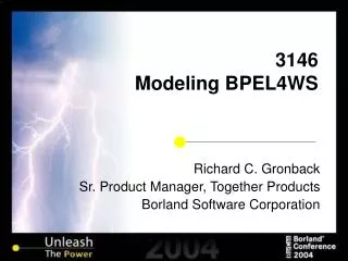
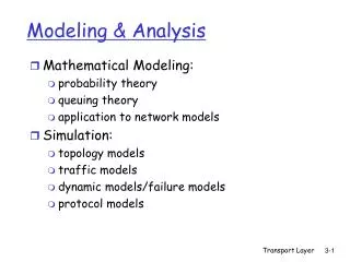
High Resolution Global Modelingwith the Land Information Systemhttp://lis.gsfc.nasa.gov Christa Peters-Lidard, Paul Houser/974 (christa.peters@nasa.gov) Sujay Kumar, Yudong Tian/974/GEST Jim Geiger, Susan Olden, Luther Lighty/580 Objective:A high performance, high resolution (1 km) global land modeling and assimilation system. Applications:Weather and climate model initialization and retrospective coupled modeling, Flood and water resources forecasting, Precision agriculture, Mobility assessment, etc. 1km MODIS LAI data
Key LIS Milestones Complete • Aug. 2002: Install LIS Cluster at GSFC • 200 nodes, 112 GB total memory, 22 TB total disk • Mar. 2003: First code improvement • Implement global LIS at 5 km resolution Future • Feb. 2004: Second code improvement • Implement global LIS at 1 km resolution • Jul. 2004: Interoperability demonstration • Implement ESMF-compliant version of CLM in Global LIS
LIS Performance and ScalingSimulation: one day, 15 minute time step a. Performance improvement on single CPU at ¼o resolution b. Scaling curves for NOAH & CLM at 5km resolution on O3K • solid lines depict LIS results on SGI O3K at NASA/ARC • hatched lines depict LIS goal of P/2 scaling 11.5 hr Time (seconds) < 2 hr Number of Processors, P
LIS ResultsLatent Heat Fluxes a. ¼o resolution b. 5km resolution 5 km resolution improvements over ¼o resolution • Coastline better resolved • - Important for Coastal Applications • Large step discontinuity due to DC urban area now smoother, more realistic • - Important for Mesoscale/Urban Applications
Status of Advanced Technology Microwave Sounder (ATMS) DevelopmentJames Shiue/NASA GSFC, Laboratory for Hydrospheric Processes, Microwave Sensors Branch (james.c.shiue@nasa.gov) • Kickoff in January 2001 –Contractor: (Aerojet) now—Northrop Grumman • System CDR held in May of 2002 • Additional ΔCDRs on MMIC RF front-end electronics (subcontractor: BAE): (a) K and Ka bands—March, 2003 (b) V & W bands—May, 2003 * NEΔT, calibration, etc., to meet requirements
500.00 CH. 22 100.00 CH. 20 CH. 3-15 CH. 18 10.00 Water Vapor CH. 1 Zenith Opacity (dB) 1.0 CH. 17 Oxygen .10 CH. 16 CH. 2 0.01 0 40 80 120 160 200 240 280 320 Frequency (GHz) Frequencies
Channel Parameters (Cont.) QV, QH : quasi-vertical, quasi-horizontal polarizations
Footprints (km) Chan Dx Dy 1, 2 323.1 141.8 3-16 136.7 60.0 17-22 68.4 30.0 Footprints (km) Chan Dx 1, 2 74.8 5.2o 3-16 31.6 2.2o 17-22 15.8 1.1o Beam width Scanning Characteristics • Cross-track (for CrIS coincidence) • Contiguous 1.1° cells • Contiguous coverage at equator (824 Km orbit, NPP) 105.45° 17.6 km Scan spacing 16.0 km Sample interval Swath = 2503 km Subsatellite track
AMSU-(A1+A2) +MHS: P~200 W, M~160 kg, Vol >1 m3 The ATMS Challenge AMSU-A1 AMSU-A2 • ATMS • 70 x 40 x 60 cm • 98 W (now ~155 w, including conting.) • 78 kg • 7 year life MHS
ATMS Instrument Nadir (z) Anti-sun (y) Velocity (x)