Download
1 / 31
310 likes | 448 Views
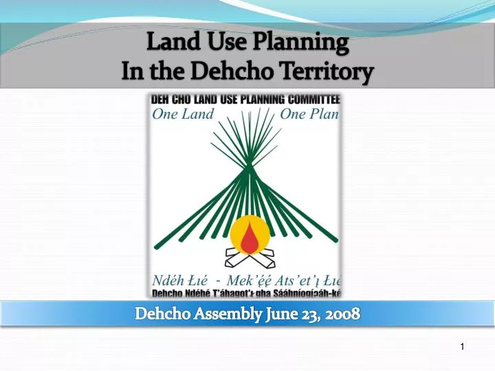
Land Use Planning In the Dehcho Territory. Dehcho Assembly June 23, 2008. 1. Dehcho Land Use Planning Committee. Mark Warren. Michael Nadli. Bob Overvold. Petr Cizek. Tim Lennie. 2. Planning Chronology. 3. Land Use Planning Chronology 2001-2007. 4.

E N D
Land Use Planning In the Dehcho Territory Dehcho Assembly June 23, 2008 1
Dehcho Land Use Planning Committee Mark Warren MichaelNadli Bob Overvold PetrCizek Tim Lennie
Map 2: Dehcho Revised Interim Land Use Plan - March, 2008 12
Definition of Conformity Requirements, Actions, and Recommendations
Federal Protected Area Initiatives Zones are separate federal initiatives for Candidate Protected Areas or National Parks with Interim Protection. • Conservation Zones are areas with significant ecological and cultural values. They provide adaptive protection to lands of important cultural or ecological value. Of the five types of land use controlled by zoning, only tourism, and with specific limitations, feeder pipelines are permitted in Conservation Zones, subject to the Interim Plan’s Conformity Requirements. Two of the zones prohibit tourism as well. • 3. Special Management Zones are areas where there is significant potential for both conservation and resource development together. Special Management Zones were established to promote certain types of land use or protect values while allowing some forms of land use to proceed. To achieve these goals, each Special Management Zone prohibits at least one of the five land use types addressed, while permitting others, subject to the Interim Plan’s other Conformity Requirements. The only Special Management Zone that permits non-renewable resource extraction is Jean Marie South Zone 28 which permits oil/gas. 15
Special Development Zones are areas where there is significant potential for both conservation and resource development. Special Development Zones permit both oil/gas and mining subject to zone-specific terms and conditions. In some Special Management Zones other land uses are also permitted. • General Use Zones permit all land uses, subject to the Interim Plan’s Conformity Requirements. • Special Infrastructure Corridors delineate two study corridors for proposed pipeline projects. The construction and operation of a pipeline is permitted within these corridors, subject to the Interim Plan’s Conformity Requirements, even where the corridors cross Zones where oil and gas operations are not permitted otherwise. All zone requirements and restrictions continue to apply in the corridors except where and to the extent that the Interim Plan states an exception. 16
Conformity Requirementsare legally-binding rules for how a land use is to be carried out. Will usually be implemented through “Policy Direction” from the Minister of DIAND to the Mackenzie Valley Land and Water Board. Apply only to land uses that require a land use permit, lease or other interest in land, water licence, commercial fishing licence, big game outfitter licence, or outfitter licence, or other authorizations.Existing land uses and traditional land use and occupancy are exempt from Conformity Requirements. • Actionsare measures directed at the Dehcho First Nations, GNWT or Canada that do not regulate land or water use (e.g. research, meetings) and are not legally binding. • Recommendations are statements which provide advisory guidance to Responsible Authorities, governments, and other organizations on additional measures that will help achieve the goals of the Plan; for clarity, they are not legally binding requirements, but where appropriate, should be given consideration in future land use decisions and policy initiatives. 17
Final Draft Plan, June 2006 5 Types of Zones: Conservation 38.3% Protected Areas 12.0% Special Management 28.9% General Use 20.8% Special InfrastructureCorridors [0.77%] Total 100% Current Revisions, March 2008 6 Types of Zones Conservation 24.2% Fed. Protected Areas 25.5% Special Management 3.9% Special Development 25.3% General Use 21.1% Special InfrastructureCorridors [0.77%] Total 100% The Special Infrastructure Corridor zones for the Mackenzie Gas Project and Netla-Arrowhead pipelines float over the other zones, but do not count in the total. Special Management Zones prohibit oil & gas and/or mining, but allow some other land uses. Special Development Zones allow oil & gas and mining, but prohibit some other land uses. 13
Conformity Requirements, Actions, Recommendations Final Draft June 2006 LUP: 25 Conformity Requirements 17 Actions 34 Recommendations March 2008 Draft LUP Revisions: –15 Conformity Requirements –4 Actions –20 Recommendations 14
Cumulative Effects Management CR#13 Regulators will consider an cumulative effects evaluation conducted by the Dehcho Land Use Planning Committee. Draft Changes: No change to previous version of CR#24. Cumulative Effects Research A#4 The Dehcho First Nation(s), Canada and the Government of the Northwest Territories in cooperation with the Committee, will create a Working Group in consultation with Regulatory Authorities, industry and other planning partners to carry out research about cumulative effects…(as listed in detail). Draft Changes: Grouping of A#13, A#14, A#15, A#16, and R#26 into A#4. Work still required on how best to deal with thresholds of disturbance.
Recommendations from Elders and Chiefs Forum (almost done) • Request by delegates: 2006 Map currently titled “Draft Land Use Map” to have statement added: “approved by the Dehcho First Nations (Kakisa Assembly 2006).” Agreed. • “Pay the Water Ceremony” should be added to R#2 (Respect Dene Values, Laws, and Principles). Agreed. • Dehcho Guides and Monitors are essential and should be included in the Plan. Under review. • “Slavey” will be changed to “Dene Zhatie.” Agreed with Slavey following in brackets. • R#11 – Mine Reclamation Planning and Security should be referred to the Main Table negotiators and form part of Dehcho Resource Management Act. Agreed.
Chiefs and Elders’ Forum (cont.) • “Give consideration/ to consider” should be changed into stronger wording (reference C#15 & R#18). Under review. • The Committee should check into the deleted CR/R/A’s, especially those that have socio-economic relevance, and refer them to the appropriate committees/organizations/corporations etc. The leadership will be asked for their advice as well. Agreed. • KFN requested a change in zoning. They would like “tourism” to be included into Zone 15 (Buffalo Lake and Trails). Agreed. • Add General recommendations about incorporating climate change issues in all land use decisions. Agreed. 9
Zoning Implications of Edehzhie/Nahanni; ADK confirmation If zone boundaries are adjusted through the Nahanni Park Expansion and Edéhzhíe PAS processes prior to Interim Plan review, any areas omitted from the approved protected area boundary will take on the Special Development Zone designation unless otherwise agreed to by the Parties. Any adjustment to the boundaries will trigger an automatic review of the Interim Plan and may result in further changes to their designation.
Mackenzie Pipeline Corridor CR#2 Mackenzie Valley Pipeline Establishes a “Special Infrastructure Corridor” based on the pipeline study corridor negotiated with Canada and Imperial Oil in the 2003 Interim Land Withdrawals, which avoids the most sensitive areas such as Trainor Lake, ponds and wetlands near JMR, Fort Simpson Mackenzie River Crossing, and north of Wrigley. Draft Changes: Still being negotiated. No agreement yet on this CR The DLUPC has not yet agreed on how to address amendments to the Interim Plan should the proposed Mackenzie Valley Pipeline be outside of the existing infrastructure corridor outlined in the Interim Plan.
Mackenzie Valley Pipeline Corridor (cont.) CR #2 Mackenzie Valley Pipeline Infrastructure (continued) Requires the applicant to locate pipeline infrastructure (barge landing sites, construction material stockpile sites, fuel storage sites, camps, supply roads, airstrips and helipads, and borrow sites) outside of Conservation Zones if reasonably feasible and to minimize impact. Draft Changes: Only minor change to wording. R#2 Mackenzie Valley Pipeline Encourages the applicant to consider and harmonize its activities with surrounding zones. Draft Changes: No Changes.
Renewal/Sunset Clause The DLUPC has not yet reached consensus on how best to address the renewable of the Interim Plan. Wording has been explored where the Interim Plan would cease after a defined period or continue on following a joint decision of the Parties.
Termination of Interim Plan • Consistent with the principle contained in the Dehcho Interim Measures Agreement, the DLUPC has been exploring language which would allow one or two of the Parties to terminate the Interim Plan. • For greater certainty, any Party [or two of the three Parties] may provide ninety (90) days written notice of its intention to terminate the Interim Plan provided that; • The Parties consult prior to the issuance of the written notification; and • The Parties consult prior to the notification date for termination. • Prior to a decision to terminate the Interim Plan, the Parties are encouraged to employ the Dispute Resolution Process.
Consultation with other stakeholders by Parties (e.g. Overlapping Aboriginal governments) Purpose of consultation – Different kinds of consultation? Who to consult? When to consult? Use of consultation feedback?
Interrelationship of IMA with Interim Plan • Regulatory Context of the Interim Plan • Legislative Context • The Interim Plan is based on the mandate provided in the Dehcho First Nations Interim Measures Agreement and Pipeline Settlement Agreement and will be implemented by means of authorities exercised under existing legislation. • The Interim Plan is intended to provide guidance on significant land use issues but is not intended to conflict with pertinent legislation, regulations or agreements of government. For greater certainty, in the event of such a conflict, the legislation, regulations or agreements of government will prevail to the extent of the conflict. • Any Conformity Requirement of the Interim Plan that addresses a land use governed by an IMA requirement or existing legislation adds to rather than taking away from the existing requirement.