Download
1 / 81
850 likes | 1.09k Views
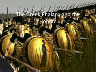
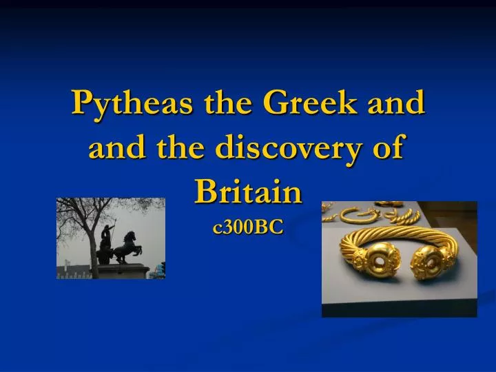
Pytheas the Greek and and the discovery of Britain. c300BC. Britain in the Iron Age 600BC-60AD. Part One : Descriptions by Classical Authors. FIRST CENTURY BC ARISTOCTATIC BRITISH CELTS. TORQUE. Pytheas the Greek.

E N D
Britain in the Iron Age 600BC-60AD Part One: Descriptions by Classical Authors.
FIRST CENTURY BC ARISTOCTATIC BRITISH CELTS TORQUE
Pytheas the Greek • The earliest comprehensive description of the British Isles to survive from the classical authors is by Diodorus Siculus 1st century BC. • He uses the word Pretannia which is probably the earliest Greek for of the word for Britain. Strabo used the same except sometimes he adopts the b instead of the p. • It is likely that DS used a text by Pytheas and he would have been the first to transcribe the local word for the islands (Pretannike) and the word the inhabitants used for themselves (Pretani, Priteni).
Trade routes between ‘Gaul” and ‘Britain’ between c500-200BC
The probable route taken by Pytheas 310BC Note the placenames
Pytheas the Greek • In standard Latin the form with b (Britannia) became common, but in the Celtic language of Britain (which became Welsh, Cornish and Breton), the form with ‘p’ persisted (Prydain). • So when Pytheas landed on the peninsula of Belerion (Cornwall), he would have learned that the island was called Albion, and that the people called themselves Pretani (painted ones).
Pytheas the Greek • Pytheas made a remarkable journey north around the British Isles some time before 320BC. On his return he wrote an account called On the Ocean of which nothing survives, but his observations are reported by no less than eighteen ancient writers all crediting Pytheas by name.
Pytheas the Greek • Some writers were dismissive (Polybius and Strabo) but others such as Pliny the Elder were more positive. • His journey can be traced in some detail. • It is assumed he went from Marseilles (Massalia), he sailed around Spain to the Bay of Biscay and then north to Britain. But it has also been suggested that he went overland to the Gironde and then boarded ship.
Pytheas the Greek • He is reported to have sailed to Uxisame, and then to Kabion and from there to the Pretannic isles (Pretannike). He calls the promontory where he landed Belerion. He mentions two other promontories Kantion and Orkas. • In passing he noted Ireland. He gives distances (circumnavigation). He probably made his journey in local vessels. • He may have ventured much further even as far as Iceland, but more likely he gives descriptions that were known to British seafarers, suggesting that Celtic Britons had reach as far as Iceland (at that time unpopulated).
Pytheas the Greek • The three writers after Pytheas who described Celtic Britain were • Diodorus Siculus • Strabo • C.Julius Caesar
Pytheas the Greek • Diodorus wrote in some detail. According to Barry Cunliffe (The Extraordinary Voyage of Pytheas the Greek), Diodorus would have based his description largely on the (now lost) work of Pytheas. Diodorus wrote in the 1st century BC after Caesar’s two landings there. • Since Diodorus is not likely to have ventured to a part of Europe still outside the control of Rome, his account can be said to reflect the work of another.
Diodorus’ Description of Britain • He gives initially very exact measurements concerning the distance from the mainland, and it is here that we are given several placenames which must have occurred in Pytheas’ text: • Belerion • Kantion • Iktis • Orka
Diodorus’ Description of Britain • Diodorus tells us that Britain (Bretannike) is inhabited by tribes which are auchthonous and preserve in their ways of living the ancient manner of life. • They use chariots, their dwellings are humble (reeds and logs). • Their method of harvesting; bread –making • A simple life-style; large population; cold climate.
Diodorus’ Description of Britain • Diodorus also states that the island is controlled by numerous ‘kings’ and warlords (dynastes), but they largely live at peace with each other. • Tin is an important export. The area around Belerion (Land’s End) is very hospitable since they are used to consorting with traders from abroad. • The description of tin-mining. The tin is exported on horseback from the island of Iktis (Mount’s Bay in Cornwall) to Galatia or Gaul, and from there to the mouth of the river Rhone (Massalia and Narbo).
Strabo and Pliny • Both Strabo and Pliny (the Elder) claim to have used the work of Pytheas for their descriptions of Britain. All three authors (Diodorus) included) give similar dimensions for Britain and the distances from Gaul implying they all used one source- Pytheas. • Strabo is often dismissive of Pytheas (especially with regard to distances).
Strabo on Britain • Like Diodorus and presumably Pytheas, Strabo starts his account by stating that Britain is triangular in shape. He mentions Kantion (today’s Kent) and calls it the most easterly point in Britain. • He describes the various approaches to Britain (ie from which ports- he is writing after Caesar’s landings)-
Strabo’s description of Britain • Strabo’s description of the land: • Most of the island is flat and overgrown with forests (some districts are hilly) • The Britons produce grain, cattle, gold, silver and iron. They export hides and slaves, and hunting dogs. • The Britons are taller than the Keltoi, not so yellow-haired. • Their habits are similar to that of the Keltoi, but more simple and barbaric. (barbarutera)
Strabo’s description of Britain • They have much milk, but do not make cheese. Apparently not experienced in agriculture. • They use chariots like the Keltoi. • They live in forested areas. • More rain than snow. Much fog. • Inhabitants called Brettann/oi
Caesar’s description 55 and 54BC • Cesar’s description of chariot-warfare amongst the Britons • Second landing (pursues Cassivellaunus). Gives more detailed description of the land and the people (south eastern Britain). • His description may well depend partly on Pytheas (not mentioned in his text):
Caesar’s description 55 and 54BC • Britain is inhabited by tribes who declare themselves to be indigenous to the island (the maritime area inhabited by Belgic tribes from Gaul). • Large population; farm-buildings close to each other (like the Galli=Gauls). Much cattle. • They use bronze or gold coins, or iron ingots. • Tin and iron is produced in ‘midland areas’. • There is a taboo against eating hare, fowl and geese.
Caesar’s description 55 and 54BC • ‘the natural shape of the island is triangular, and one side lies opposite Gaul’. • He mentions Cantium (Kent, Gr: Kantion) • Also mentions Ireland, ‘smaller by one half than Britain’. • Also mentions the island of Man (Isle of Man), possibly also influence of Pytheas’ writings. He mentions the long nights in the north which only someone such as Pytheas could have known.
Caesar’s description 55 and 54BC • Caesar saw that the people of Cantium (Kantiaki) were the most similar to the Gauls. • Of the inlanders, the emphasis, he claims, is on cattle, since they do not sow. They live on milk and meat. • Woad. They have long hair. Their non-mediterranean domestic arrangements.
The Geography of Ptolemy • Claudius Ptolemaeus was a celebrated geographer and astronomer who lived in the second century AD. • He was a Greek by descent and a native of Alexandria in Egypt. • He invented the Ptolemaic System, an earth-centred view of the workings of the universe, which remained unchallenged until the time of Copernicus whose Solar System was published in 1543.
The Geography of Ptolemy • His most remarkable publication was perhaps his Geography, a work of seven volumes which also became a standard work until the 15th century. • In the opening chapters of the second book of the Geography we find information about the British Isles, chapter two is called Albion island of Britannia. • He gives lists of prominent coastal landmarks, estuaries, as well as the names of the British tribes and their principal towns. • Probably his information reflects the situation during the 1st century AD.
Britain in the Iron Age Part Two: Archaeology
Tribal groupings • When the Romans invaded Britain in 43AD they found a country divided into a number of tribal groupings. • Some of them they adopted as the basis of their own administrative systems. • Many of the tribes to the south would have been socially cohesive, but in the north it is far more likely that the names recorded were those of powerful lineages to whom the scattered population owed some allegiance.
Tribal groupings • http://www.roman-britain.org/tribes.htm • http://en.wikipedia.org/wiki/List_of_Celtic_tribes#Great_Britain • http://www.celtnet.org.uk/brythonic-tribes.html • http://www.gallica.co.uk/celts/tribe-map.htm
Tribal groupings • The tribes of the south-east were minting distinctive coins by the middle of the first century BC (c50BC) which indicates some degree of socio-economic unity. • But how far can ‘tribal groupingd’ be traced in the archaeological record? • One way to approach the question is by considering the distribution patterns of distinctive pottery styles, assuming that pottery decoration reflects ethnic division (ethnos= a tribe, a people).
Tribal groupings • It can be suggested that some of the zones favouring particular styles of pottery decoration, which are distinguishable as early as the 6th-5th century BC retained a separate identity throughout the Iron Age, emerging later in the Roman invasion period as larger tribal units.
Tribal groupings • The region where the pottery styles are clearest –central southern Britain-is the very area where settlement pattern evidence suggests the development of a complex social system based on territorial units dominated by developed hillforts. (Atrebates, Catuvellauni, Dobunni, Coritani).
Tribal groupings • The sheer density of population in that area led to the creation of a regional coherence early in the Iron Age, and eventually to the emergence of distinct tribes or confederations. • (The White Horse of Uffington, Berkshire). • Another area of such cohesion was in the Yorkshire Wolds that gave the so-called Arras Culture, dominated by the Parisi tribe. From 5th century BC.
Tribal groupings • In other areas of the west and north, where the settlement pattern is more dispersed and the social unit was the extended family (or clan), a network of relationships would have developed by intermarriage, that created patchworks of social interdependence. • Regional identities may well have evolved:
Tribal groupings • The groupings found in Devon and Cornwall may have recognized their difference from those in the east, and thought of themselves as people of Dumnonia (Dyfnaint, Downans, Devon).
Major changes in the early 1st century BC • The most important change that took place during this period was the gradual move from hillforts (the centres oif tribal groupings, large and small) to oppida, often called territorial oppidathat extended over a large area, close to river crossing. • Such was their importance that the Romans later took several over as regional centres, and eventually medieval towns would be build on these sites.
THE EXTENSION OF THE OPPIDA in S. Britain. • Influence from northern Gaul. • The beginnings of ‘urbanisation’ in Cetic Britain. • Greater interdependance of the SE and central tribal groups. Beginnings of a ‘state’. • THIS WAS THE WORLD THE Romans found in c50BC.
Hallstatt and La Tène in Britain • From the fifth to the second century contacts between Britain and the adjacent parts of the Continent were maintained.. • Metalwork in the new La Tène style which developed in Europe towards the beginning of the fifth century BC found its way into Britain largely through exchange networks.
Hallstatt and La Tène in Britain • Many of the incoming types were rapidly copied by local craftsmen, giving rise to distinctive British varieties. • The Yorkshire area (Arras Culture) seems to have seen a more extensive cultural assemblage introduced, not only metal types but even a different burial rite (inhumation rather than the usual cremation).
Hallstatt and La Tène in Britain • The 6th century production of a distinctive series of daggers and dagger sheaths in the Thames reflect the Hallstatt D of Europe. • Production of such improved prototypes continued through the 5th and 4th centuries, and absorbing after about 450BC the La Tène innovations from the Continent.
Hallstatt and La Tène in Britain • La Tène-style (1) swords start to appear on the rivers Thames and Witham (Lincolnshire), a few are imports. Yet, many swords in Britain seem to follow indigenous styles and may suggest a decline in trade between Britain and the continent beyond the SE.