Download
1 / 38
400 likes | 662 Views
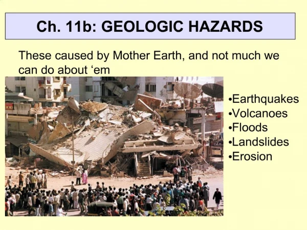
Geologic Hazards of Idaho. Bill Phillips Idaho Geological Survey Presentation for Prepared Idaho 2007 September 13, 2007. Natural Hazards. Flooding Urban/Wildland Interface Fires Earthquakes Landslides Snow Avalanches Drought Lightening Severe Storms Volcanic Eruptions

E N D
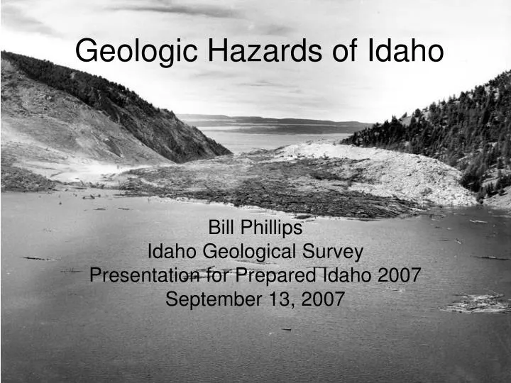
Geologic Hazards of Idaho Bill Phillips Idaho Geological Survey Presentation for Prepared Idaho 2007 September 13, 2007
Natural Hazards • Flooding • Urban/Wildland Interface Fires • Earthquakes • Landslides • Snow Avalanches • Drought • Lightening • Severe Storms • Volcanic Eruptions • Wind/Tornadoes Source: 2004 Idaho State Hazard Mitigation Plan
Natural Hazards • Flooding • Urban/Wildland Interface Fires • Earthquakes • Landslides • Snow Avalanches • Drought • Lightening • Severe Storms • Volcanic Eruptions • Wind/Tornadoes “Geologic Hazards” Source: 2004 Idaho State Hazard Mitigation Plan
Natural Hazards • Flooding • Urban/Wildland Interface Fires • Earthquakes • Landslides • Snow Avalanches • Drought • Lightening • Severe Storms • Volcanic Eruptions • Wind/Tornadoes “Geologic Hazards” Source: 2004 Idaho State Hazard Mitigation Plan
Hazard or Risk? • Hazard: “a source of danger.” • Risk: “the chance of loss to the subject matter of an insurance contract; also, the probability of such loss.” Source: Websters New Collegiate Dictionary “Risk = Hazard x (People + Property)” This talk is about Hazards
Regional Local Frequency of Idaho Geologic Hazards Earthquake – large event every 15 years (?) Volcanic Eruption – infrequent (but remember May 18, 1980?) Landslides – almost every year Source: 2004 Idaho State Hazard Mitigation Plan Magnitude Frequency Effects Big Rare Volcanoes Earthquakes Landslides Small Common
Earthquakes • What causes them? • Where are they found in Idaho? • What are earthquake effects? • Where is the hazard highest? Effects of 1959 Hebgen Lake Earthquake (Montana-Idaho border)
Generation of Earthquakes • Stress: applied force (N/m2) • Strain: permanent deformation (%) • Rock strength • Brittle Failure • Elastic Limit brittle failure Strain elastic limit Stress The “earthquake cycle” image from http://www.seismo.unr.edu/ftp/pub/louie/class/100/seismic-waves.html
Crust Depth for Idaho quakes ~16 km or less (Hypocenter)
Types of Faults Applied Stress shear Most Idaho “active” faults are Normal Faults extensional compressional http://earthquake.usgs.gov/4kids/image_glossary/fault.html
Idaho’s active faults are NORMAL FAULTS Fault scarp, Borah Peak, Idaho Earthquake (October 1983)
Most (but not all!) large Idaho earthquakes occurred on Basin and Range Normal Faults in the Intermountain Seismic Zone
Pacific Northwest Earthquakes (not Basin and Range features) Historical Earthquakes in the Intermountain West (source: http://earthquake.usgs.gov/regional/imw/images/figure2.php
Large Historical Earthquakes Have Occurred in the Intermountain Seismic Zone Source: http://www.seis.utah.edu/NEHRP_HTM/perseq.htm
Faults and earthquakes also occur in western Idaho. In fact, earthquakes can occur ANYWHERE in Idaho.
Effects of Earthquakes • Intersection by fault (uncommon) • Structural Damage by shaking (common) • Distant events can cause damage • Landslides • Un-Reinforced Masonry (URM) • Liquefaction • Seiches • Bridges, Dams, Power Lines, Communication Facilities, Nuclear Reactors, Gas Lines (Fires) • Nonstructural Damage (very common)
M 6.5 San Simeon Earthquake, 12/22/03. Non-structural damage to Paso Robles area wineries. / IMG_2980 Photos by Joshua Marrow, Simpson Gumpertz Heger
Hazard maps produced by USGS show probability of peak ground acceleration Download these maps (for FREE) at: http://earthquake.usgs.gov/research/hazmaps/
Google Earth maps showing position of Idaho faults can be seen at www.idahogeology.org
Summary-Earthquakes • Numerous quakes every year in Idaho • Few are damaging but LARGEST historical events in USA outside of Alaska occurred in/near Idaho • Hazard is highest in SE Idaho along Montana-Wyoming-Idaho-Utah borders • Risk (in terms of property loss and economic disruption) may be greatest in metro Boise area.
Volcanic Eruptions Mt St Helens ash in Elmira, Idaho (http://gesswhoto.com/idaho/ells-helens.html)
Landslides Hebgen Lake, Montana, Earthquake August 1959. (Photo: I.J. Witikin, USGS Photographic Library)
Causes of Landslides:Forces acting on a slope N S W t a W: weight of material N: normal force acting perpendicular to slope t: shear force acting parallel to slope S: shear strength (resistance to shear) a: slope angle
Factor of Safety • Factor of Safety (FS) • ratio of resisting forces (S) and driving forces () • FS = S / • When > S, slope is unstable, FS < 1 • When S < , slope is stable, FS < 1 • If FS close to 1, then slope is posed for failure
Classification of Mass Wasting Slurries, mudflows, debris flows (closely associated with flood hazards) Images from: http://www.tulane.edu/~sanelson/geol204/masswastproc
Causes of Landslides • Increase pore pressure by adding water to slope • heavy/high intensity precipitation • blocked culverts • Increase slope angle by excavation/undercutting • Loading of slope • road construction • Seismic shaking/liquefaction • Fires Bluegill (Little Salmon) Slide near Bliss Highway 95 near Bonners Ferry
Detail of Surficial Geologic Map of the Sweetwater Quadrangle, Nez Perce County, Idaho , by Kurt L.Othberg, Roy M.Breckenridge, Daniel W.Weisz: Idaho Geological Survey DWM-13, 2003. Hazard Identification: Mapping, Inventory, and Analysis of Landslides Geological maps locate existing landslides and identify conditions that predispose hillslopes to failure.
Basalt Sedimentary interbed Snake River Canyon near Waha, Idaho
Lost River Fault Scarp Prehistoric (co-seismic?) landslide near Mackay
Earthquake-induced landslides; A, B, D 1959 Hebgen; C 1983 Borah Peak A B C D
ROCKSLIDE IN WASHINTON STATE, USA: The North Cascades Highway was seriously damaged by the record-breaking October 2003 rainstorm. Flooding eroded the roadway, overwhelmed culvert and drainage systems and caused several large sections of road to buckle and collapse. Within three weeks of the flooding, a massive rockslide crashed into the highway, in the same general area. That slide and its twin slide that came down days later, were so large that they registered on the earthquake monitoring seismic scale in Rockport, for the North Cascades.
Debris flow on Middle Fork Salmon River, July 2002 (Wayne Wurtsbaugh photo) Log jam at Pistol Creek on Middle Fork Salmon, July 2007 Landslides in wilderness areas May affect recreational activities.
Mitigation of Landslide Hazards • Geomorphic and Geologic Mapping • “if slope has failed before, it will fail again” • Terrain Analysis • need slopes >20 degrees • Engineering Studies • can establish Factor of Safety • Logging Practices • Removal of culverts and roads • Public Education, Zoning, Land Use • keep people from living on unsafe slopes
Summary: Landslides • Very common • Linked to: • heavy/intense precipitation • earthquakes • fires • logging roads/logging practices • High hazard in steep canyons of central and western Idaho, north Idaho • Transportation network • Highway 95 and 55 have high landslide risk • Residences Lightning Creek, near Clark Fork, Idaho November 2006 17 inches rain/snow in 1 week ~$3 million damage to forest road network
Idaho Natural Hazards Highest Earthquake Hazard SE Idaho (except Snake River Plain) Highest Earthquake Risk may be metro Boise area (lots more people + property) Volcanic Eruptions N Idaho—Ash from Cascade Volcanoes Snake River Plain—Basalt lava flows Yellowstone— Supervolcano! Landslides Mountainous areas, esp. roads and bridges Highways 95 and 55 Canyons of central and western Idaho Snake River Plain – canyon edges Debris flows – Boise Front Range Post-wildfire effects Logging practices