Download
1 / 33
330 likes | 416 Views
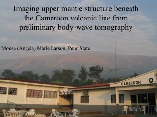
Imaging the 410 and 660km discontinuities beneath the Transantarctic Mountains and the East Antarctic Craton using Receiver Functions. Mouse Marie Larson CIDER program July 2006. Talk outline. What? How? Results? Weird Results?!? What does it mean?.

E N D
Imaging the 410 and 660km discontinuities beneath the Transantarctic Mountains and the East Antarctic Craton using Receiver Functions Mouse Marie Larson CIDER program July 2006
Talk outline What? How? Results? Weird Results?!? What does it mean?
This study will use receiver functions to place depth constraints on any thermal anomaly beneath the TAMs Two main questions are addressed here: 1. Can receiver functions be used in Antarctica, or do the ice sheets mask arrivals from the 410 and 660 km discontinuities? 2. Is there evidence for thinning of the transition zone between the 410 and 660? http://home.freeuk.com/gtlloyd/tam/main.htm
East and West Antarctica are geologically distinct http://home.freeuk.com/gtlloyd/tam/main.htm
Many different mechanisms have been proposed for creating the tectonic features of Antarctica Mantle plume Localized thermal anomaly http://mitglied.lycos.de/mapu2001/dryvalleys.html
Previous studies show a negative anomaly beneath the Ross Sea at 300 km Watson 2005 Seiminski et al 2003
Clapeyron Slopes Phase transformation at ~ 410 km Phase transformation at ~660 km Bina and Helffrich, 1994
The thermal anomalies affect the depth of the major phase transformations
TAMSEIS The Transantarctic Mountains Seismic Experiment (2000 - 2003) included 41 portable broadband seismometers http://epsc.wustl.edu/admin/whatsnew/tamseis/
Three arrays: Coastal array North array East array http://epsc.wustl.edu/admin/whatsnew/tamseis/
Receiver functions generated using Ammon’s water level-deconvolution code and stacked using Owen’s stacking codes. http://eqseis.geosc.psu.edu/~cammon/HTML/RftnDocs/rftn01.html http://epsc.wustl.edu/admin/whatsnew/tamseis/
Maps of the points show the lateral extent of the ray sampling from teleseismic events 410 km cross-sectional slice 660 km cross-sectional slice
A B C D E ‘410’ C E A ‘660’ D B EAC Ross I.
Preliminary(?) Results: The ice layer is not causing the double peak but what is? AND The average transition zone thickness is greater than 250 km (the global average) -- currently no evidence for a plume or thermal anomaly in the transition zone http://home.freeuk.com/gtlloyd/tam/main.htm
Geographical binning reduces bias based on azimuth latitude longitude
Each bin table is populated by the names of station/event pairs for which the wave passed through that node as well as the time that this occurs Station1-eventA Station1-eventG Station3-eventA, etc Node size 1° by 2° A t t*