Download
1 / 7

E N D
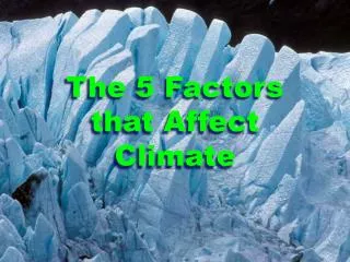
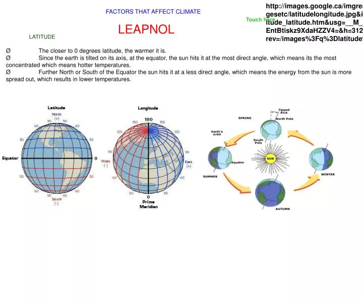
http://images.google.ca/imgres?imgurl=http://www.geographyalltheway.com/ks3_geography/maps_atlases/imagesetc/latitudelongitude.jpg&imgrefurl=http://www.geographyalltheway.com/ks3_geography/maps_atlases/longitude_latitude.htm&usg=__M_Lt26vX-EntBtiskz9XdaHZZV4=&h=312&w=572&sz=47&hl=en&start=2&tbnid=BlqDfbHJqSWcyM:&tbnh=73&tbnw=134&prev=/images%3Fq%3Dlatitude%26gbv%3D2%26hl%3Den%26sa%3DGhttp://images.google.ca/imgres?imgurl=http://www.geographyalltheway.com/ks3_geography/maps_atlases/imagesetc/latitudelongitude.jpg&imgrefurl=http://www.geographyalltheway.com/ks3_geography/maps_atlases/longitude_latitude.htm&usg=__M_Lt26vX-EntBtiskz9XdaHZZV4=&h=312&w=572&sz=47&hl=en&start=2&tbnid=BlqDfbHJqSWcyM:&tbnh=73&tbnw=134&prev=/images%3Fq%3Dlatitude%26gbv%3D2%26hl%3Den%26sa%3DG FACTORS THAT AFFECT CLIMATE Touch here LEAPNOL LATITUDE Ø The closer to 0 degrees latitude, the warmer it is. ØSince the earth is tilted on its axis, at the equator, the sun hits it at the most direct angle, which means its the most concentrated which means hotter temperatures. ØFurther North or South of the Equator the sun hits it at a less direct angle, which means the energy from the sun is more spread out, which results in lower temperatures.
ELEVATION Ø The higher up you are, the colder and dryer it will be. Ø When air rises it expands due to low air pressure which causes it to cool. Ø 100 metres = -1 degree celsius
Air Masses Prevailing Winds Ø Wind and Air Masses move west to east ØWarm wind increase temperature ØCold wind decrease temperature
Near WATER Ø Water heats up and cools down slower than land does. ØOn colder days, the water heats up the land, whereas on hotter days, the land is cooled down by the water. Ø These areas also experience more precipitation. Vancouver, BC Halifax, NS
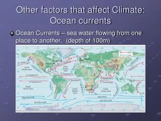
OCEAN CURRENTS Ø They have different temperatures. Ø Warm ocean currents warm the air above it, which warms the coast. Ø Cold ocean currents cool the air above it, which cools the coast.
Landforms and Relief Precipitation Ø The differences in the elevation in land. Ø As air is forced to rise over a piece of land (eg mountain) the temperature decreases and condensation increases, thus creating precipiation. Ø Once the air mass goes over the mountain the temperature and evaporation increases but condensations decreases, resulting in a hault in precipitation and a rain shadow.