Download
1 / 27
270 likes | 400 Views
The Next Edition of the Manual of Surveying Instructions and the Modern Cadastre. Presented by: John Sroufe, Chief Cadastral Surveyor BLM Alaska State Office, Anchorage, AK. Bob Dahl, Cadastral Surveyor BLM Lands and Realty Group, Washington, D.C.

E N D
The Next Edition of theManual of Surveying Instructionsand the Modern Cadastre Presented by: John Sroufe, Chief Cadastral Surveyor BLM Alaska State Office, Anchorage, AK. Bob Dahl, Cadastral Surveyor BLM Lands and Realty Group, Washington, D.C. 40th Annual Alaska Surveying and Mapping Conference Anchorage, AK February 15, 2006
Agenda • Cadastre – Cadastral – Cadastral Survey • What is the Manual of Surveying Instructions? • Why is the Manual relevant to the Surveyor in Alaska?
Agenda • Scope of the project • – Technical project nested in a web of administration • What is the process? • How are we going about it? • Where are we to date?
OHA → ↑ IBLA IBIA IBCA
Cadastral Presence • At the DOI level – BLM is 1 of 15 Bureaus and Offices • Within BLM – Cadastral is one of nearly 60 programs
What is the Manual of Instructions for the Survey of the Public Lands of the United States? (Manual) Whom/What is affected?
Why is the Manual Relevant to the Professional Land Surveyor in Alaska?
By fundamental law, upon the issuance of a patent for land by the Federal government; it is just as if the monuments, survey plat and field notes, and the laws, regulations and rules governing how to survey the land described in the patent, are stapled to the face of the patent. The survey rules are spelled out in the manuals, circulars, instructions and regulations issued by the GLO and later by the BLM.
UNITED STATES CODETitle 43 Public Lands § 2 The Secretary of the Interior or such officer as he may designate (the BLM) shall perform all executive duties appertaining to the surveying and sale of the public lands of the United States
Other Federal Laws – Containing Survey Rules – The Federal Survey Rules Title 43 U.S.C. §§ 751a, 751b, 751-753, 770, 772, 773
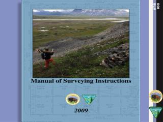
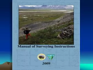
MANUAL The Manual of Surveying Instructions describes how cadastral surveys of the public lands are made in conformance to statutory law and its judicial interpretation. (1973 Manual § 1-1.) It is within the province of the Director to determine what are public lands, what lands have been surveyed, what are to be surveyed, what have been disposed of, what remains to be disposed of, and what are reserved. (1973 Manual § 1-11.)
When a boundary location • is to be run and marked; or • 2) becomes unclear; • the Manual is the guidance (the rules) governing 1) the running and marking of lines and corners; and 2) the relocation of boundaries and corners; • in conformance to the controlling monuments, survey plat(s), field notes, rules, regulations and laws.
United States Supreme Court It is settled law that the United States may survey what it owns and thereby establish and reestablish boundaries, but what the government does in this regard is for its own information and cannot affect the rights of owners on the other side of an existing boundary. United States v. State Investment Co., 264 U.S. 206, 212 (1924), citing Lane v. Darlington, 249 U.S. 331, 333 (1919).
Land Law Gauthier v. Morrison, 62 Wash. 572 (1911); reversed on other grounds, 232 US 452 (1914) The state cannot undo what the SOI has done, or decree rights of private parties in the land The power to make and correct surveys of the lands prior to issuance of patent belongs to the SOI; decisions within her exclusive jurisdiction are unassailable by the courts, except by a direct proceeding; the latter have no concurrent or original power to make similar corrections; and this is an elementary principle of our land law - Cragin v. Powell, 128 U.S. 691) (1888) The reason of this rule is that great confusion and litigation would ensue if the judicial tribunals, State and Federal, were permitted to interfere and overthrow the public surveys on no other ground than an opinion that they could have the work in the field better done and divisions more equitably made than the department of public lands could do
Has Congress passed laws, with survey rules, pertaining to Alaska only: • which waived requirements of; • authorized deviation from; or • modified a portion of; • the Manual?
Federal Laws – Containing Survey Rules – Different from the General Federal Land Survey Rules • Alaska Statehood Act (72 Stat 339); • Alaska Native Claims Settlement Act (ANCSA) 43 USC 1601 et seq.; and • Alaska National Interest Lands Conservation Act (ANILCA) 43 USC 1631 et seq.
Congress has Created for Alaska Monumentation 2-mile Interval Township Exterior No Monumentation Interior Township No Ground Survey or Monumentation Along Meanderable Water Protraction Diagram Basis of Conveyance Tentative Approval Interim Conveyance
By fundamental law, upon the issuance of a (tentative approval) (interim conveyance) (patent) for land by the Federal government; it is just as if the monuments, survey plat and field notes, and the laws, regulations and rules governing how to survey the land described in the (tentative approval) (interim conveyance) (patent), are stapled to the face of the patent. The survey rules are spelled out in the manuals and instructions issued by the BLM?
ALASKA STATUTESTitle 38. Public LandChapter 04. Policy for Use and Classification of State Land SurfaceChapter 05. Alaska Land Act AS § 38.04.900. Regulations AS § 38.05.020. Authority and Duties of the Commissioner Department of Natural Resources shall adopt regulations to carry out purposes of chapters
Alaska Administrative CodeTitle 11. Natural ResourcesPart 6. LandsChapter 53. Records, Surveys, and PlattingArticle 2. Survey and Platting Standards 11 AAC 53.150. Supplemental cadastral rectangular surveys (b) The following survey and platting standards apply to supplemental cadastral rectangular surveys: (2) For the north tier of sections, the 1/4 and 1/16 sec. cors. must be at mid-point
Should Federal Statute Law Alaska-Centric waivers, deviations and modifications be included in the next edition of the Manual?
Is there still a need for the Manual? Questions and Discussion
Next Edition Website http://www.blm.gov/cadastral/Manual/nextedition.htm Contact Information Announcements: Upcoming Presentations General Information http://www.glorecords.blm.gov