Download
1 / 22
230 likes | 343 Views
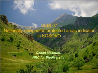
MINISTRY OF ENVIRONMENT AND PHYSICAL PLANNING. SEBI 07 - Nationally designated protected areas indicator. Sashko Jordanov Robertina Brajanoska. Expert Workshop on biodiversity indicators, 4-6.11.2013 Dubrovnik, Croatia. Indicator definition.

E N D
MINISTRY OF ENVIRONMENT AND PHYSICAL PLANNING SEBI 07 - Nationally designated protected areas indicator Sashko Jordanov Robertina Brajanoska Expert Workshop on biodiversity indicators, 4-6.11.2013 Dubrovnik, Croatia
Indicator definition The indicator shows the total (cumulative) designated area of sites protected under national instruments, or under the EU Birds and/or Habitats Directives (Natura 2000 sites), or under the Bern Convention (Emerald sites) and other multilateral agreements over time
The indicator is also broken down to show the different trends of surface area in ha designated under international conventions and initiatives, under EU Directives and under national legislation: • Number and coverage of protected areas (PAs) under the national categorization • Percentage of individual national categories of PAs out of the total PAs coverage • Cumulative surface area of Emerald sites (designated under the Bern Conv).
Policy context and targets • Spatial Plan of the Republic of Macedonia, Natural Heritage Study (1999) • Second National Environmental Action Plan (2006) • National Strategy for Biodiversity Protection and Action Plan (2004) • Law on Nature Protection (2004)
Targets • Expansion of the network of national protected areas up to around 12% of the territory of the Republic of Macedonia as it is foreseen with the National Spatial Plan • Expansion of 50% of the network of national protected areas is also envisaged with the First National Strategy for Biological Diversity and Action Plan • The 35 areas were identified and designated as National Emerald network; they will be used as a basis for establishment of Natura 2000 network.Revision of the Emerald Network needs to be undertaken due to changes in the Resolutions no. 4 and 6 of the Bern Convention • Strengthening the capacities at national and local level is priority action for starting the process of identification of all areas in accordance with Natura 2000 and the EU Birds and Habitats Directive
Key policy question What is the progress in designation/protection of areas under the national legislation, EU Directives and multilateral agreements?
Methodology • Annual reports for realized activities are prepared by the Nature Sector including the progress in proclamation of PAs • Reports for realized activities for different projects related to PAs • Other reports are prepared as obligation from international conventions and organizations (CBD, Ramsar, Bern, EEA etc).
Methodology for gap filling Cadastre for PAs should be developed including all necessary information regarding the PAS network
Data specifications EEA data references • Data set 1 CDDA • Data set 2 Emerald database External data references • Data set 1 National Biodiversity Information System (developed but not updated) • Data set 2 UNESCO and Ramsar database
UncertaintiesData sets uncertainty Because of the current transitional state of the system of PAs the analysis of PAs for this indicator includes all PAs in the Republic of Macedonia, designated both under old and new categorization
Further work Short-term work Regular update of the data in the National Cadastre of PAs Long-term work Finalization of the process for revalorisation and re-proclamation of PAs
Indicator Assessment Key message • Network of designated PAs comprises 81 areas which cover around 9% of the total national territory • National Emerald Network of Areas of Special Conservation Interest includes 35 locations, which cover about 29% of the territory of the Republic of Macedonia • Several areas in the Republic of Macedonia have international conservation status: two Ramsar sites - Lake Prespa (17789 ha) and Lake Doyran (2720 ha), Ohrid Region as World natural and cultural heritage covering an area 83400 ha
Figure 1. Number and area of protected areas in accordance with the national categorization
Figure 2. Share of individual national categories of designated areas on the overall territory of the Republic of Macedonia
Figure 3. Cumulative surface area of Emerald sites (designated under the Bern Convention) and other internationally designated areas (Ramsar sites and UNESCO sites) over time Да се дополни ???
Key assessment text 1. Nationally protected areas 2. Internationally designated areas • Emerald network • UNESCO and Ramsar sites
Figure 4.Map National protected areas - current status (source: Representative Network of Protected Areas)
Figure 5.Map National Emerald network of the Republic of Macedonia
References in key assessment text Macedonian Ecological Society (2011) Development of representative protected areas network-part I. Report for the UNDP/GEF/MEPP Project “Strengthening of ecological, institutional and financial sustainability of the system of protected areas in the Republic of Macedonia”