Download
1 / 35
371 likes | 548 Views
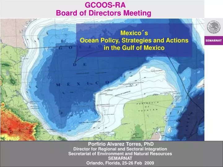
GCOOS-RA Board of Directors Meeting. Mexico´s Ocean Policy, Strategies and Actions in the Gulf of Mexico. Porfirio Alvarez Torres, PhD Director for Regional and Sectoral Integration Secretariat of Environment and Natural Resources SEMARNAT Orlando, Florida, 25-26 Feb 2009.

E N D
GCOOS-RA Board of Directors Meeting Mexico´s Ocean Policy, Strategies and Actions in the Gulf of Mexico Porfirio Alvarez Torres, PhDDirector for Regional and Sectoral IntegrationSecretariat of Environment and Natural ResourcesSEMARNATOrlando, Florida, 25-26 Feb 2009
ENVIRONMENTAL OCEAN POLICY BACKGROUND 1992 Rio de Janeiro, Agenda 21 (Chapter 17) 2001-2003 World Ocean Conference 2002 Johannesburg Summit 2004 Environmental Evaluation (coastal areas integrated management) 2004 National Consultative Council for Sustainable Development recommended to build an environmental ocean policy 2005 Federal Fiscal Authority, called for an integrated policy on ocean and coastal areas
Ocean Management Sustainable Development Strategy for the Seas of East Asia, Dec. 2003 An Ocean Blueprint for the Century Ocean Commission, Sep. 2004 National Environmental Policy for the Sustianble Development of Oceans and Coasts Mexico, Oct. 2006 EU Maritime Policy Oct. 2007
“NATIONAL ENVIRONMENTAL POLICY FOR THE SUSTAINABLE DEVELOPMENT OF THE OCEANS AND COASTS OF MEXICO” Provides the strategic framework for the conservation and sustainable use of oceans and coasts. Includes the guidelines to articulate public and sectorial policies. Build on ecosystem based management and ecosystem based approach.
COASTAL ZONE BOUNDARIES DEFINITION ENVIRONMENTAL CRITERIA Proximidad a línea costera Planicie costera Vegetación costera Perfil hipsográfico (200 msnm) Cuencas costeras SIG`s & MULTICRITERIA ANALYSIS MARINE PORTION.- Continental Plataform ISLAND PORTION.- Federal jurisdiction CONTINENTAL PORTION.- 263 municipalities in the littoral with a high and medium coastal nfluence index EXPERT CONSULTATION
NATIONAL STRATEGY FOR THE LAND AND SEA USE PLANNING OF THE TERRITORY IN OCEANS AND COASTS • The President mandates to: • Elaborate the General Land Use Planning Physical Model for the Territory • Elaborate a National Ocean Policy • Strengthen the Strategy for conservation of coastal wetlands, particularly mangrove ecosystems • Enhance the Strategy for the Protection of Coastal and Marine Biodiversity • “… build inmediately the Interministerial Commission for the Sustainable Management of Oceans and Coasts (CIMARES). This Commission will be encharged to formulate at the national level the necesary policies and strategies” • Mazatlán, Sinaloa, Feb 21 2007
Interministerial Commission for the Sustainable Management of Oceans and Coasts, CIMARES PRESIDENTIAL DECREED.O.F. 13 DE JUNIO 2008 PRINCIPLES • Integrated vision and nation wide coverage • Strengthen federal coordination mechanisms • Mainstreaming and crosscuting • Optimize current capacities • Enhance social participation and adaptive management • Enhance communication, extension, transparency and accountability • Governance
INSTALACIÓN DE LA CIMARES1º de diciembre de 2008 ACUERDOS DE LA SESIÓN Se declara instalada la Comisión Se acepta la designación del Secretario Técnico Se aprueba el Reglamento para la operación de la CIMARES Se sanciona la estructura de las Subcomisiones y Grupos de Trabajo Se acepta el programa de trabajo y los 27 temas prioritarios Se acuerdan las fechas de sesiones ordinarias 2009 que se realizarán el 13 de abril en Mazatlán, Sin. y 12 de octubre en la Ciudad de México.
SUBCOMISIONES Y GRUPOS DE TRABAJO COMISIÓN INTERSECRETARIAL PARA EL MANEJO SUSTENTABLE DE MARES Y COSTAS SUBCOMISIONES Esquemas Institucionales para la Administración Integral y Sustentable de los Mares y Costas Ordenamiento Ecológico en Mares y Costas Deterioro, Riesgo y Vulnerabilidad a los Efectos del Cambio Climático Fomento a la Inversión Sustentable y producción Agenda Internacional y Buenas Prácticas GRUPOS DE TRABAJO Desarrollo de sectores productivos Marco jurídico Ecosistemas, Biodiversidad y Contaminación B A C OE Locales o Municipales OE Regional (en zonas costeras) OE Marino Regional
MAPA DE ACTORES E INVITADOS MIEMBROS DE LA COMISIÓN: INVITADOS GOBIERNOS DE LOS ESTADOS COSTEROS GOBIERNOS MUNICIPALES Únicamente los municipios costeros de la entidad donde se realizará el evento(en su caso) Consejos Consultivos para el Desarrollo Sustentable ACADEMIA UABC, UABCS, CICESE, CIBNOR, USON, CIDESON, UAS, CIAD, UAN, UDEG, UCOL, UAGRO, UMAR, UNACH, UAT, UV, UJAT, UACAM, UQROO, UADY, CICY, ECOSUR, UNAM, UAM, IPN ONG´s ACTORES PRODUCTIVOS CÁMARAS SECTORIALES
Sea and Land Use Processes Estrategia de Mares y Costas Procesos sin convenio 26. Municipal de La Huerta 27. Municipal de Cihuatlán 28. Municipal de Tomatlán 29. Laguna de Zapotlán 30. Cuenca del Valle de México
Benefits of Land and Sea Use Planning Process • Mapping all sectoral activities • Reduce environmental and social conflicts • Promotes sustainability in regions • Encourage sectors to prevent and reduce environmental impacts • Protects natural heritage • Provides certainity for investment • Reconsiders the process of occupation and use of the territory • Defines the intensity of use of the territory • Promotes alternative solutions to sectoral activities • Supports informed decision making for other environmental instruments (i.e. EIA, Coastal Federal Areas, Change of Land Use)
Veracruz Quintana Roo Campeche Yucatán Tabasco Tamaulipas Regional Sea and Land Use Process in the Gulf of Mexico
MARINE ZONING AND COASTAL LAND USE PLANNING Land area.-144 coastal counties Marine area.- EEZ of Gulf of México and Caribbean Sea
Current status of the Land and Sea Use Planning Process in the Gulf of Mexico and Caribbean Sea Evaluation Formulation Adoption Modification Indicators:* Policies Guidelines Strategies Physical & Environ Criteria Program Review & Update Public Consultation Agreement Coordinaton MOU Report with Results* Committee Legally binding Decree Plan Program X Committee and Environmental Logbook Implementation Linkage to (EIA) Programing …
Challenges to run the process N Scarce and scattered information on the marine environment Higher complexity compared to land use plannning Limited information and geographical coverage Tools for marine analysis limited Need to elaborate a more creative and critical scenarios regardless of the limited tools and information availability
Sea and Land Use Process Analysis Compilation of existing statistical and cartographic information in federal agencies Determine sea and land uses based on wide participative workshops with sectors and civil society Main analysis conducted using multicriteria and multiobjective approaches Environmental indexes such as Pressure, Risk, and Vulnerability play an important role to build a strong and reliable Diagnostic on the marine and coastal areas current condition
MARINE ZONING AND COASTAL LAND USE PLANNING CHARACTERIZATION.- Land Area
MARINE ZONING AND COASTAL LAND USE PLANNING Regionalization [Esc 1:250,000] Region Coastal Land Areas 168,462.4 km2 Hidrography Sub-Cuenca [INEGI-INE-CNA, 2007] Curvas de nivel. Hidrología superficial (ríos y cuerpos de agua). Modelos digitales de elevación MDE. Geomorphology ENVIRONMENTAL LAND & COASTAL AREAS UNITS Land Use/ Vegetation SERIE III, CHARACTERIZATION.- Land Area
MARINE ZONING AND COASTAL LAND USE PLANNING CHARACTERIZATION.- Marine Area
MARINE ZONING AND COASTAL LAND USE PLANNING Regionalization [Esc 1:250,000] Marine Area 827,023.8 km2 FLORA & FAUNA Commercial species (CNP, 2006) Protected species NOM-059-SEMARNAT Geology CONABIO/INE/UNAM Batimetry and Geomorphology Carta batimétrica INE Hydrodinamics UNAM Primary Productivity & Temperature FC-UABC, 2007 MARINE ENVIRONMENTAL UNITS CHARACTERIZATION.- Marine Area
MARINE ZONING AND COASTAL LAND USE PLANNING Tourism Oil Energy Electric National Security commercial SECTORIAL WORKSHOPS fishing Ports and Maritime industry touristic industrial Fisheries Aquaculture artisanal Conservation Sectorial interactions in the region
MARINE ZONING AND COASTAL LAND USE PLANNING Primary Sector Agriculture, fisheries and livestock Secondary Sector Oil production activities and energy production Terciary Sector Servicies, harbor storage facilities and oil distribution, Tourism Activities & Maritime transportation. Fragile Ecosystems Geomorphology Vegetation Climate Precipitation Slope Coral Reefs Islands Coastal areas Batimetry Current intensity Pressure • Main River Runoff • Fisheries overexploitation • Degradation processes • Ports and Oil activities
MARINE ZONING AND COASTAL LAND USE PLANNING Hydrometeorological Risk Factors and Climate Change Impacts Risk for Flooding and Rain Hurricane incidence Vulnerability Risk of Flooding and sea level rise
Gulf of Mexico and Caribbean Sea condition… POLLUTION SEAWAGE BIODIVERSITY LOSS DUE TO UNSUSTAINABLE FISHING PRACTICES WATERS DOMESTIC AND . INDUSTRIAL Watershed discharges Increasing pollution Ilegal fishing Overexploitation of Fish stocks Seawage waters MARINE AND COASTAL AREAS OF THE GULF OF MEXICO AND CARIBBEAN SEA ARE HIGHLY DEGRATED AND UNDER EXTREME INCREASING PRESSURE Domestic and industrial Lack of technology In mariculture In coastal areas Increasing development, port, tourism and oil exploitation activities HYPOXIA condition in selected coastal areas Increase in number and frequency of extreme meteorological events Sea floor changes and coastal erosion Increased in biological productivity with signs of euthophication HABs Inestable coastal areas due to sea level rise HIGHER FRAGILE CONDITION INESTABILITY OF DUE TO BENTHOS AND NECTON INCREASING NUTRIENT LOAD .
Habitat modification, Ecosystem degradation, Loss of Resilence & Assests Reduction of Fishery Stocks Increased risk for endangered species Loss of ecosystems/ ecosystem services Impacts Immediate causes Agricultural/ industrial/ urban pollution Eutrophication and HABs Overexploitation Construction/ development in the coastal zone Port Tourism activities Global climate change Underlying causes • Poor urban planning • Inadequate building codes • Inadequate ICZM • Lack of mitigation compensation mechanisms • Weak enforcement of urban regulation • Increase fishing Effort • Increase technological capabilities • Non selective Fishing Gear • Uncertainty of assessments • Overcapitalizaton • Deficient fisheries control policies • Poor agricultural practices • Poor planning • Lack of capacity • Lack of wastewater treatment • Weak enforcement • Aerosol Contaminants • Weak enforcement agricultural regulation • Poor environmental planning/ • lack of assessment of impacts • Historical development planning (TOP-DOWN). Lack of ecosystem approach. Lack of integrated management. Poverty, Policies promoting increasing coastal population. Root causes
Gulf of Mexico Large Marine Ecosystem Participant countries: Mexico-US (SEMARNAT- NOAA) The long-term development/environmental goal of the project is: Sustainable development of the Gulf of Mexico LME enhanced through ecosystem-based management approaches Project Objective: To rehabilitate marine and coastal ecosystems, recover depleted fish stocks and to reduce nutrient overloading to the Gulf of Mexico Large Marine Ecosystem based on an assessment and management approach that considers LME productivity, fish and fisheries, pollution and ecosystem health, socioeconomics and governance.
Main activities Joint Integrated Assessment of the Gulf of Mexico Monitoring ecosystem health and environmental quality assessment Conservation and restoration of coastal areas Recovery of depleted fisheries stocks Gulf of Mexico Large Marine Ecosystem
Final Remarks Build a strong GCOOS SEMARNAT parternship Sign the MOA Data sharing Joint Monitoring Enhance Communication Enhance capabilities GoM LME, NOAA-SEMARNAT Joint Integrated Ecosystem Assessment Monitoring