Download
1 / 27
270 likes | 404 Views
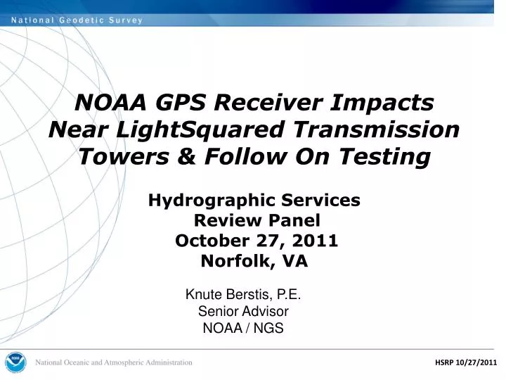
NOAA GPS Receiver Impacts Near LightSquared Transmission Towers & Follow On Testing Hydrographic Services Review Panel October 27, 2011 Norfolk, VA . Knute Berstis, P.E. Senior Advisor NOAA / NGS . Presentation Overview. LightSquared Issue Background

E N D
NOAA GPS Receiver ImpactsNear LightSquared TransmissionTowers & Follow On TestingHydrographic Services Review Panel October 27, 2011Norfolk, VA Knute Berstis, P.E. Senior Advisor NOAA / NGS
Presentation Overview • LightSquared Issue Background • Federal Working Groups and LightSquared TWG • NOAA Summary Testimony • NOAA Live Sky Test Results • LightSquared Modified Spectrum Plan • Follow On Testing
Background • FCC grants LightSquared a waiver on January 26, 2011 to establish a high density terrestrial network in the MSS band adjacent to the GPS L1 band. • The waiver also requires that LightSquared establish a Technical Working Group (TWG) to evaluate potential interference to GPS. • Other federal organizations also establish working groups to assess the impact of LightSquared’s Ancillary Terrestrial Component (ATC) base stations and mobile handsets on GPS receiver desensitization and possible receiver overload
Defense Transportation State Interior NATIONALEXECUTIVE COMMITTEEFOR SPACE-BASED PNT Executive Steering Group Co-Chairs: Defense, Transportation ADVISORY BOARD Sponsor: NASA Agriculture Commerce NATIONAL COORDINATION OFFICE Host: Commerce Homeland Security Joint Chiefs of Staff NASA Nat. PNT Engineering Forum (NPEF) Co-Chairs: Defense, Transportation GPS International Working Group Chair: State Ad Hoc Working Groups Information Coordination and Dissemination Team Co-Chairs: DOT, STRAT U.S. Space-Based PNT Organizational Structure WHITE HOUSE
What is LightSquared? • New Telecom company formed Mid 2010 • Formerly SkyTerra and before that Mobile Satellite Ventures • Company formed to create a nationwide 4G LTE (Long Term Evolution) open wireless broadband network • First wholesale-only broadband network • Intends to provide coverage to 92% of USA by 2015 • Key Asset • Mobile Satellite Service /Ancillary Terrestrial Component license for 1525–1559 MHz; 1626.5-1660.5 MHz
Illustration of Concernswith LightSquared Situation before LightSquared GNSS receiver filter response GLONASS low power (on Earth) satcom emissions 1559 1575 1610 1525 Situation with LightSquared GNSS receiver filter response Up to 15 kW base station emissions low power (on Earth) satcom emissions GLONASS 1559 1575 1610 1525
L1 L Band Satellite Downlink (34 MHz) RNSS band (GPS, 51MHz) 1525 1610 1559 16.42 MHz LTE (5) LTE (5) Phase 0/1 1526.3 1531.3 1550.2 1555.2 1575.42 MHz 9.2 3.8 LTE (10) LTE (10) Phase 2 1536 1526 1555.2 1545.2 LightSquared Spectrum Plans 1610 1660.5 1525 1559 1626.5 Big LEO (Uplink) Aeronautical Radio navigation/ Radio navigation-Satellite (GPS, 51MHz) Aeronautical Telemetry L Band Satellite (Uplink) L Band Satellite (Downlink)
LightSquared & Federal Working Groups • On February 9 the National Coordination Office (NCO) tasked the National Space-Based PNT Engineering Forum (NPEF) working group to conduct an assessment of the LightSquared potential interference effects. • On February 10 RTCA, Inc. (an advisory group for the FAA operating under the Federal Advisory Committee Act) tasked its Special Committee 159 Working Group 6 ("GPS interference") to conduct an assessment of LightSquared potential interference effects on aviation. This task was requested by the FAA. • On March 3, LightSquared and the GPS Industry Council (co-chairs of the Technical Working Group) held its first meeting in Washington, DC. • TWG has 10 federal representatives participating and providing technical input. • NOAA /NGS participates in the TWG Las Vegas Live Sky Testing April 19-23.
LightSquared & Federal Working Groups Completed Activities • TWG Final report filed with the FCC June 30 • LightSquared also filed a modified deployment plan on the same date as the TWG report. • NPEF Final Report public version filed with the FCC on July 06. • RTCA report focusing on aviation receivers available to the public on the FCC website
Congressional Hearings • 23 June: House Transportation and Infrastructure Committee • 8 Sept: House Science Committee • Mary Glackin / Deputy Under Secretary for Operations at NOAA Testified • 15 Sept: House Armed Services Committee, Strategic Forces Subcommittee • More Hearings Likely
Summary NOAA Testimony onLightSquared’s Original Spectrum Plan • NOAA GPS based systems impacted by original spectrum plan: • Ground stations that control GOES and POES spacecraft depend on GPS for accurate system timing. • NOAA’s satellite-based search and rescue system, SARSAT uses multiple GPS receivers at ground stations to determine and maintain precise time. • Future satellites, including NPOESS Preparatory Project (NPP) and GOES-R will use on-board GPS receivers for timing and orbit determination. • NOAA has deployed over 23,000 environmental sensor platforms that depend critically for accurate geo-referencing and time stamping of data.
Summary NOAA Testimony (Continued) • NOAA GPS based systems impacted by LightSquared’s original spectrum plan: • NOAA’s network of NEXRAD weather radars and sea surface radar altimeters require GPS-based time synchronization to enable sharing of radio frequencies • NOAA’s fleet of 19 ships employs a variety of GPS and differential GPS receivers for navigation and scientific use. • If GPS service becomes unavailable or unreliable along U.S. coasts and waterways, NOAA vessels will be unable to perform many operations and missions. • NOAA’s radiosondes and dropsondes (attached to weather balloons or deployed from aircraft) are entirely dependent on GPS for accurate position and velocity.
NOAA /NGS Configuration for the Upper and Lower 5 MHz Live Sky Tests in Las Vegas • Six high precision geodetic / survey GPS receivers connected through an eight way splitter to a geodetic antenna using magnetic mounts on the vehicle roof. • Another antenna similarly mounted was connected to a single survey receiver with another geodetic antenna. • Testing concentrated on the open sky rural site LightSquared transmitter (Site 53) May 19 -20.
East – West Maximum GPS Receiver Tracking Loss Distances May 19, 2011 May 20, 2011
Potential NOAA Impacts from LightSquared's Modified Spectrum Plan • LightSquared proposes voluntary power limits (1500 watts vs. 15,000 watts authorized in the FCC waiver) • Postponement of the upper 10 MHz channel bordering the GPS signal.
L1 L Band Satellite Downlink (34 MHz) RNSS band (GPS, 51MHz) 1525 1610 1559 16.42 MHz LTE (5) LTE (5) Phase 0/1 1526.3 1531.3 1550.2 1555.2 1575.42 MHz 9.2 3.8 LTE (10) LTE (10) Phase 2 1536 1526 1555.2 1545.2 LightSquared Spectrum Plans 1610 1660.5 1525 1559 1626.5 Big LEO (Uplink) Aeronautical Radio navigation/ Radio navigation-Satellite (GPS, 51MHz) Aeronautical Telemetry L Band Satellite (Uplink) L Band Satellite (Downlink)
NOAA /NGS Configuration for the Lower 10 MHz at Holloman AFB • Four high precision geodetic / survey GPS receivers connected through an eight way splitter to a geodetic antenna using magnetic mounts on the vehicle roof. • Another antenna similarly mounted was connected to a single survey receiver with the manufacturer recommended geodetic antenna. • Due to high wind conditions on April 15th, the LightSquared Ancillary Terrestrial Component (ATC) reference station could only be raised to 32 ft. (9.8 m.) instead of the 100 ft. (30.48 m.) specified operational height.
High Precision Receiver Performance withLightSquared Lower 10MHz Signal
Five Major NOAA Systems or Functions that Require Wideband GPS Equipment • Six-satellite COSMIC systems that observes the Earth’s atmosphere • Monitoring sea level trends to protect natural and human communities • Ground –Based Meteorology (GPS-Met) project which measures atmospheric moisture • Total Electron Content (US-TEC) product to inform users about space weather conditions • Maintenance of the National Spatial Reference System to insure compatibility among geospatial products.
LightSquared Modified Spectrum Plan (Continued) • LightSquared will commence terrestrial commercial operations only on the lower 10 MHz portion of its spectrum. • They will coordinate and share the cost of underwriting a workable solution with GPS manufacturers of legacy precision measurement devices that may be at risk. • A filter solution for the Lower 10 MHz band has been developed by Javad in partnership with LightSquared for high precision receivers. • NOAA / NGS is planning to test this antenna / filter combination using a Javad receiver purchased for the Foundation CORS network at White Sands Oct. 31- Nov. 4, if available.
Javad Filter Response to Mitigate the Lower 10 MHz LightSquared Signal
New NPEF Testing Oct. 31 – Nov. 4, 2011 • Targeted Testing • Navigation/Cellular Devices • Low 10 MHz • Hand set (LSQ Cell Phone) simulation to be included • NOAA Participants • NOS / NGS – 4 Precision survey /geodetic receivers • NOS / Office of Coast Survey – 4 marine navigation receivers • NWS – 3 general location / navigation receivers and 1 timing receiver
Additional testing for High Precision and Timing Receivers Anticipated in early 2012 • Possible NOAA Participants • NOS / NGS - Up to 8 high precision geodetic survey receivers and multi - sensor Applanix integrated ground based system • NOS / Office of Coast Survey – Marine navigation receivers • NWS – General navigation, timing receivers, radiosondes and weather radar • NESDIS – Search and rescue beacons and data collection buoys • OAR – CORS reference stations in the GPS - Met network and rawinsondes • OMAO - Dropsondes and multi – sensor Applanix integrated airborne system
Testing Integrated Platforms at Site 53 with Sectors 300 and 2700 Max. Power Max. LightSquared Power in This Direction
Where to get more information? www.pnt.gov/interference/lightsquared/ www.gps.gov • PNT Media Clips (Daily) • GPS Tracker for Policy Makers (Monthly) • To subscribe contact: • steven.sidorek@pnt.gov
Questions? Knute Berstis National Coordination Office for Space-Based PNT 1401 Constitution Ave, NW – Room 6822 Washington, DC 20230 Phone: (202) 482-2007 Knute.Berstis@pnt.gov Knute.Berstis@noaa.gov