Download
1 / 1
10 likes | 115 Views
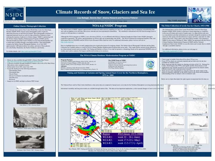
Climate Records of Snow, Glaciers and Sea Ice. Lisa Ballagh, Dennis Dye*, Allaina Howard and Florence Fetterer * JAMSTEC Frontier Research Center for Global Change, Japan. http://nsidc.org/noaa/. NOAA@NSIDC Program. The Dehn Collection of Arctic Sea Ice Charts, 1953-1986.

E N D
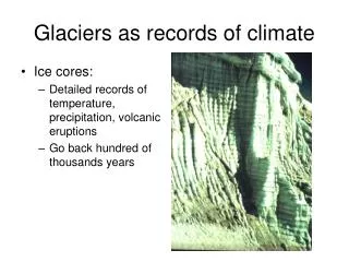
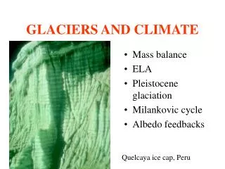
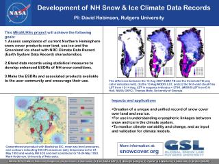
Climate Records of Snow, Glaciers and Sea Ice Lisa Ballagh, Dennis Dye*, Allaina Howard and Florence Fetterer *JAMSTEC Frontier Research Center for Global Change, Japan http://nsidc.org/noaa/ NOAA@NSIDC Program The Dehn Collection of Arctic Sea Ice Charts, 1953-1986 Online Glacier Photograph Collection • The NOAA team at NSIDC supports approximately 60 data sets while actively compiling new data sets. Our primary focus is managing and publishing data sets with an emphasis on in situ data, data rescue, and data sets from operational communities. We contribute to educational web sites and encourage users to contact us with questions or comments. • Although the NOAA program at NSIDC is not a division of NOAA, we are affiliated with NOAA’s National Geophysical Data Center (NGDC) through a cooperative agreement. We archive and disseminate our NOAA data sets in partnership with NGDC. The NOAA National Environmental Satellite, Data, and Information Service (NESDIS) and the NOAA Arctic Research Office fund our work. For additional information, please visit our web site at: http://nsidc.org/noaa/ • Here we highlight three new or recently updated data sets of particular interest for studying climate. The Online Glacier Photograph Collection and the Dehn Collection are available online as a result of NOAA Climate Database Modernization Program data rescue tasks. They make historic and previously difficult to use observational records easily accessible. The Timing and Statistics of Snow Cover data set presents a climatology based on the operational NESDIS series of weekly snow and ice analysis: the longest satellite-derived data set in existence. • Program Partners • Joe D. Elms, CDMP Program Manager, NOAA NCDC, Asheville, NC • John Jacobs, Program Manager, LASON, Beltsville, MD • Daniel R. Herlihy, NOAA Task Manager, NOAA NGDC, Boulder, CO • Advisors • Richard L. Armstrong, Senior Research Scientist, NSIDC • Bruce F. Molnia, Research Geologist, U.S. Geological Survey, Reston, VA • The National Snow and Ice Data Center/World Data Center for Glaciology, • Boulder (NSIDC/WDC) holds a collection of charts depicting ice conditions • in the seas off Alaska and western Canada coasts. Ice edge position and some • ice concentration and other information are included, though the notations on the • charts are often sparse and discontinuous in space and time, especially for older • charts in the series. These charts, more that 6,800 in number, were donated to • NSIDC by the estate of William H. Dehn. NSIDC has partnered with the NOAA • Climate Database Modernization Program (CDMP) and the National • Geophysical Data Center (NGDC) to scan the charts and to make them available • through a searchable interface. • For additional information, please review our web page at: • http://nsidc.org/data/g01111.html • The National Snow and Ice Data Center/World Data Center for Glaciology, • Boulder (NSIDC/WDC) houses many photographic prints of glaciers, • taken both from the air and from the ground. These photographs constitute an • important historical record, as well as a data collection of interest to those • studying the response of glaciers to climate change. NSIDC is partnering with • the NOAA Climate Database Modernization Program (CDMP) and the • National Geophysical Data Center (NGDC) to scan selected photographs and • to make them available through a searchable interface. These photographs • comprise the Online Glacier Photograph Database. As of July 2005, • approximately 3,000 glacier photos are online, and most of these glaciers • are in the Rocky Mountains, the Pacific Northwest, and Alaska. • For further details, visit: http://nsidc.org/data/g00472.html The NOAA Climate Database Modernization Program at NSIDC The CDMP Team at NSIDC Lisa Ballagh, User Services Advisor Florence Fetterer, Team Lead Allaina M. Howard, Librarian and Analog Data Archivist Jonathan Kovarik, Operations I-Pin Wang, Database Manager • Charts range in number from about 80 to about 350 per year. • From 1975 on charts are extremely detailed and are believed to be the best available for Alaskan waters. • Many charts pre-date the regular ice charting activities of the U.S. National Ice Center, which began in the 1970s, and regular satellite observations as well. • Applications may include research on sea ice edge position for climate studies, fisheries research, and coastal processes research. • There are two main impediments to using the charts: the spotty nature of the drawn ice features, especially on the earlier charts in the series and incomplete understanding of the ice analysis code or notations used. Below are ice charts that depict the eight regions incorporated into this data set. • Photos are also available through NGDC’s Glacier Data Map Viewer http://map.ngdc.noaa.gov/website/nsidc/glacier/viewer.htm • Collection available through EarthSLOT, thanks to the work of Dr. Matt Nolan. • Most photos show terminus location. • Earliest photo from 1883, latest from 1995. • Search the database by the following parameters: • Photographer Name • Photograph Date • Glacier Name • Glacier Coordinates (Latitude/Longitude) • State/Province • Keyword • Images are in JPEG and high resolution TIFF format. Timing and Statistics of Autumn and Spring Annual Snow Cover for the Northern Hemisphere, 1972 to 2000 The National Snow and Ice Data Center distributes a time-series data set comprised of annual snow cover data for the Northern Hemisphere (covering land primarily over 45 degrees North) from 1972 to 2000. Data are derived from the NOAA weekly snow cover charts, which integrate data from visible bands of AVHRR and geostationary sensors, with corrections applied by Dr. David Robinson of Rutgers University. For each year of the 29-year period, there are three binary files (89 x 89 grids). The first detected snow cover in the fall is included in the WFS file, the timing of the last observed snow cover in the spring is incorporated into the WLS file, and the duration of snow-free period is shown through the DFS file. Interannual variability and long-term trends are available through statistic files. This data set has important implications, as the seasonal changes of snow cover in the Northern Hemisphere can be used to study climate change. Results from prior research (Dye 2002) suggest that the alterations in the timing of snow cover may have an impact on the terrestrial ecosystem, as the significant conclusion from the research reveals a positive trend in the snow free period (DFS) of 5 to 6 days per decade. To access the data set documentation, please visit our web site at: http://nsidc.org/data/g02168.html Mackenzie Bay Bering Sea East • Field, William O. 1935. Claremont Glacier. Bering Sea West Bering Strait • Wentworth, Chester Keeler. 1930. Gannett Glacier. Beaufort Sea Point Barrow Bering Sea Chukchi Sea • NSIDC/WDC for Glaciology, Boulder, compiler. 2005. • The Dehn collection of Arctic sea ice charts, 1953-1986. • Boulder, CO : National Snow and Ice Data Center/ • World Data Center for Glaciology. Digital media. Dye, Dennis. 2005. Timing and Statistics of Autumn and Spring Annual Snow Cover for the Northern Hemisphere, 1972 to 2000. Boulder, CO: National Snow and Ice Data Center. Digital media. • Buddington, Arthur Francis. 1925. Chickamin Glacier.