Download
1 / 30
300 likes | 406 Views
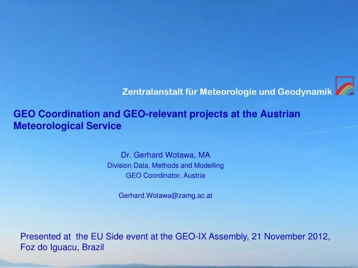
GEO Coordination and GEO-relevant projects at the Austrian Meteorological Service. Dr. Gerhard Wotawa, MA Division Data, Methods and Modelling GEO Coordinator, Austria Gerhard.Wotawa@zamg.ac.at. Presented at the EU Side event at the GEO-IX Assembly, 21 November 2012, Foz do Iguacu, Brazil.

E N D
GEO Coordination and GEO-relevant projects at the Austrian Meteorological Service Dr. Gerhard Wotawa, MA Division Data, Methods and Modelling GEO Coordinator, Austria Gerhard.Wotawa@zamg.ac.at Presented at the EU Side event at the GEO-IX Assembly, 21 November 2012,Foz do Iguacu, Brazil
Outline • GEO structures in Austria • Responsibilities of the Austrian GEO Secretariat • Related projects and activities • Phenology • Sonnblick Observatory/Histalp • Conrad Observatory/Space weather • Soil moisture and agricultural modelling Eastern Africa • EODC Water
History Austria participated in GEO as observer since the GEO-II Assembly in Geneva (December 2005) 2008: Feasibility study regarding possible Austrian membership in GEO (by ZAMG and Austrian Environmental Protection Agency): GEO considered as a useful process April 2009: Decision to join GEO as member August 2009: Establishment of a GEO Secretariat at ZAMG
GEO Structures in Austria • Responsible Ministry: Federal Ministry of Science and Research (BMWF) • BMWF has appointed ZAMG to coordinate GEO in Austria • GEO Secretariat has been established at ZAMG in August 2009
Responsibilities of GEO Secretariat • Participation in the GEO Assembly and the meetings of the European HLWG • National Point of contact for persons and institutions interested and/or involved in GEO activities • Coordination of the Austrian involvement in specific GEO tasks and Implementation Boards • Identification of needs for research and development related to GEO, and channeling these needs to the Federal Ministry • Public information related to GEO
Responsibilities of GEO Secretariat (2) • Communication with the GEO Secretariat in Geneva • Organization of national workshops and information events • Analysis of the GEO-relevant data in Austria, and assessment of the data needs • Establishment of a GEO Web site in Austria • Organizing meetings of the Austrian GEO group (GEO principal, Ministry of Science and Research, GEO coordinator and various partners) twice a year
Inter-ministerial coordination Different ministries in charge of GEO, GMES and INSPIRE Policyarea ExistingCoordination Geo-Portal ofthe Austrian Provinces IMG Weltraumpolitik (Inter-Ministerial Group Space Politics) E-Government PG Umweltinformation (E-Government Project Group for Environmental Data and Information)
Public Web Site http://www.zamg.ac.at/geo_office/ (English) http://www.zamg.ac.at/geo-sekretariat/ (German)
GEO Workshop 2012, Vienna • BMWF & ZAMG co-organize a GEO Workshop on 10 December 2012 in Vienna • Information on GEO process and GEO-IX outcome • Information on European initiatives (GMES) • Oral and poster sessions – bringing together data providers and users • Engagement of private sector: cooperation with Austrian Chamber of Commerce
GEO & GCOS The GEO Secretariat at ZAMG is also involved in the Austrian GCOS process (GCOS Web site, GCOS data survey)
GEO related projects and activities Examples for GEO related activities and projects
Phenology Phenology is the study of the timing of recurring biological events in the animal and plant world Examples: Leaf unfolding and flowering of plants in spring, fruit ripening, colour changing and leaf fall in autumn, as well as the appearance and departure of migrating birds and the timing of animal breeding
Purpose of Phenological data Whatare Phenological Data goodfor? • Necessary for Understanding the Interaction between Atmosphere and Biosphere • Increase the Knowledge about Critical Changes in the Global Carbon Balance • Are Climate Change Indicators
Phenological data shows climate change • CLIMATE CHANGE INDICATOR 2 WEEKS EARLIER FRUIT RIPENING OF ELDER IN THE ALPS SINCE 1970S y-axes left: summer temperature deviation from the meany-axes right: entry date right of fruit ripeness of elder (Sambucus nigra)
Phenology shows Seasonal variability Green Wave in Spring
Sonnblick Observatory • Sonnblick, Goldberggruppe, Hohe Tauern, 3106 m • The only summit observatory world-wide above 3000 m asl • Highest continuously inhabited building of Austria • Continuously active for more than 125 years
Measurement of air quality and CO2 • Environmental Protection Agency (UBA) Vienna measures the following parameters at Sonnblick: • Air quality: CO, NOy and O3 • Greenhouse gases: CO2
Aerosol measurements (ZAMG) • New Aerosol inlet was installed in September 2011 • PM10 monitor (Sharp) was installed in 2012
Sonnblick Observatory 125 YEARS OF CLIMATE VARIABILITY AND TRENDS AT SONNBLICK 125 years of monitoring show: It gets continuously warmer and brighter in the Alps http://www.zamg.ac.at/histalp
The greater alpine region (GAR) has warmed stronger than the global mean +2° +1°
GEOSAF Using GEO for Early Warning and Food Security in East Africa • Using GEO for Early Warning and Food Security in East Africa • Investigatetheinfluenceof high impactweather (flood, drought) on African agricultureandwatermanagement. • Improvemonitoringandlongrangeforecastingofsoilmoisture • Useofspace-bornesensorsformonitoringandvalidation • Seasonal, ensemblebasedweatherforecastsandcropmodeling • Set up an earlywarningsystemforlocalfarmersand international organisations
GEOSAF - Use of satellite data • Soilmoisturedataarederivedfrom different space-borne microwavesensors: • AdvancedScatterometer (ASCAT) on METOP • SoilMoistureandOceanSalinity (SMOS) mission • AdvancedSyntheticAperture Radar (ASAR) on ENVISAT
EODC Water Earth Observation Data Centrefor Water Resources Monitoring a cooperation of
Proposal for an Earth Observation Data Centre • Following the example of other countries • e.g. CEMS in the UK • Thematic focus on water resources (instead of an “Austrian EODC”) • Strategic goals • Establish Austria as a key player in the operational EO ground segment and service market • Strengthen its academic, institutional and commercial organisations by coordinating, focusing, and reinforcing their expertise and capabilities • Be a focal point for water-related programmes • Overall aims • Provide unique EO products for improved monitoring of water resources • Operate Collaborative Ground Segment components for the Sentinel satellites • Apply service standards as commonly employed by NWP centres • Focus on fully automatic and continental to global scale products • Establish the logistics and seamless ITC infrastructure system
Product Portfolio • Water resources management requires an integrated view of the complete water cycle • Potential product portfolio is relatively broad • Room for diversification
Thank you for your attention! Please visit us in the exhibition area.