Download
1 / 43
430 likes | 437 Views
Latin America #1. Originally controlled by Spain and Portugal. Basic Geography, Climate, People Andes Mt., Grasslands, Rainforest, Farming. https :// www.youtube.com/watch?v=7DMbqhVw9mg 5:31.

E N D
Latin America #1 Originally controlled by Spain and Portugal
Basic Geography, Climate, PeopleAndes Mt., Grasslands, Rainforest, Farming https://www.youtube.com/watch?v=7DMbqhVw9mg 5:31
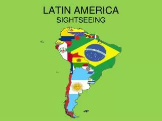
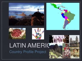
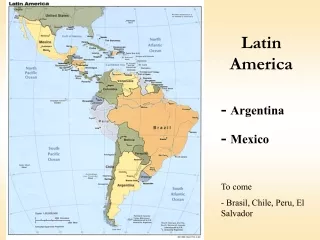
Latin America is a region in the Western Hemisphere that includes Mexico, Central America, the West Indies, and South America.
Goals • Locate Latin America on a world map • Describe the physical characteristics (i.e., landforms, climate, and vegetation) of Latin America
Paste in notebook • Latin America map-label Central and South America & Mexico, Equator, Tropic of Capricorn • World map-Label South America & Mexico
Latin America/South America • Latin America is an umbrella cultural concept just like Hispanic America. • South America, geographical concept, is a continent. • Which Latin American country is closest to U. S.?
vocab • Biome=flora (vegetation) and fauna (animals) occupying a major habitat, e.g. forest or tundra. • Subsistence farming=farmers grow crops to feed themselves and their families. Farm output is for survival with little or no surplus. • Amerindians=the indigenous people of the Americas • Indigenous=native, naturally there • Isthmus=narrow strip of land that connects two larger land areas.
Climate determines where biomes are found. Each biome has a range of temperatures and precipitation. We can often predict what type of biome will be found there.
Begin Geography Graphic Organizerwith discoveryeducation.com
Social Studies Techbook Discoveryeducation.com Username- Password-huron Course: World Geography and Cultures Explore 1-7: Use the graphic organizer and answer questions. Click on the map, choose large size. To compare to U.S. and Canada use search-physical map of United States and Canada. When you use large, you’ll see a +/- to zoom in Exit out of large *Use back arrow to go to next Explore*
Latin America Population Majority Mestizo=mixed race, especially one having Spanish and indigenous descent.
Vocabulary Isthmus of Panama WEST INDIES (Caribbean Islands) CENTRAL AMERICA SOUTH AMERICA Connects Central America and South America
The Panama Canal • Shortcut through land saves 7,000 miles of travel • Took 10 years to build after French gave up and U.S. took over • 5,609 workers died, mostly from malaria or yellow fever carried by mosquitoes • 40 ships cross daily; each can take up to 10 hours to get through the canal
Watch how the Canal works6:54 https://www.youtube.com/watch?v=m8TkcWhmByg
2 min. film of Galapagoswhich is part of the Republic of Ecuador https://www.youtube.com/watch?v=8SYyHiot-lE • 21 islands in the archipelago (string of islands) • 25, 000 people live there
Peru, Argentina, Brazil 23% live in poverty *Population: 209million *25 %live below the poverty line *family income of $5.50 a day. *33% live below poverty line *20% live on less than two dollars per day.
Brazil’s MatoGrosso PlateauMostly savanna (grassy, with few trees) and woodland Ecotourism=tourism to endangered areas for purpose of supporting conservation Hectare=100 acres
Brazil’s MatoGrosso 3:41 https://www.youtube.com/watch?v=w46tBZdrvos
Reading an Elevation Map Where are the highest land elevations? ISLANDS WEST INDES YUCATAN PENINSULA DARK BROWN= 10,000 ft. • Yucatan Peninsula? • The west coast of South America? • The islands of the West Indies? • Brazil’s MatoGrossoPlateau? MATO GROSSO GREEN=500 ft. LIGHT BEIGE=100 FT.
West Indiesmountain tops surrounded by water • Group of 5,000 volcanic and coral islands • Rich volcanic soil grows sugar cane, bananas, cacao, limes, and spices • Sandy beaches and warm weather • 5-8 hurricanes per year • Active volcano • Strong French Influence
History of Caribbean Islands 4:43 What do you think the climate is like? https://www.youtube.com/watch?v=YVkjwh6OavM
Caribbean Island Vacation Guide 11 min. https://www.youtube.com/watch?v=SUXPxtVEeS4
Tropical Rainforest • The tropical rainforest is a hot, moist biome found near Earth's equator. • The world's largest tropical rainforests are in South America, Africa, and Southeast Asia. • Tropical rainforests receive from 60 to 160 inches of precipitation that is fairly evenly distributed throughout the year.
Rainforests cover around 2% of the Earth, but about 50 percent of the plants and animals on the earth live in the rainforest. • Very high annual rainfall, high average temperatures, nutrient-poor soil (rain washes organic materials away), and high levels of biodiversity (species richness).
Biomes of South America LARGE RAIN FORESTS PAMPAS EXPANSIVE GRASSLANDS
Bolivia • Varied terrain spanning Andes Mountains, the Atacama Desert and Amazon rainforest • Population:11.05 million • 60% live in poverty • 38% in extreme poverty
Latin America’s Economy • Fertilizer • Sugar • Wheat • Coffee • Rubber • Petroleum, especially Venezuela
Tomorrow, during social studies you be testing in the lab. • I still expect your test to be Friday.
How do present-day Latin Americans adapt to life, modify and depend on the environment in the Andes Mountains? • Use the Human-Environment Interaction in Latin America Categorization Chart as you • read pages 5-7
Page 8 Explore As you read about the causes of natural disasters and the effects, fill out the cause/effect chart.