Download
1 / 118
1.18k likes | 1.28k Views
GOES: Current (10/12/11/N/O/P) to Future (GOES-R+). Timothy J. Schmit NOAA/NESDIS/STAR Advanced Satellite Products Branch (ASPP) Madison, WI and many others. Seminar March 2006. UW-Madison. Many others to be acknowledged… Tom Wrublewski Fred Prata Steve Kirkner Jim Gurka

E N D
GOES: Current (10/12/11/N/O/P) to Future (GOES-R+) Timothy J. Schmit NOAA/NESDIS/STAR Advanced Satellite Products Branch (ASPP) Madison, WI and many others Seminar March 2006 UW-Madison
Many others to be acknowledged… Tom Wrublewski Fred Prata Steve Kirkner Jim Gurka Mat Gunshor Roger Heymann Scott Bachmeier Rick Kohrs Ed Miller Wayne Feltz Mike Weinreb Jaime Daniels Sandy Ashton Eric Chipman Fred Wu SSEC Data Center Tim Walsh Tony Wimmers Don Hillger …. Tony Schreiner GOES-N,O,P Booklet Jun Li Paul Menzel
and... Achtor, Tom; Ackerman, Steve; Antonelli, Paolo; Aune, Bob; Bachmeier, Scott; Baggett, Kevin; Baum, Bryan; Flanagan, Dan; Ellrod, Gary; Feltz, Joleen; Feltz, Wayne; Frey, Rich; Griffin, Michael K.; Gumley, Liam; Gunshor, Mat; Gurka, James J.; Hillger, Don; Huang, Allen; Key, Jeff; Knuteson, Bob; Karnauskas, Kristopher; Li, Jun; Mecikalski, John; Menzel, Paul; Moeller, Chris; Mosher, Fred; Nelson, James; Nasiri, Shaima; Olander, Tim; Plokhenko, Youri; Prins, Elaine; Purdom, Jim; Rabin, Bob; Revercomb, Hank; Schmidt, Chris; Schreiner, Tony; Seemann-Wetzel, Suzanne; Sieglaff, Justin; Strabala, Kathy; Sun, Fengying; Tobin, Dave; Uhlenbrock, Nate; Velden, Chris; Wade, Gary; Whittaker, Tom; and Woolf, Hal, Heymann, Roger, …
Topics GOES-12/11/10 GOES-N GOES-O/P GOES-R+ ABI HES Data Compression GUC-IV etc. GIFTS More information
From D. Han Due to the 4um data being affected… GOES-12 Imager 4 um band just before eclipse Imager Cloud-top pressure product affected… A GOES (Geostationary Operational Environmental Satellite) Incident Report (GIR) was submitted. During several space looks… These space looks showed large standard deviations.
GOES-11 • The current plan is for GOES-11 to come out of storage in mid-June of 2006 and replace GOES-10 approximately on the 20th of July, 2006. • Plan to transmit GVAR during the move to 135 West
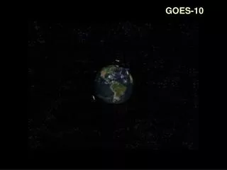
GOES-10 at 60 West Sounder – hourly scans? Imager – 15 minute scans? Late 2006 or early 2007
GOES-10 • Need to deal with a Large inclination • Possibly via on-ground remapping
GOES-10 Patch Temperature On March 10, 2006 (DOY 69), SOCC Engineers changed the GOES-10 Sounder patch temperature from its MID setpoint (100.1 K) to its MID setpoint (92.5 K) at about 8:22 z (3:22 ET). The change was done during keep out zone time and prior to eclipse to minimize the impact on users. The temperature transition will take approximately 4 hours. The users may see slight data degradation (venetian blinding) in the first few frame after the eclipse (11:01:50 CONUS) until the patch temperature stabilizes at its new setpoint. The signal to noise ratio will improve as a result of operation at a lower patch (detector) temperature. The patch will be controlled at this temperature (92.5 K)until October 2006 when it will be switched back to MID setting during the autumn eclipse/KOZ season.
Star Trackers GOES-N Spacecraft
GOES-N Spacecraft Images from NASA
GOES Schedules • GOES-N is slated to be launched no earlier than early May 2006 and operational in mid-2008. GOES-N will be called GOES-13 when it reaches geostationary orbit. • GOES-O is slated to be launched in 2007 and operational in late 2009.
GOES-8/12 GOES-N/O/P will have similar instruments to GOES-8-12, but will be on a different spacecraft bus. The new bus will allow improvements both to the navigation and registration, as well as the radiometrics. GOES-N/P Position of the boom allows for colder detectors and hence less instrument noise
Limitations of Current GOES Imagers • Regional/Hemispheric scan conflicts • Low spatial resolution • Missing spectral bands • Eclipse and related outages GOES-R (2012+) addresses the first 3 limitations, but GOES-N addresses the data outage issues!
The Onset Of Hurricane Ivan: 16 September 2004 0100 UTC 0200 UTC 0300 UTC 0400 UTC 0500 UTC 0600 UTC Outage during landfall 0700 UTC 0800 UTC 0900 UTC GOES-10 & -12 Sounder Cloud Top Pressure Coverage
Note satellite outage during landfall Note: GOES-10 was taking images during this time. GOES satellite loop: http://www.ssec.wisc.edu/~rickk/eclipseivan.html
Note satellite outage during landfall Note: GOES-10 was taking images during this time. GOES satellite loop: http://www.ssec.wisc.edu/~rickk/eclipseivan.html
Note satellite outage during landfall Note: GOES-10 was taking images during this time. GOES satellite loop: http://www.ssec.wisc.edu/~rickk/eclipseivan.html
Note satellite outage during landfall Note: GOES-10 was taking images during this time. GOES satellite loop: http://www.ssec.wisc.edu/~rickk/eclipseivan.html
Note satellite outage during landfall Note: GOES-10 was taking images during this time. GOES satellite loop: http://www.ssec.wisc.edu/~rickk/eclipseivan.html
Note satellite outage during landfall Note: GOES-10 was taking images during this time. GOES satellite loop: http://www.ssec.wisc.edu/~rickk/eclipseivan.html
Note satellite outage during landfall Note: GOES-10 was taking images during this time. GOES satellite loop: http://www.ssec.wisc.edu/~rickk/eclipseivan.html
Note satellite outage during landfall Note: GOES-10 was taking images during this time. GOES satellite loop: http://www.ssec.wisc.edu/~rickk/eclipseivan.html
Note satellite outage during landfall Note: GOES-10 was taking images during this time. GOES satellite loop: http://www.ssec.wisc.edu/~rickk/eclipseivan.html
Note satellite outage during landfall Note: GOES-10 was taking images during this time. GOES satellite loop: http://www.ssec.wisc.edu/~rickk/eclipseivan.html
Note satellite outage during landfall Note: GOES-10 was taking images during this time. GOES satellite loop: http://www.ssec.wisc.edu/~rickk/eclipseivan.html
Note satellite outage during landfall Note: GOES-10 was taking images during this time. GOES satellite loop: http://www.ssec.wisc.edu/~rickk/eclipseivan.html
Reduced KOZ 10 3 Sun Earth The values have not yet been defined for GOES-N operations
Improved radiometrics on GOES-N+ The GOES-N+ instruments will be less noisy. Lower (colder) patch (detector) temperature is the main driver. Other modifications have been made to improve the noise performance on both instruments.
longwave shortwave Improved GOES-N (Sounder) noise compared to GOES-12
Improved calibration on GOES-N+ Reduction in striping to be achieved through increasing the Imager's scan-mirror's dwell time on the blackbody from 0.2 sec to 2 sec. The more accurate blackbody characterization improves the calibration of the infrared detectors.
GOES-N Imager and Sounder spectral response functions. Note the imager band selection is similar to GOES-12.
GOES-12 Imager and Sounder spectral response functions. Note the imager band selection is similar to GOES-12.
GOES-N Imager Weighting Functions Pressure CIMSS
GOES-12 Imager Weighting Functions Pressure CIMSS
GOES-N Sounder Weighting Functions Pressure
GOES-12 Sounder Weighting Functions Pressure
GOES-O – improved spatial resolution of the 13.3 um band. 1 km 2 km “GOES-R” 4 km 8 km “GOES-O/P” “GOES-M”
GOES R Baseline Instruments • Advanced Baseline Imager (ABI) • Hyperspectral Environmental Suite (HES) • Disk Sounding • Severe Weather Mesoscale • Coastal Waters • Geostationary Lightning Mapper (GLM) • Solar Instrument Suite (SIS) • Space Environment In Situ Suite (SEISS) • Auxiliary Services
Advanced Baseline Imager (ABI) • ITT Industries has been selected to build the ABIs • Completed a successful System Preliminary Design Review (December 2005) Full Disk with stepped-edge
ABI Current Spectral Coverage 16 bands 5 bands Spatial resolution 0.64 mm Visible 0.5 km Approx. 1 km Other Visible/near-IR 1.0 km n/a Bands (>2 mm) 2 km Approx. 4 km Spatial coverage Full disk 4 per hour Every 3 hours CONUS 12 per hour ~4 per hour Mesoscale Every 30 sec n/a Visible (reflective bands) On-orbit calibrationYes No The Advanced Baseline Imager: