Download
1 / 8
200 likes | 907 Views
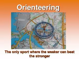
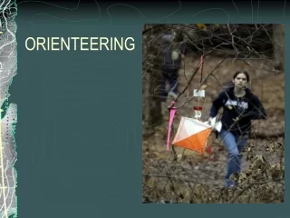
Orienteering is a sport that requires the participants to navigate with a map through unknown terrain with the purpose of finding certain checkpoints marked with an orange and white flag. Think of a mixture of a scavenger hunt, and a car rally on foot through the wilderness.

E N D
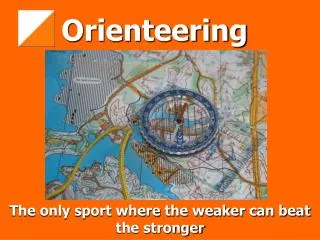
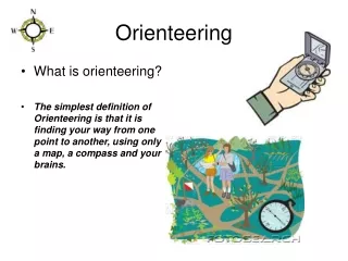
Orienteering is a sport that requires the participants to navigate with a map through unknown terrain with the purpose of finding certain checkpoints marked with an orange and white flag. Think of a mixture of a scavenger hunt, and a car rally on foot through the wilderness. The sport involves a large mental element. The participants make many decisions every race. Foot “O” is the most popular form of the sport. Orienteering is a tremendous aerobic activity. Orienteering
The sport was originally designed for military purposes in Sweden. The sport is very popular in the whole of Europe, especially in the Scandinavian countries of Sweden, Denmark, Norway, and Finland. Mass events in these countries attract more the 10,000 participants. Imagine that!!! Orienteering was fully established in Canada during the early 70’s. The annual national championships attract between 300-500 participants. Every province has a provincially funded governing body except for P.E.I., and Saskatchewan. Origins of “O”
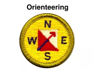
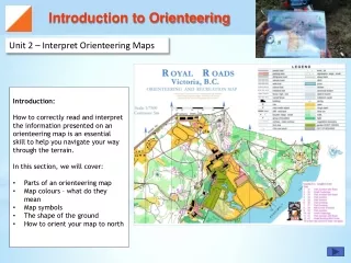
Clothing: you need to wear something that will keep you feeling comfortable throughout the activity. A lightweight, stretchy suit that allows for maximum movement even when wet is ideal. Shoes: light strong shoes with a non-slip gripping are ideal. Cross-training type. Map: a detailed topographical map is needed so you know where to go!! These are provided for you at the events Compasses: there is a wide variety to choose from. Orienteers use either a thumb, or base-plate compass. Controlcard: to prove you have been to each point, you will use the punch on the flag to leave an Impression. Equipment: What is needed…
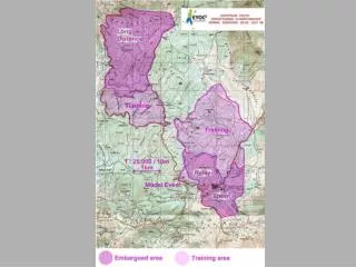
The orange/white controls are located in the middle of the circles on your map. Each control has a number or letter code that distinguishes them from one another. This will tell you whether or not you have found the right one!! They are usually hanging between 2-5 feet off the ground from a tree or on a pole. On the flag you will notice a punch that you will use to show you have been to the correct location. Smaller versions for school events can be made very easily using construction paper. Orienteering Controls/Flags
Orienteering is an excellent lifetime sport/activity that all students should have the opportunity to try. Competitive orienteering is all individual, but when starting with young children it is a good idea to use partners. Grades 4-8: great age to begin to introduce the sport/activity. Students at this age learn very quickly how to start. Senior: at this age the students are quite capable of finishing lengthy courses (5-10KM.) in forest terrain. They can also organize their own courses. Orienteering has obvious P.E./H.E. connections, but is also closely tied to Math, Geography, Science. School Applications
One of the drawbacks of organizing this type of an activity in your schools is the time/leg-work the teacher needs to put in. Before you start an introductory course you need to do the following: Find a suitable area to Orienteer (inside of school, school grounds, city park, mapped areas) Find an accurate Map of the area you would like to use. Do some field work to ensure the map is to scale, and is accurate. Set out the controls/markers in the area, and mark them on your master map. Draw/Copy the appropriate number of maps for your students. How does this all work?
Once you have everything in place you need to make sure that all of the controls are still in the correct places. Start!!! The student should go in partners the first time, and should be staggered about 2-3 min. between each group. Make sure you time your students so they can compare results with each other. At the end of the event you need to retrieve all the controls, and ensure that the area you are using is looking the same as when you got there.
The object of the orienteering is to find each control in the correct order in the shortest possible time. To do this you need to make smart route choices. The route you should take is not marked on your map. You need to decide where to go!! Remember “the shortest route is not always the fastest.” Map contact is key. You should always have a rough idea of where you are on the map. Look out for key features. Keep your eye out for certain landmarks such as fences, trails, large hills, boulders that will assist you in finding the control. Don’t give up….frustration is inevitable!! Strategy/Technique